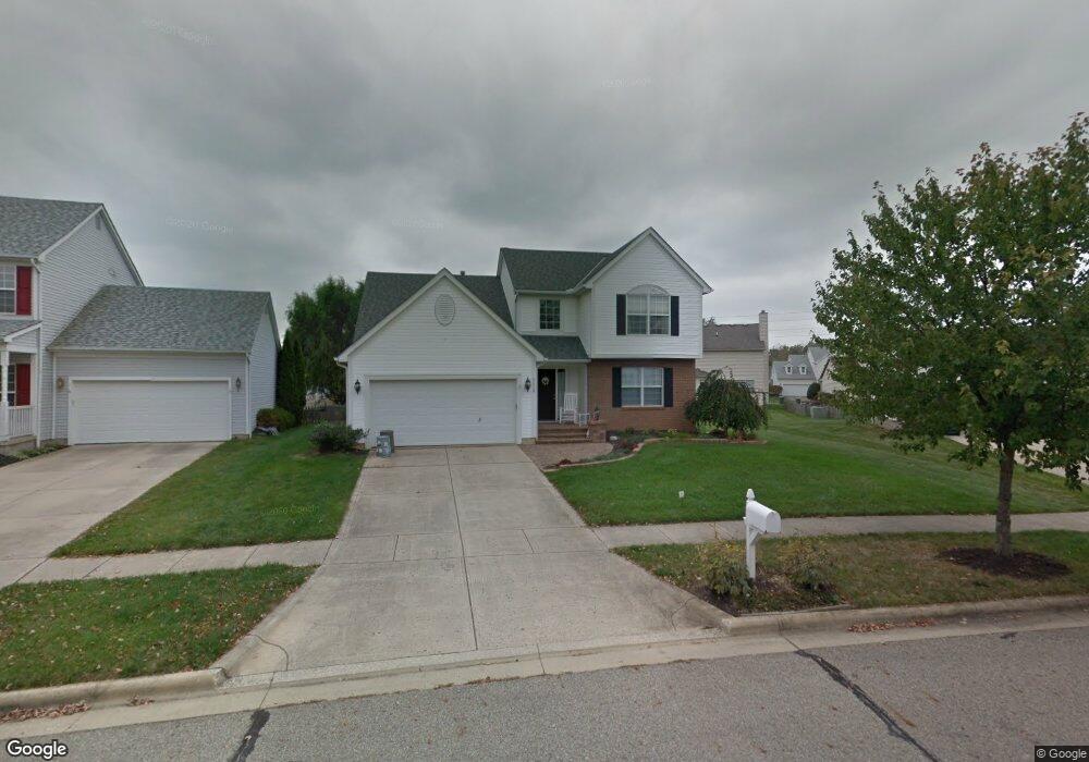
5539 Breshly Way Westerville, OH 43081
West Albany NeighborhoodEstimated Value: $404,639 - $450,000
3
Beds
3
Baths
1,830
Sq Ft
$234/Sq Ft
Est. Value
About This Home
This home is located at 5539 Breshly Way, Westerville, OH 43081 and is currently estimated at $428,660, approximately $234 per square foot. 5539 Breshly Way is a home located in Franklin County with nearby schools including Avalon Elementary School, Northgate Intermediate, and Woodward Park Middle School.
Ownership History
Date
Name
Owned For
Owner Type
Purchase Details
Closed on
Jan 18, 1999
Sold by
Diyanni Brothers Inc
Bought by
Thill Mary E
Current Estimated Value
Home Financials for this Owner
Home Financials are based on the most recent Mortgage that was taken out on this home.
Original Mortgage
$100,000
Outstanding Balance
$21,102
Interest Rate
6.76%
Estimated Equity
$407,558
Create a Home Valuation Report for This Property
The Home Valuation Report is an in-depth analysis detailing your home's value as well as a comparison with similar homes in the area
Home Values in the Area
Average Home Value in this Area
Purchase History
| Date | Buyer | Sale Price | Title Company |
|---|---|---|---|
| Thill Mary E | $179,900 | Title First Agency Inc |
Source: Public Records
Mortgage History
| Date | Status | Borrower | Loan Amount |
|---|---|---|---|
| Open | Thill Mary E | $100,000 |
Source: Public Records
Tax History
| Year | Tax Paid | Tax Assessment Tax Assessment Total Assessment is a certain percentage of the fair market value that is determined by local assessors to be the total taxable value of land and additions on the property. | Land | Improvement |
|---|---|---|---|---|
| 2025 | $6,001 | $133,710 | $39,380 | $94,330 |
| 2024 | $6,001 | $133,710 | $39,380 | $94,330 |
| 2023 | $5,924 | $133,700 | $39,375 | $94,325 |
| 2022 | $4,744 | $91,460 | $16,800 | $74,660 |
| 2021 | $4,752 | $91,460 | $16,800 | $74,660 |
| 2020 | $4,758 | $91,460 | $16,800 | $74,660 |
| 2019 | $4,552 | $75,040 | $14,000 | $61,040 |
| 2018 | $4,237 | $75,040 | $14,000 | $61,040 |
| 2017 | $4,549 | $75,040 | $14,000 | $61,040 |
| 2016 | $4,332 | $65,390 | $12,990 | $52,400 |
| 2015 | $3,932 | $65,390 | $12,990 | $52,400 |
| 2014 | $3,942 | $65,390 | $12,990 | $52,400 |
| 2013 | $1,851 | $62,265 | $12,355 | $49,910 |
Source: Public Records
Map
Nearby Homes
- 5556 Falco Dr
- 6431 Gossamer Ct
- 5308 Apple Ridge Place Unit 5308
- 5328 Branscom Blvd
- 6789 Rolfe Ave Unit 11
- 5600 Apothecary Way
- 6836 Newrock Dr Unit 21
- 5604 Apothecary Way Unit 4
- 5326 Bridwell Ln
- 5628 Apothecary Way
- 6435 Walnut Fork Dr Unit 16-643
- 5656 Apothecary Way Unit 2
- 5652 Apothecary Way Unit 2
- 5069 Cloudberry Pass
- 0 N Hamilton Rd
- 5412 Tathwell Dr Unit 39
- 5396 Nottinghamshire Ln Unit 5396
- 5791 Burke Cir Unit 1103
- 6950 Harlem Rd
- 6931 Rothwell St Unit 36931
- 5533 Breshly Way
- 6795 Annelise Ln
- 5542 Benpatrick Ct
- 5536 Benpatrick Ct
- 5527 Breshly Way
- 5530 Benpatrick Ct
- 5548 Benpatrick Ct
- 5534 Breshly Way
- 5524 Benpatrick Ct
- 5546 Breshly Way
- 5521 Breshly Way
- 5488 Benpatrick Ct
- 5554 Breshly Way
- 5506 Benpatrick Ct
- 5482 Benpatrick Ct
- 5515 Breshly Way
- 6796 Annelise Ln
- 6788 Annelise Ln
- 5562 Breshly Way
Your Personal Tour Guide
Ask me questions while you tour the home.