Estimated Value: $317,911 - $354,000
3
Beds
2
Baths
1,527
Sq Ft
$217/Sq Ft
Est. Value
About This Home
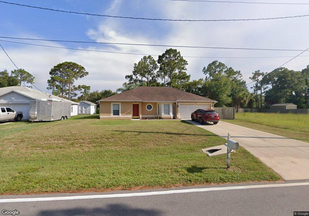
This home is located at 5539 Curtis Blvd, Cocoa, FL 32927 and is currently estimated at $330,728, approximately $216 per square foot. 5539 Curtis Blvd is a home located in Brevard County with nearby schools including Enterprise Elementary School, Space Coast Junior/Senior High School, and East Atlantic Prep of Brevard County.
Ownership History
Date
Name
Owned For
Owner Type
Purchase Details
Closed on
Sep 16, 2002
Sold by
Maronda Homes Inc Fl
Bought by
Thornton Jean E
Current Estimated Value
Home Financials for this Owner
Home Financials are based on the most recent Mortgage that was taken out on this home.
Original Mortgage
$94,192
Outstanding Balance
$39,204
Interest Rate
6.19%
Mortgage Type
Purchase Money Mortgage
Estimated Equity
$291,524
Purchase Details
Closed on
Nov 28, 2001
Sold by
Valdez Agustin A and Valdez Salome R
Bought by
Maronda Homes Inc Fl
Create a Home Valuation Report for This Property
The Home Valuation Report is an in-depth analysis detailing your home's value as well as a comparison with similar homes in the area
Home Values in the Area
Average Home Value in this Area
Purchase History
| Date | Buyer | Sale Price | Title Company |
|---|---|---|---|
| Thornton Jean E | $95,000 | -- | |
| Maronda Homes Inc Fl | -- | -- |
Source: Public Records
Mortgage History
| Date | Status | Borrower | Loan Amount |
|---|---|---|---|
| Open | Thornton Jean E | $94,192 |
Source: Public Records
Tax History
| Year | Tax Paid | Tax Assessment Tax Assessment Total Assessment is a certain percentage of the fair market value that is determined by local assessors to be the total taxable value of land and additions on the property. | Land | Improvement |
|---|---|---|---|---|
| 2025 | $1,298 | $269,400 | -- | -- |
| 2024 | $1,262 | $90,820 | -- | -- |
| 2023 | $1,262 | $88,180 | $0 | $0 |
| 2022 | $1,175 | $85,620 | $0 | $0 |
| 2021 | $1,166 | $83,130 | $0 | $0 |
| 2020 | $1,101 | $81,990 | $0 | $0 |
| 2019 | $1,035 | $80,150 | $0 | $0 |
| 2018 | $1,025 | $78,660 | $0 | $0 |
| 2017 | $1,013 | $77,050 | $0 | $0 |
| 2016 | $1,009 | $75,470 | $18,000 | $57,470 |
| 2015 | $1,016 | $74,950 | $15,000 | $59,950 |
| 2014 | $1,021 | $74,360 | $11,000 | $63,360 |
Source: Public Records
Map
Nearby Homes
- 6581 Bancroft Ave
- 6481 La Brea Ave
- 6643 Emil Ave
- 6615 Dock Ave
- 5721 Beaverbrook St
- 5680 Banos Ave
- 6438 Hudson Rd
- 5601 Banos Ave
- 6450 Ember Ave
- 6460 Ainsworth Rd
- 6760 Cairo Rd
- 0 Aruin St Unit 1222557
- 6815 Bryant Rd
- 00 Unknown
- 5555 Brandon St
- 5680 Brandon St
- 6460 Homestead Ave
- 6545 Addie Ave
- 23-35-21-JX-B-2 Aruin St
- 7065 Hundred Acre Dr
- 5535 Curtis Blvd
- 5531 Curtis Blvd
- 5555 Curtis Blvd
- 5560 Fairbridge St
- 5530 Curtis Blvd
- 5550 Fairbridge St
- 5570 Fairbridge St
- 5540 Fairbridge St
- 5525 Curtis Blvd
- 5565 Curtis Blvd
- 5580 Fairbridge St Unit 4
- 5580 Fairbridge St
- 6561 Bancroft Ave
- 6564 Haven Ave
- 6550 Bancroft Ave
- 5530 Fairbridge St
- 6555 Haven Ave
- 5590 Fairbridge St
- 5519 Curtis Blvd
- 6560 Bancroft Ave
Your Personal Tour Guide
Ask me questions while you tour the home.