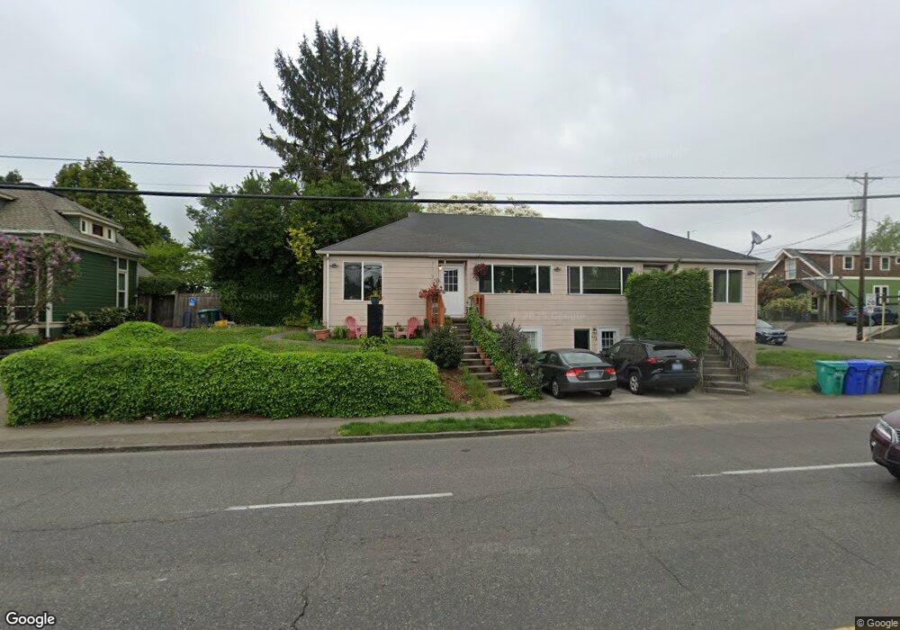
5539 E Burnside St Unit 5543 Portland, OR 97215
North Tabor NeighborhoodEstimated Value: $426,819 - $1,002,000
Studio
4
Baths
1,586
Sq Ft
$488/Sq Ft
Est. Value
About This Home
This home is located at 5539 E Burnside St Unit 5543, Portland, OR 97215 and is currently estimated at $774,705, approximately $488 per square foot. 5539 E Burnside St Unit 5543 is a home located in Multnomah County with nearby schools including Glencoe Elementary School, Mt Tabor Middle School, and Franklin High School.
Ownership History
Date
Name
Owned For
Owner Type
Purchase Details
Closed on
Mar 8, 2005
Sold by
Scosha Properties Llc
Bought by
Miller Scott R and Miller Tasha J
Current Estimated Value
Home Financials for this Owner
Home Financials are based on the most recent Mortgage that was taken out on this home.
Original Mortgage
$345,000
Outstanding Balance
$174,203
Interest Rate
5.65%
Mortgage Type
Stand Alone First
Estimated Equity
$600,502
Purchase Details
Closed on
Feb 26, 2004
Sold by
Criswell Harry S
Bought by
Scosha Properties Llc
Purchase Details
Closed on
Oct 25, 1997
Sold by
Criswell Harry and Criswell Betty
Bought by
Pohrman Howard A and Diversified Trust
Create a Home Valuation Report for This Property
The Home Valuation Report is an in-depth analysis detailing your home's value as well as a comparison with similar homes in the area
Home Values in the Area
Average Home Value in this Area
Purchase History
| Date | Buyer | Sale Price | Title Company |
|---|---|---|---|
| Miller Scott R | -- | Chicago Title Co | |
| Scosha Properties Llc | $165,000 | First American | |
| Pohrman Howard A | -- | -- |
Source: Public Records
Mortgage History
| Date | Status | Borrower | Loan Amount |
|---|---|---|---|
| Open | Miller Scott R | $345,000 |
Source: Public Records
Tax History
| Year | Tax Paid | Tax Assessment Tax Assessment Total Assessment is a certain percentage of the fair market value that is determined by local assessors to be the total taxable value of land and additions on the property. | Land | Improvement |
|---|---|---|---|---|
| 2025 | $7,326 | $271,890 | -- | -- |
| 2024 | $7,063 | $263,980 | -- | -- |
| 2023 | $6,792 | $256,300 | $0 | $0 |
| 2022 | $6,645 | $248,840 | $0 | $0 |
| 2021 | $6,532 | $241,600 | $0 | $0 |
| 2020 | $5,993 | $234,570 | $0 | $0 |
| 2019 | $5,772 | $227,740 | $0 | $0 |
| 2018 | $5,603 | $221,110 | $0 | $0 |
| 2017 | $5,370 | $214,670 | $0 | $0 |
Source: Public Records
Map
Nearby Homes
- 11 NE 55th Ave
- 135 NE 55th Ave
- 5248 NE Couch St
- 77 NE 58th Ave
- 65 NE 58th Ave
- 5525 NE Everett St
- 7 SE 52nd Ave
- 5842 E Burnside St
- 5615 SE Oak St
- 5357 SE Stark St
- 5353 SE Stark St
- 508 NE 56th Ave
- 512 NE 56th Ave
- 5135 NE Flanders St
- 330 SE 50th Ave Unit D1
- 227 NE 61st Ave Unit 1
- 6055 E Burnside St
- 255 NE 61st Ave Unit 12
- 235 NE 61st Ave Unit 36
- 232 NE 61st Ave
- 11-17-17 NE 56th Ave Unit 17
- 11 NE 56th Ave Unit 17
- 5525 E Burnside Live Work
- 25 NE 56th Ave
- 5515 E Burnside St
- 5605 E Burnside St
- 5540 NE Couch St
- 5501 E Burnside St
- 5514 NE Couch St
- 2026-26 NE 56th Ave Unit 26
- 2026-26 NE 56th Ave Unit 20
- 20 NE 56th Ave
- 16 NE 55th Ave
- 5607 5625 E Burnside St 15 Ne 57th Ave
- 5616 NE Couch St
- 32 NE 56th Ave
- 32 NE 56see New Ml#267357
- 5506 NE Couch St
- 5607 E Burnside St
- 25 NE 57th Ave
Your Personal Tour Guide
Ask me questions while you tour the home.