Estimated Value: $470,743 - $509,000
3
Beds
2
Baths
1,200
Sq Ft
$403/Sq Ft
Est. Value
About This Home
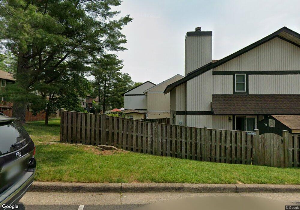
This home is located at 5539 Peppercorn Dr, Burke, VA 22015 and is currently estimated at $484,186, approximately $403 per square foot. 5539 Peppercorn Dr is a home located in Fairfax County with nearby schools including Kings Park Elementary School, Kings Glen Elementary School, and Lake Braddock Secondary School.
Ownership History
Date
Name
Owned For
Owner Type
Purchase Details
Closed on
Dec 7, 2010
Sold by
Langford Alison R
Bought by
Cotchan Robin E
Current Estimated Value
Home Financials for this Owner
Home Financials are based on the most recent Mortgage that was taken out on this home.
Original Mortgage
$224,169
Outstanding Balance
$148,255
Interest Rate
4.24%
Mortgage Type
FHA
Estimated Equity
$335,931
Purchase Details
Closed on
Nov 2, 1993
Sold by
Alexander D L
Bought by
Langford Alison R
Home Financials for this Owner
Home Financials are based on the most recent Mortgage that was taken out on this home.
Original Mortgage
$90,250
Interest Rate
6.86%
Create a Home Valuation Report for This Property
The Home Valuation Report is an in-depth analysis detailing your home's value as well as a comparison with similar homes in the area
Home Values in the Area
Average Home Value in this Area
Purchase History
| Date | Buyer | Sale Price | Title Company |
|---|---|---|---|
| Cotchan Robin E | $230,000 | -- | |
| Langford Alison R | $95,000 | -- |
Source: Public Records
Mortgage History
| Date | Status | Borrower | Loan Amount |
|---|---|---|---|
| Open | Cotchan Robin E | $224,169 | |
| Previous Owner | Langford Alison R | $90,250 |
Source: Public Records
Tax History
| Year | Tax Paid | Tax Assessment Tax Assessment Total Assessment is a certain percentage of the fair market value that is determined by local assessors to be the total taxable value of land and additions on the property. | Land | Improvement |
|---|---|---|---|---|
| 2025 | $4,592 | $451,790 | $200,000 | $251,790 |
| 2024 | $4,592 | $396,350 | $170,000 | $226,350 |
| 2023 | $4,355 | $385,880 | $170,000 | $215,880 |
| 2022 | $4,119 | $360,220 | $150,000 | $210,220 |
| 2021 | $4,041 | $344,350 | $140,000 | $204,350 |
| 2020 | $3,816 | $322,470 | $138,000 | $184,470 |
| 2019 | $3,421 | $289,030 | $115,000 | $174,030 |
| 2018 | $3,324 | $289,030 | $115,000 | $174,030 |
| 2017 | $3,221 | $277,460 | $105,000 | $172,460 |
| 2016 | $3,059 | $264,050 | $95,000 | $169,050 |
Source: Public Records
Map
Nearby Homes
- 5552 Peppercorn Dr
- 5502 Peppercorn Dr
- 5601 Castlebury Ct
- 9604 Glenarm Ct
- 5635 Sutherland Ct
- 9752 High Water Ct
- 9662 Westport Ln
- 5401 Kinnerly Ct
- 9532 Burdett Rd
- 9984 Whitewater Dr
- 5342 Guinea Rd
- 5406 Midship Ct
- 5482 Midship Ct
- 5460 Truxion Ct
- 9329 Raintree Rd
- 9502 Wallingford Dr
- 9438 Wallingford Dr
- 9634 Blincoe Ct
- 9928 Wood Wren Ct
- 5513 Westcliff Ct
- 5537 Peppercorn Dr
- 5541 Peppercorn Dr
- 5535 Peppercorn Dr
- 5543 Peppercorn Dr
- 5533 Peppercorn Dr
- 5545 Peppercorn Dr
- 5547 Peppercorn Dr
- 5516 Crossrail Ct
- 5518 Crossrail Ct
- 5514 Crossrail Ct
- 5520 Crossrail Ct
- 5522 Crossrail Ct
- 5549 Peppercorn Dr
- 5524 Crossrail Ct
- 5460 Crossrail Dr
- 5551 Peppercorn Dr
- 5526 Crossrail Ct
- 5553 Peppercorn Dr
- 5458 Crossrail Dr
- 5512 Crossrail Ct
Your Personal Tour Guide
Ask me questions while you tour the home.