Estimated Value: $209,000 - $1,077,447
3
Beds
2
Baths
1,980
Sq Ft
$225/Sq Ft
Est. Value
About This Home
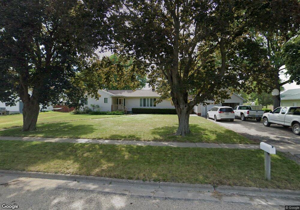
This home is located at 554 7th St, Jesup, IA 50648 and is currently estimated at $445,612, approximately $225 per square foot. 554 7th St is a home located in Buchanan County with nearby schools including Jesup Elementary School, Jesup Middle School, and Jesup High School.
Ownership History
Date
Name
Owned For
Owner Type
Purchase Details
Closed on
Feb 28, 2014
Sold by
Jrl Holding Co Llc
Bought by
Trumbauer Jason P and Trumbauer Danielle M
Current Estimated Value
Purchase Details
Closed on
Jul 19, 2010
Sold by
Trumbauer Jason P and Trumbauer Danielle M
Bought by
Junge Noah G
Home Financials for this Owner
Home Financials are based on the most recent Mortgage that was taken out on this home.
Original Mortgage
$144,900
Interest Rate
4.74%
Mortgage Type
New Conventional
Create a Home Valuation Report for This Property
The Home Valuation Report is an in-depth analysis detailing your home's value as well as a comparison with similar homes in the area
Home Values in the Area
Average Home Value in this Area
Purchase History
| Date | Buyer | Sale Price | Title Company |
|---|---|---|---|
| Trumbauer Jason P | $544,000 | None Available | |
| Junge Noah G | $161,000 | None Available |
Source: Public Records
Mortgage History
| Date | Status | Borrower | Loan Amount |
|---|---|---|---|
| Previous Owner | Junge Noah G | $144,900 |
Source: Public Records
Tax History
| Year | Tax Paid | Tax Assessment Tax Assessment Total Assessment is a certain percentage of the fair market value that is determined by local assessors to be the total taxable value of land and additions on the property. | Land | Improvement |
|---|---|---|---|---|
| 2025 | $3,346 | $222,960 | $33,470 | $189,490 |
| 2024 | $3,346 | $193,120 | $29,880 | $163,240 |
| 2023 | $3,244 | $193,120 | $29,880 | $163,240 |
| 2022 | $3,154 | $164,400 | $23,720 | $140,680 |
| 2021 | $3,064 | $164,400 | $23,720 | $140,680 |
| 2020 | $3,064 | $151,120 | $21,740 | $129,380 |
| 2019 | $2,966 | $151,120 | $21,740 | $129,380 |
| 2018 | $2,810 | $145,990 | $21,740 | $124,250 |
| 2017 | $2,544 | $145,990 | $21,740 | $124,250 |
| 2016 | $2,480 | $130,530 | $11,760 | $118,770 |
| 2015 | $2,480 | $130,530 | $11,760 | $118,770 |
| 2014 | $2,522 | $130,530 | $11,760 | $118,770 |
Source: Public Records
Map
Nearby Homes
- 414 Main St
- 435 5th St
- 814 Duroe St
- 915 Young St
- 1634 Dalton St
- 524 Christopher Cir
- 1245 Hawley St
- 1124 3rd St
- 1225 10th St
- 1225 1st St
- 0 220th St
- 1341 12th St
- 1644 Killarney Dr
- Lot 4 Benson Shady Grove Ave
- Lot 2 Benson Shady Grove Ave
- Lot 1 Benson Shady Grove Ave
- 0 Benson Ridge Addition Unit Lot 7
- 0 Benson Ridge Addition Unit Lot 1
- 0 Benson Ridge Addition Unit Lot 2
- Lot 7 Dalton St
Your Personal Tour Guide
Ask me questions while you tour the home.