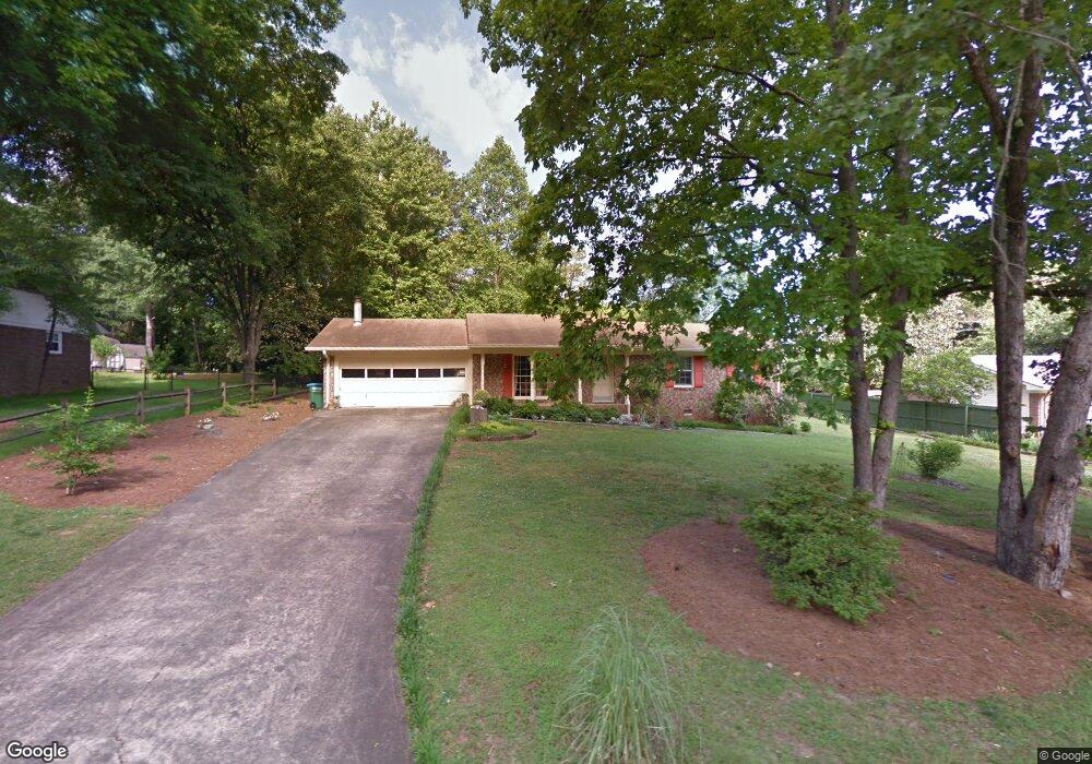
554 Cherokee Ridge Athens, GA 30606
Estimated Value: $320,000 - $341,000
3
Beds
3
Baths
1,948
Sq Ft
$170/Sq Ft
Est. Value
About This Home
This home is located at 554 Cherokee Ridge, Athens, GA 30606 and is currently estimated at $331,247, approximately $170 per square foot. 554 Cherokee Ridge is a home located in Clarke County with nearby schools including Cleveland Road Elementary School, Burney-Harris-Lyons Middle School, and Clarke Central High School.
Ownership History
Date
Name
Owned For
Owner Type
Purchase Details
Closed on
Oct 8, 2024
Sold by
Bandit Properties Llc
Bought by
Bandit Residential Properties Llc
Current Estimated Value
Purchase Details
Closed on
Jun 26, 2019
Sold by
Rigby Randolph S
Bought by
Bandit Properties Llc
Home Financials for this Owner
Home Financials are based on the most recent Mortgage that was taken out on this home.
Original Mortgage
$96,000
Interest Rate
3.9%
Mortgage Type
New Conventional
Purchase Details
Closed on
Jan 1, 2002
Sold by
Piercy Ruby W Life Estate
Bought by
Pless Helen P
Purchase Details
Closed on
Feb 26, 1997
Sold by
Piercy Ruby W
Bought by
Piercy Ruby W Life Estate
Create a Home Valuation Report for This Property
The Home Valuation Report is an in-depth analysis detailing your home's value as well as a comparison with similar homes in the area
Home Values in the Area
Average Home Value in this Area
Purchase History
| Date | Buyer | Sale Price | Title Company |
|---|---|---|---|
| Bandit Residential Properties Llc | -- | -- | |
| Bandit Properties Llc | -- | -- | |
| Rigby Randolph S | $120,000 | -- | |
| Pless Helen P | -- | -- | |
| Piercy Ruby W Life Estate | -- | -- | |
| Piercy Ruby W | -- | -- |
Source: Public Records
Mortgage History
| Date | Status | Borrower | Loan Amount |
|---|---|---|---|
| Previous Owner | Rigby Randolph S | $96,000 |
Source: Public Records
Tax History Compared to Growth
Tax History
| Year | Tax Paid | Tax Assessment Tax Assessment Total Assessment is a certain percentage of the fair market value that is determined by local assessors to be the total taxable value of land and additions on the property. | Land | Improvement |
|---|---|---|---|---|
| 2025 | $2,961 | $95,357 | $12,000 | $83,357 |
| 2024 | $2,961 | $88,871 | $12,000 | $76,871 |
| 2023 | $2,777 | $82,586 | $12,000 | $70,586 |
| 2022 | $2,188 | $68,596 | $10,400 | $58,196 |
| 2021 | $1,993 | $59,149 | $10,400 | $48,749 |
| 2020 | $1,618 | $56,892 | $10,400 | $46,492 |
| 2019 | $1,318 | $54,077 | $9,600 | $44,477 |
| 2018 | $1,267 | $50,399 | $9,600 | $40,799 |
| 2017 | $1,230 | $47,783 | $9,600 | $38,183 |
| 2016 | $1,162 | $44,222 | $9,600 | $34,622 |
| 2015 | $1,535 | $45,148 | $9,600 | $35,548 |
| 2014 | $1,543 | $45,328 | $9,600 | $35,728 |
Source: Public Records
Map
Nearby Homes
- 532 Huntington Rd Unit 7
- 470 Huntington Rd Unit 5
- 141 Huntington Shoals Dr
- 637 Huntington Rd Unit B1
- 256 Cherokee Ridge
- 212 Huntington Shoals Dr
- 170 Huntington Ct
- 241 Meeler Cir
- 240 W Huntington Rd
- 212 Meeler Cir
- 450 River Bottom Rd
- 190 W Huntington Rd
- 682 Chesterfield Rd
- 211 Littleton Way
- 150 Callaway Dr
- 115 Woodhaven St
- 240 Cleveland Rd Unit 105
- 860 Mitchell Bridge Rd Unit 8
- 860 Mitchell Bridge Rd Unit 8
- 548 Cherokee Ridge
- 560 Cherokee Ridge
- 520 Huntington Rd
- 522 Huntington Rd
- 524 Huntington Rd Unit U3
- 524 Huntington Rd Unit 524
- 524 Huntington Rd
- 526 Huntington Rd
- 454 Huntington Rd
- 528 Huntington Rd
- 452 Huntington Rd
- 530 Huntington Rd
- 532 Huntington Rd
- 450 Huntington Rd
- 450 Huntington Rd Unit 450
- 534 Huntington Rd
- 448 Huntington Rd
- 566 Cherokee Ridge
- 476 Huntington Rd
- 446 Huntington Rd