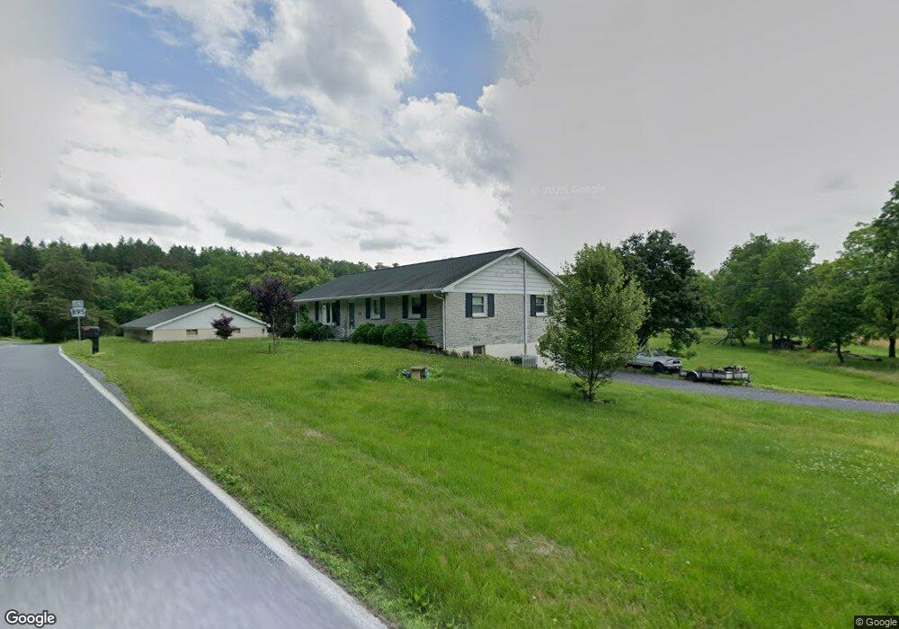
554 Dad Burnhams Rd Schuylkill Haven, PA 17972
Estimated Value: $282,000
3
Beds
1
Bath
1,288
Sq Ft
$219/Sq Ft
Est. Value
About This Home
This home is located at 554 Dad Burnhams Rd, Schuylkill Haven, PA 17972 and is currently estimated at $282,000, approximately $218 per square foot. 554 Dad Burnhams Rd is a home located in Schuylkill County with nearby schools including Pine Grove Elementary School, Pine Grove Area Middle School, and Pine Grove Area High School.
Ownership History
Date
Name
Owned For
Owner Type
Purchase Details
Closed on
Mar 5, 2018
Sold by
Krause Ernest L and Thomas Sandra J
Bought by
Drey Jennifer L
Current Estimated Value
Home Financials for this Owner
Home Financials are based on the most recent Mortgage that was taken out on this home.
Original Mortgage
$120,000
Outstanding Balance
$102,264
Interest Rate
4.15%
Mortgage Type
Unknown
Estimated Equity
$179,736
Create a Home Valuation Report for This Property
The Home Valuation Report is an in-depth analysis detailing your home's value as well as a comparison with similar homes in the area
Home Values in the Area
Average Home Value in this Area
Purchase History
| Date | Buyer | Sale Price | Title Company |
|---|---|---|---|
| Drey Jennifer L | -- | None Available |
Source: Public Records
Mortgage History
| Date | Status | Borrower | Loan Amount |
|---|---|---|---|
| Open | Drey Jennifer L | $120,000 |
Source: Public Records
Tax History Compared to Growth
Tax History
| Year | Tax Paid | Tax Assessment Tax Assessment Total Assessment is a certain percentage of the fair market value that is determined by local assessors to be the total taxable value of land and additions on the property. | Land | Improvement |
|---|---|---|---|---|
| 2025 | $3,188 | $47,660 | $13,225 | $34,435 |
| 2024 | $2,890 | $47,660 | $13,225 | $34,435 |
| 2023 | $2,890 | $47,660 | $13,225 | $34,435 |
| 2022 | $2,890 | $47,660 | $13,225 | $34,435 |
| 2021 | $2,918 | $47,660 | $13,225 | $34,435 |
| 2020 | $2,918 | $47,660 | $13,225 | $34,435 |
| 2018 | $2,839 | $47,935 | $13,500 | $34,435 |
| 2017 | $2,751 | $47,935 | $13,500 | $34,435 |
| 2015 | -- | $47,935 | $13,500 | $34,435 |
| 2011 | -- | $47,935 | $0 | $0 |
Source: Public Records
Map
Nearby Homes
- 234 Frieden Manor
- 257 Covered Bridge Rd
- 107 Blue Mountain Rd
- 118 Natures Rd
- 1114 Deturksville Rd
- 979 Deturksville Rd
- 519 Birds Hill Rd
- 0 Manor Rd
- 651 Deturksville Rd
- 0 Camp Rd
- 204 Stanhope Rd
- 1051 Schubert Rd
- 146 Mexico Rd
- 148 Mexico Rd
- 11 Spring Rd
- 9 Hallton Hill Rd
- 149 Pleasant Valley Rd
- 30 Meadow Brook Dr
- 0 S Route 183 Unit PASK130762
- 122 Rock Rd
- 531 Dad Burnhams Rd
- 526 Dad Burnhams Rd
- 507 Dad Burnhams Rd
- 527 Dad Burnhams Rd
- 0 Sr 895 Unit 1002317756
- 0 Sr 895 Unit 6703281
- 7 Rail Ln
- 1097 Rock Rd
- 1089 Rock Rd
- 4 Rail Ln
- 0 Rock Rd Unit 6717314
- 0 Rock Rd Unit 1002322178
- 1092 Rock Rd
- 1086 Rock Rd
- 1036 Rock Rd
- 1074 Rock Rd
- 129 Wild Cherry Rd
- 1074 Rock Rd
- 0 Route Sr 3009 Unit 1007078006
- 0 Route Sr 3009 Unit 5964815