Estimated Value: $82,000 - $266,000
3
Beds
2
Baths
1,612
Sq Ft
$113/Sq Ft
Est. Value
About This Home
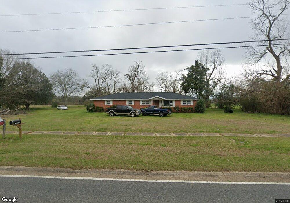
This home is located at 554 Harris St, Pavo, GA 31778 and is currently estimated at $182,171, approximately $113 per square foot. 554 Harris St is a home located in Brooks County with nearby schools including North Brooks Elementary School.
Ownership History
Date
Name
Owned For
Owner Type
Purchase Details
Closed on
Nov 4, 2005
Sold by
Mathews Shirley A
Bought by
Hardy William Daniel
Current Estimated Value
Home Financials for this Owner
Home Financials are based on the most recent Mortgage that was taken out on this home.
Original Mortgage
$109,250
Outstanding Balance
$58,633
Interest Rate
5.9%
Mortgage Type
New Conventional
Estimated Equity
$123,538
Purchase Details
Closed on
Dec 11, 1998
Sold by
Mathews Shirley A
Bought by
Mathews Shirley A and Mathews Jimmy F
Purchase Details
Closed on
Sep 18, 1998
Sold by
Anderson Anderson C and Anderson W
Bought by
Mathews Shirley A
Create a Home Valuation Report for This Property
The Home Valuation Report is an in-depth analysis detailing your home's value as well as a comparison with similar homes in the area
Home Values in the Area
Average Home Value in this Area
Purchase History
| Date | Buyer | Sale Price | Title Company |
|---|---|---|---|
| Hardy William Daniel | $115,000 | -- | |
| Mathews Shirley A | -- | -- | |
| Mathews Shirley A | $72,000 | -- |
Source: Public Records
Mortgage History
| Date | Status | Borrower | Loan Amount |
|---|---|---|---|
| Open | Hardy William Daniel | $109,250 |
Source: Public Records
Tax History Compared to Growth
Tax History
| Year | Tax Paid | Tax Assessment Tax Assessment Total Assessment is a certain percentage of the fair market value that is determined by local assessors to be the total taxable value of land and additions on the property. | Land | Improvement |
|---|---|---|---|---|
| 2025 | $2,006 | $51,996 | $10,040 | $41,956 |
| 2024 | $2,006 | $51,996 | $10,040 | $41,956 |
| 2023 | $817 | $49,996 | $9,240 | $40,756 |
| 2022 | $1,117 | $39,716 | $8,800 | $30,916 |
| 2021 | $1,010 | $36,756 | $8,640 | $28,116 |
| 2020 | $1,564 | $37,076 | $8,640 | $28,436 |
| 2019 | $896 | $34,196 | $8,800 | $25,396 |
| 2018 | $1,497 | $34,596 | $8,680 | $25,916 |
| 2017 | $891 | $33,676 | $8,680 | $24,996 |
| 2016 | $897 | $34,156 | $8,680 | $25,476 |
| 2015 | -- | $34,396 | $8,680 | $25,716 |
| 2014 | -- | $36,316 | $8,680 | $27,636 |
| 2013 | -- | $36,316 | $8,680 | $27,636 |
Source: Public Records
Map
Nearby Homes
- 2055 S Roberts St
- 2051 W Pear St
- 1230 Parrish Rd
- 1136 Nesbitt Rd
- 16343 Georgia 33
- 16343 Ga Hwy 33 -8 34 Acres
- 16343
- 16343 Ga Hwy 33 - 8 34 Acres Hwy
- 813 Vonier Road (6 Acres)
- 13876 Ga Highway 122
- 1038-BA Church St
- 9283 Tallokas Rd Unit 54/13
- 9283 Tallokas Rd
- 7402 Coffee Rd
- 7921 Five Forks Rd
- 3812 Ponder Rd
- 110 Nicole Britt Dr
- 101 Bailey Cir
- 203 Bailey Cir