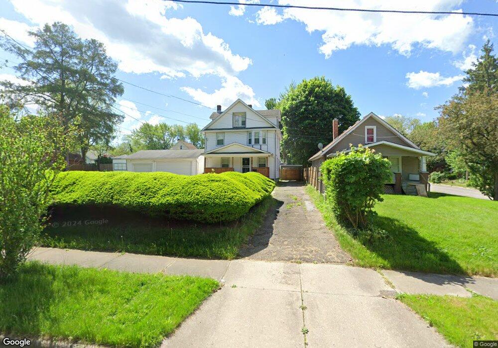
554 Mckinley Ave Akron, OH 44311
South Akron NeighborhoodEstimated Value: $91,000 - $105,000
4
Beds
1
Bath
1,824
Sq Ft
$53/Sq Ft
Est. Value
About This Home
This home is located at 554 Mckinley Ave, Akron, OH 44311 and is currently estimated at $96,378, approximately $52 per square foot. 554 Mckinley Ave is a home located in Summit County with nearby schools including Glover Community Learning Center, Kenmore Garfield Community Learning Center, and Main Preparatory Academy.
Ownership History
Date
Name
Owned For
Owner Type
Purchase Details
Closed on
Jun 9, 2008
Sold by
Bell Sheldon E and Bell Taleya A
Bought by
Bell Sheldon E
Current Estimated Value
Purchase Details
Closed on
Oct 26, 2005
Sold by
Bell Sheldon E
Bought by
Bell Sheldon E and Bell Taleya A
Home Financials for this Owner
Home Financials are based on the most recent Mortgage that was taken out on this home.
Original Mortgage
$75,000
Outstanding Balance
$46,082
Interest Rate
8.1%
Mortgage Type
New Conventional
Estimated Equity
$50,296
Purchase Details
Closed on
Mar 18, 2002
Sold by
Estate Of Simon J Bell
Bought by
Bell Sheldon
Home Financials for this Owner
Home Financials are based on the most recent Mortgage that was taken out on this home.
Original Mortgage
$36,000
Interest Rate
6.82%
Mortgage Type
Unknown
Create a Home Valuation Report for This Property
The Home Valuation Report is an in-depth analysis detailing your home's value as well as a comparison with similar homes in the area
Home Values in the Area
Average Home Value in this Area
Purchase History
| Date | Buyer | Sale Price | Title Company |
|---|---|---|---|
| Bell Sheldon E | -- | Patriot Title | |
| Bell Sheldon E | -- | Patriot Title Agency Inc | |
| Bell Sheldon | -- | -- |
Source: Public Records
Mortgage History
| Date | Status | Borrower | Loan Amount |
|---|---|---|---|
| Open | Bell Sheldon E | $75,000 | |
| Closed | Bell Sheldon | $36,000 |
Source: Public Records
Tax History Compared to Growth
Tax History
| Year | Tax Paid | Tax Assessment Tax Assessment Total Assessment is a certain percentage of the fair market value that is determined by local assessors to be the total taxable value of land and additions on the property. | Land | Improvement |
|---|---|---|---|---|
| 2025 | $2,146 | $24,388 | $5,299 | $19,089 |
| 2024 | $1,399 | $24,388 | $5,299 | $19,089 |
| 2023 | $2,146 | $24,388 | $5,299 | $19,089 |
| 2022 | $1,229 | $16,555 | $3,115 | $13,440 |
| 2021 | $1,230 | $16,555 | $3,115 | $13,440 |
| 2020 | $1,213 | $16,560 | $3,120 | $13,440 |
| 2019 | $1,809 | $23,490 | $6,050 | $17,440 |
| 2018 | $1,786 | $23,490 | $6,050 | $17,440 |
| 2017 | $1,833 | $23,490 | $6,050 | $17,440 |
| 2016 | $1,835 | $23,780 | $6,050 | $17,730 |
| 2015 | $1,833 | $23,780 | $6,050 | $17,730 |
| 2014 | $1,819 | $23,780 | $6,050 | $17,730 |
| 2013 | $1,973 | $26,530 | $6,050 | $20,480 |
Source: Public Records
Map
Nearby Homes
- 559 Morgan Ave
- 566 Mckinley Ave
- 610 Morgan Ave
- 1033 Herberich Ave
- 979 Neptune Ave
- 1051 Brown St
- 859 Clay Dr
- 568 Stanton Ave
- 867 Kling St
- 1094 Dietz Ave
- 1025 Coventry St
- 848 Kling St
- 1102 Dietz Ave
- 1043 Coventry St
- 802 Clay Dr
- 1100 Beardsley St
- 1125 Beardsley St
- 750 Baird St
- 804 Beardsley St
- 436 Cole Ave
- 550 Mckinley Ave
- 561 Corice St
- 559 Corice St
- 565 Corice St
- 570 Mckinley Ave
- 559 Mckinley Ave
- 563 Mckinley Ave
- 569 Corice St
- 547 Mckinley Ave
- 542 Mckinley Ave
- 574 Mckinley Ave
- 567 Mckinley Ave
- 547 Corice St
- 577 Corice St
- 571 Mckinley Ave
- 543 Corice St
- 573 Corice St
- 578 Mckinley Ave
- 541 Corice St
- 566 Kipling St