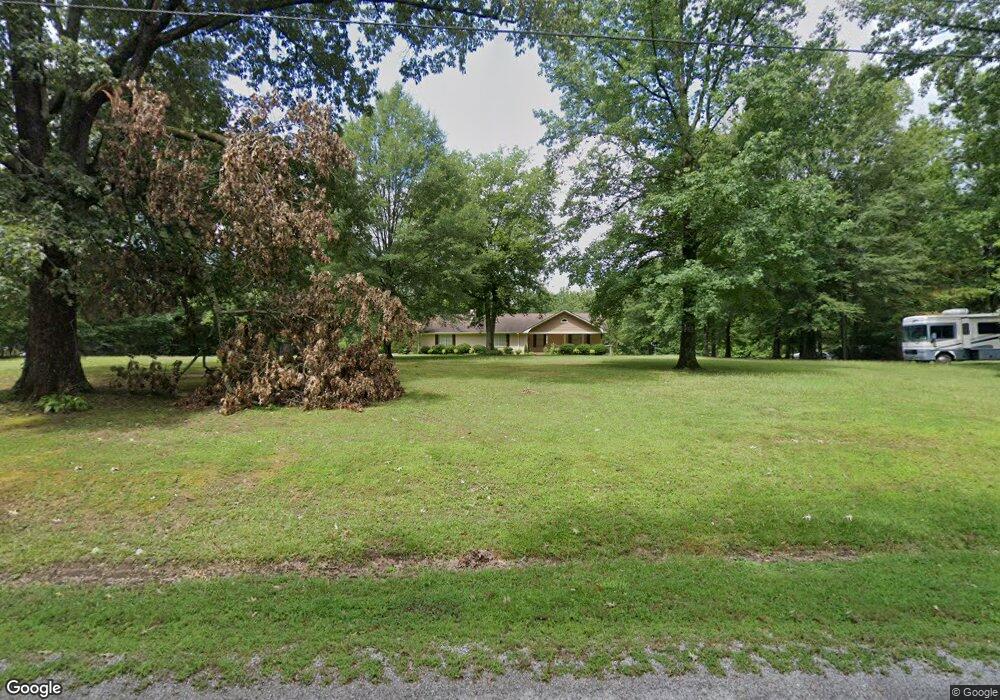
554 S McGregor Chapel Rd Pontotoc, MI 38863
Estimated Value: $186,237 - $323,000
3
Beds
2
Baths
1,897
Sq Ft
$125/Sq Ft
Est. Value
About This Home
This home is located at 554 S McGregor Chapel Rd, Pontotoc, MI 38863 and is currently estimated at $236,559, approximately $124 per square foot. 554 S McGregor Chapel Rd is a home located in Pontotoc County with nearby schools including Pontotoc Elementary School, D.T. Cox Elementary School, and Pontotoc Junior High School.
Ownership History
Date
Name
Owned For
Owner Type
Purchase Details
Closed on
Aug 8, 2019
Sold by
Huffstatler James Britt and Huffstatler Mary K
Bought by
Carter Justin T
Current Estimated Value
Home Financials for this Owner
Home Financials are based on the most recent Mortgage that was taken out on this home.
Original Mortgage
$165,151
Outstanding Balance
$144,642
Interest Rate
3.7%
Mortgage Type
New Conventional
Estimated Equity
$91,917
Purchase Details
Closed on
Jun 27, 2016
Sold by
Mckay Gerald and Mckay Jerry
Bought by
Huffstatler James Britt and Huffstatler Mary K
Home Financials for this Owner
Home Financials are based on the most recent Mortgage that was taken out on this home.
Original Mortgage
$129,505
Interest Rate
3.64%
Mortgage Type
Purchase Money Mortgage
Create a Home Valuation Report for This Property
The Home Valuation Report is an in-depth analysis detailing your home's value as well as a comparison with similar homes in the area
Home Values in the Area
Average Home Value in this Area
Purchase History
| Date | Buyer | Sale Price | Title Company |
|---|---|---|---|
| Carter Justin T | -- | None Available | |
| Huffstatler James Britt | -- | -- |
Source: Public Records
Mortgage History
| Date | Status | Borrower | Loan Amount |
|---|---|---|---|
| Open | Carter Justin T | $165,151 | |
| Previous Owner | Huffstatler James Britt | $129,505 |
Source: Public Records
Tax History Compared to Growth
Tax History
| Year | Tax Paid | Tax Assessment Tax Assessment Total Assessment is a certain percentage of the fair market value that is determined by local assessors to be the total taxable value of land and additions on the property. | Land | Improvement |
|---|---|---|---|---|
| 2024 | $1,483 | $11,607 | $0 | $0 |
| 2023 | $1,480 | $11,607 | $0 | $0 |
| 2022 | $1,072 | $10,733 | $0 | $0 |
| 2021 | $1,106 | $10,733 | $0 | $0 |
| 2020 | $1,332 | $10,733 | $0 | $0 |
| 2019 | $1,051 | $10,701 | $0 | $0 |
| 2018 | $961 | $9,979 | $0 | $0 |
| 2017 | $317 | $9,921 | $0 | $0 |
| 2016 | $317 | $9,921 | $0 | $0 |
| 2015 | -- | $10,027 | $0 | $0 |
| 2014 | -- | $10,027 | $0 | $0 |
Source: Public Records
Map
Nearby Homes
- 410 McGregor Chapel Rd N
- 0 Veterans Hwy W
- 575 Rocky Ford Rd
- 401 Dusty Trail
- 535 Beulah Grove Rd
- 484 ac Mud Creek Rd
- 438 W Reynolds St
- 0 0 Tallant Lane (16 6 Ac)
- 0 Mississippi 336
- 0 Tallant Ln
- 332 Greenwood St
- 0 0 Hwy 15 Unit 25-1317
- 44.36 ac City Ave N
- 231 Greenbriar Cir
- 0 Henry Southern Dr
- 0 5 Star Road (6 97 Ac)
- 0 Henry Southern Dr 5 Star Ro Unit 25-1459
- 0 5 Star Road (1 25 Ac)
- 0 5 Star Road (1 Ac)
- 5 Star Rd
- 554 McGregor Chapel Rd S
- 598 McGregor Chapel Rd S
- 598 McGregor Chapel Rd S
- 639 S McGregor Chapel Rd
- 654 McGregor Chapel Rd S
- 639 McGregor Chapel Rd S
- 428 McGregor Chapel Rd S
- 357 McGregor Chapel Rd S
- 357 McGregor Chapel Rd S
- 341 McGregor Chapel Rd S
- 771 McGregor Chapel Rd S
- 335 McGregor Chapel Rd S
- 156 McGregor Chapel Rd S
- 157 McGregor Chapel Rd S
- 157 McGregor Chapel Rd S
- 157 McGregor Chapel Rd S
- 937 McGregor Chapel Rd S
- 137 McGregor Chapel Rd S
- 109 McGregor Chapel Rd S
- 65 McGregor Chapel Rd S