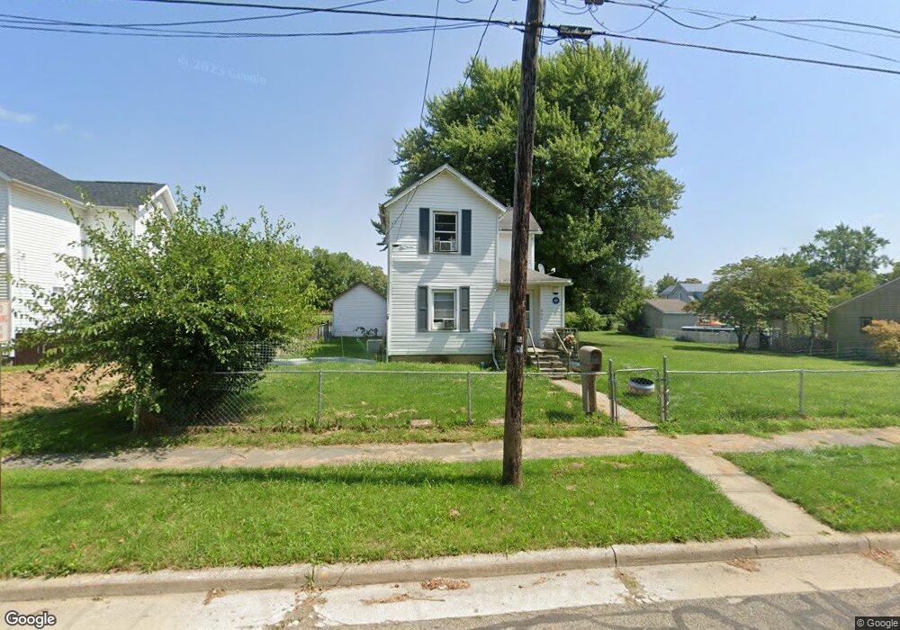
554 Thompson St Marion, OH 43302
Estimated Value: $87,615 - $116,000
3
Beds
1
Bath
1,470
Sq Ft
$68/Sq Ft
Est. Value
About This Home
This home is located at 554 Thompson St, Marion, OH 43302 and is currently estimated at $99,404, approximately $67 per square foot. 554 Thompson St is a home located in Marion County with nearby schools including Rutherford B. Hayes Elementary School, Ulysses S. Grant Middle School, and Harding High School.
Ownership History
Date
Name
Owned For
Owner Type
Purchase Details
Closed on
Oct 22, 2020
Sold by
Cunningham Loren
Bought by
Keller Lowell S and Keller Debbie R
Current Estimated Value
Home Financials for this Owner
Home Financials are based on the most recent Mortgage that was taken out on this home.
Original Mortgage
$45,600
Outstanding Balance
$40,112
Interest Rate
2.8%
Mortgage Type
New Conventional
Estimated Equity
$59,292
Purchase Details
Closed on
Apr 25, 2016
Sold by
Estate Of Mary Jane Cunningham
Bought by
Cunningham Loren
Create a Home Valuation Report for This Property
The Home Valuation Report is an in-depth analysis detailing your home's value as well as a comparison with similar homes in the area
Home Values in the Area
Average Home Value in this Area
Purchase History
| Date | Buyer | Sale Price | Title Company |
|---|---|---|---|
| Keller Lowell S | $57,000 | None Available | |
| Cunningham Loren | -- | None Available |
Source: Public Records
Mortgage History
| Date | Status | Borrower | Loan Amount |
|---|---|---|---|
| Open | Keller Lowell S | $45,600 |
Source: Public Records
Tax History
| Year | Tax Paid | Tax Assessment Tax Assessment Total Assessment is a certain percentage of the fair market value that is determined by local assessors to be the total taxable value of land and additions on the property. | Land | Improvement |
|---|---|---|---|---|
| 2025 | $372 | $26,890 | $1,310 | $25,580 |
| 2024 | $372 | $19,700 | $1,250 | $18,450 |
| 2023 | $372 | $19,700 | $1,250 | $18,450 |
| 2022 | $685 | $19,700 | $1,250 | $18,450 |
| 2021 | $591 | $15,280 | $1,090 | $14,190 |
| 2020 | $591 | $15,280 | $1,090 | $14,190 |
| 2019 | $590 | $15,280 | $1,090 | $14,190 |
| 2018 | $580 | $15,030 | $1,070 | $13,960 |
| 2017 | $588 | $15,030 | $1,070 | $13,960 |
| 2016 | $244 | $15,030 | $1,070 | $13,960 |
| 2015 | $237 | $14,730 | $1,030 | $13,700 |
| 2014 | $239 | $14,730 | $1,030 | $13,700 |
| 2012 | $316 | $16,660 | $1,450 | $15,210 |
Source: Public Records
Map
Nearby Homes
- 641 Blake Ave
- 414 Thompson St
- 805 Silver St
- 230 Edwards St
- 343 Commercial St
- 384 Mary St
- 213 Sharp St
- 636 Oak St
- 233 Tully St
- 138 Park Blvd
- 839 Bennett St
- 552 N Prospect St
- 532 N Prospect St
- 438 N Prospect St Unit 434
- 284 Latourette St
- 531 N Main St
- 199 Olney Ave
- 245 Park Blvd
- 736 N Main St
- 324 W Church St
- 562 Thompson St
- 542 Thompson St
- 567 Thompson St
- 537 Scranton Ave
- 555 Thompson St
- 545 Thompson St
- 575 Thompson St
- 537 Thompson St
- 520 Thompson St
- 581 Thompson St
- 529 Thompson St
- 585 Thompson St
- 521 Scranton Ave
- 618 Evans St
- 513 Scranton Ave
- 517 Thompson St
- 508 Thompson St
- 482 David''S St
- 6559 6559
- 507 Scranton Ave
Your Personal Tour Guide
Ask me questions while you tour the home.