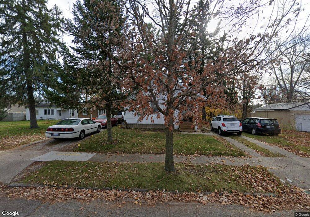
554 Tisdale Ave Lansing, MI 48910
Clifford Park NeighborhoodEstimated Value: $117,000 - $145,000
--
Bed
--
Bath
938
Sq Ft
$134/Sq Ft
Est. Value
About This Home
This home is located at 554 Tisdale Ave, Lansing, MI 48910 and is currently estimated at $125,813, approximately $134 per square foot. 554 Tisdale Ave is a home located in Ingham County with nearby schools including Lyons Elementary School, Attwood School, and Eastern High School.
Ownership History
Date
Name
Owned For
Owner Type
Purchase Details
Closed on
Feb 8, 2022
Sold by
Johnson Jr Richard P
Bought by
Johnson Richard P
Current Estimated Value
Purchase Details
Closed on
Jul 10, 2002
Sold by
Kelly Beverly J and Johnson Beverly J
Bought by
Johnson Richard P and Johnson Beverly J
Home Financials for this Owner
Home Financials are based on the most recent Mortgage that was taken out on this home.
Original Mortgage
$39,000
Interest Rate
6.62%
Mortgage Type
Purchase Money Mortgage
Purchase Details
Closed on
Jun 1, 1992
Create a Home Valuation Report for This Property
The Home Valuation Report is an in-depth analysis detailing your home's value as well as a comparison with similar homes in the area
Home Values in the Area
Average Home Value in this Area
Purchase History
| Date | Buyer | Sale Price | Title Company |
|---|---|---|---|
| Johnson Richard P | -- | None Listed On Document | |
| Johnson Richard P | -- | First American Title | |
| -- | $43,900 | -- |
Source: Public Records
Mortgage History
| Date | Status | Borrower | Loan Amount |
|---|---|---|---|
| Previous Owner | Johnson Richard P | $39,000 | |
| Closed | Johnson Richard P | $24,000 |
Source: Public Records
Tax History Compared to Growth
Tax History
| Year | Tax Paid | Tax Assessment Tax Assessment Total Assessment is a certain percentage of the fair market value that is determined by local assessors to be the total taxable value of land and additions on the property. | Land | Improvement |
|---|---|---|---|---|
| 2025 | $2,380 | $60,700 | $9,400 | $51,300 |
| 2024 | $19 | $55,100 | $9,400 | $45,700 |
| 2023 | $2,233 | $50,600 | $9,400 | $41,200 |
| 2022 | $2,015 | $43,400 | $8,600 | $34,800 |
| 2021 | $1,973 | $40,000 | $5,600 | $34,400 |
| 2020 | $1,961 | $38,100 | $5,600 | $32,500 |
| 2019 | $1,878 | $33,300 | $5,600 | $27,700 |
| 2018 | $1,762 | $30,700 | $5,600 | $25,100 |
| 2017 | $1,686 | $30,700 | $5,600 | $25,100 |
| 2016 | $1,613 | $30,200 | $5,600 | $24,600 |
| 2015 | $1,613 | $28,900 | $11,241 | $17,659 |
| 2014 | $1,613 | $28,200 | $8,743 | $19,457 |
Source: Public Records
Map
Nearby Homes
- 601 Tisdale Ave
- 626 Tisdale Ave
- 538 Pacific Ave
- 701 Tisdale Ave
- 520 Riley St
- 2208 Lyons Ave
- 2230 Maplewood Ave
- 904 Pacific Ave
- 704 Mckim Ave
- 2107 Teel Ave
- 2340 S Pennsylvania Ave
- 525 E Mount Hope Ave
- 413 E Hodge Ave
- 1818 Ray St
- 1927 Teel Ave
- 2309 S Pennsylvania Ave
- 3145 S Cedar St
- 2201 S Pennsylvania Ave
- 918 Mckim Ave
- 610 N Dexter Dr
- 558 Tisdale Ave
- 548 Tisdale Ave
- 562 Tisdale Ave
- 540 Tisdale Ave
- 555 Lincoln Ave
- 553 Lincoln Ave
- 566 Tisdale Ave
- 549 Lincoln Ave
- 563 Lincoln Ave
- 555 Tisdale Ave
- 551 Tisdale Ave
- 541 Lincoln Ave
- 561 Tisdale Ave
- 549 Tisdale Ave
- 567 Tisdale Ave
- 545 Tisdale Ave
- 571 Lincoln Ave
- 569 Lincoln Ave
- 571 Tisdale Ave