Estimated Value: $399,000 - $506,000
3
Beds
2
Baths
1,030
Sq Ft
$438/Sq Ft
Est. Value
About This Home
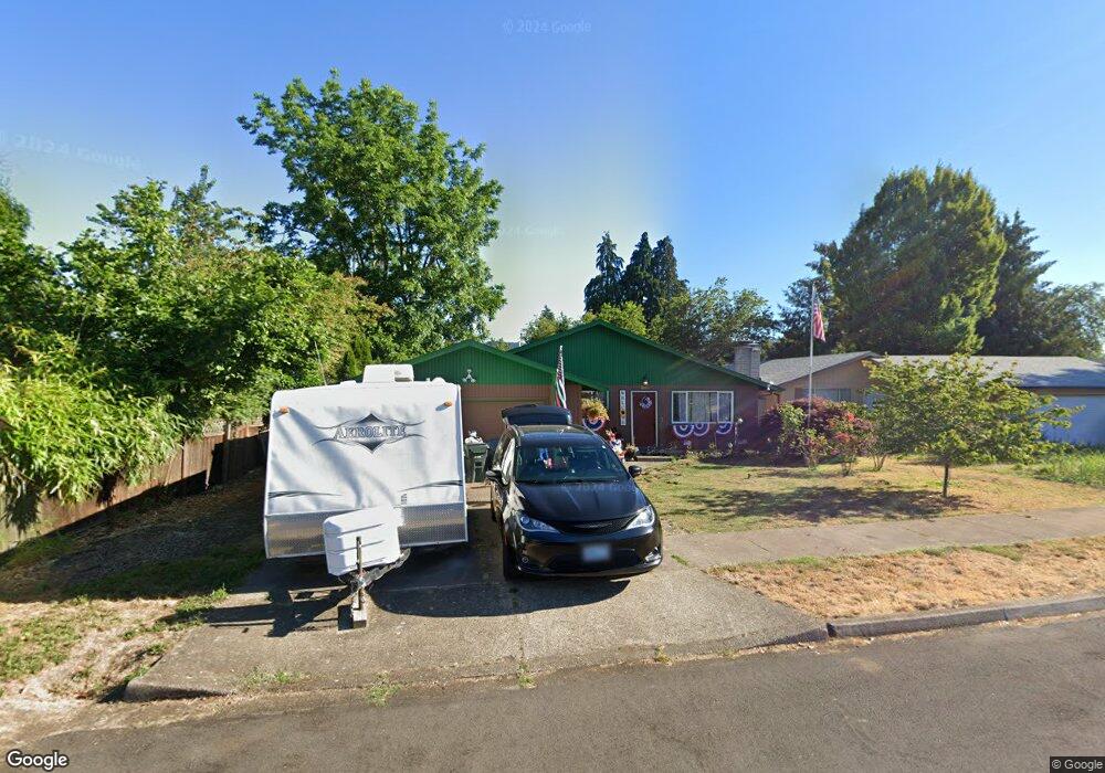
This home is located at 554 V St, Springfield, OR 97477 and is currently estimated at $451,003, approximately $437 per square foot. 554 V St is a home located in Lane County with nearby schools including Elizabeth Page Elementary School, Briggs Middle School, and Springfield High School.
Ownership History
Date
Name
Owned For
Owner Type
Purchase Details
Closed on
Jul 20, 2006
Sold by
Scott Kassandra L and Taylor Kassandra L
Bought by
Scott Kassandra L
Current Estimated Value
Purchase Details
Closed on
Mar 5, 2002
Sold by
Lanphear John and Lanphear Terri
Bought by
Taylor Kassandra L
Home Financials for this Owner
Home Financials are based on the most recent Mortgage that was taken out on this home.
Original Mortgage
$100,605
Outstanding Balance
$44,968
Interest Rate
8.37%
Estimated Equity
$406,035
Create a Home Valuation Report for This Property
The Home Valuation Report is an in-depth analysis detailing your home's value as well as a comparison with similar homes in the area
Home Values in the Area
Average Home Value in this Area
Purchase History
| Date | Buyer | Sale Price | Title Company |
|---|---|---|---|
| Scott Kassandra L | -- | First American Title | |
| Taylor Kassandra L | $105,900 | Western Title & Escrow Compa |
Source: Public Records
Mortgage History
| Date | Status | Borrower | Loan Amount |
|---|---|---|---|
| Open | Taylor Kassandra L | $100,605 |
Source: Public Records
Tax History
| Year | Tax Paid | Tax Assessment Tax Assessment Total Assessment is a certain percentage of the fair market value that is determined by local assessors to be the total taxable value of land and additions on the property. | Land | Improvement |
|---|---|---|---|---|
| 2025 | $4,703 | $256,470 | -- | -- |
| 2024 | $4,627 | $249,000 | -- | -- |
| 2023 | $4,627 | $241,748 | $0 | $0 |
| 2022 | $4,285 | $234,707 | $0 | $0 |
| 2021 | $4,208 | $227,871 | $0 | $0 |
| 2020 | $4,085 | $221,234 | $0 | $0 |
| 2019 | $3,963 | $214,791 | $0 | $0 |
| 2018 | $3,735 | $202,461 | $0 | $0 |
| 2017 | $3,592 | $202,461 | $0 | $0 |
| 2016 | $3,516 | $196,564 | $0 | $0 |
| 2015 | $3,416 | $190,839 | $0 | $0 |
| 2014 | $3,365 | $185,281 | $0 | $0 |
Source: Public Records
Map
Nearby Homes
- 421 Woodlane Dr
- 2136 8th St
- 2268 9th St
- 817 River Knoll Way
- 212 Hayden Bridge Way
- 2545 Walnut Ridge Dr
- 126 Woodlane Dr
- 937 S St
- 114 Hayden Bridge Way
- 780 Q St
- 40 Allen Ave
- 1132 T St
- 1194 R St
- 2150 Laura St Unit 119
- 2150 Laura St Unit 111
- 2150 Laura St Unit 39
- 2150 Laura St Unit 57
- 2150 Laura St Unit 83
- 2150 Laura St Unit 44
- 2150 Laura (#57) St Unit 57
Your Personal Tour Guide
Ask me questions while you tour the home.