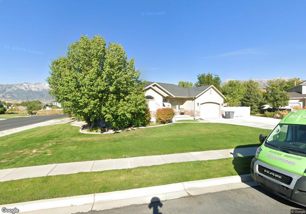
554 W 1250 North Cir American Fork, UT 84003
Estimated Value: $597,000 - $663,062
3
Beds
3
Baths
1,520
Sq Ft
$411/Sq Ft
Est. Value
About This Home
This home is located at 554 W 1250 North Cir, American Fork, UT 84003 and is currently estimated at $624,266, approximately $410 per square foot. 554 W 1250 North Cir is a home located in Utah County with nearby schools including Legacy Elementary School, American Fork Junior High School, and American Fork High School.
Ownership History
Date
Name
Owned For
Owner Type
Purchase Details
Closed on
Jun 8, 2021
Sold by
Waite Mark S and Waite Tamara L
Bought by
Waite Mark Stephen and Waite Tamara Lee
Current Estimated Value
Purchase Details
Closed on
Jun 23, 2004
Sold by
Carson Harvey R
Bought by
Waite Mark S and Waite Tamara L
Home Financials for this Owner
Home Financials are based on the most recent Mortgage that was taken out on this home.
Original Mortgage
$171,600
Outstanding Balance
$85,511
Interest Rate
6.29%
Mortgage Type
Purchase Money Mortgage
Estimated Equity
$538,755
Purchase Details
Closed on
Sep 22, 2003
Sold by
Carson Davis Investment Lc
Bought by
Carson Harvey R
Create a Home Valuation Report for This Property
The Home Valuation Report is an in-depth analysis detailing your home's value as well as a comparison with similar homes in the area
Home Values in the Area
Average Home Value in this Area
Purchase History
| Date | Buyer | Sale Price | Title Company |
|---|---|---|---|
| Waite Mark Stephen | -- | None Available | |
| Waite Mark S | -- | Bartlett Title Insurance Ag | |
| Carson Harvey R | -- | Bartlett Title Insurance |
Source: Public Records
Mortgage History
| Date | Status | Borrower | Loan Amount |
|---|---|---|---|
| Open | Waite Mark S | $171,600 | |
| Closed | Waite Mark S | $32,150 |
Source: Public Records
Tax History Compared to Growth
Tax History
| Year | Tax Paid | Tax Assessment Tax Assessment Total Assessment is a certain percentage of the fair market value that is determined by local assessors to be the total taxable value of land and additions on the property. | Land | Improvement |
|---|---|---|---|---|
| 2025 | $2,652 | $327,140 | $241,100 | $353,700 |
| 2024 | $2,652 | $294,635 | $0 | $0 |
| 2023 | $2,443 | $287,815 | $0 | $0 |
| 2022 | $2,757 | $320,485 | $0 | $0 |
| 2021 | $2,205 | $400,400 | $137,200 | $263,200 |
| 2020 | $2,118 | $373,000 | $127,000 | $246,000 |
| 2019 | $1,872 | $340,900 | $127,000 | $213,900 |
| 2018 | $1,872 | $326,100 | $123,300 | $202,800 |
| 2017 | $1,714 | $161,150 | $0 | $0 |
| 2016 | $1,733 | $151,305 | $0 | $0 |
| 2015 | $1,757 | $145,640 | $0 | $0 |
| 2014 | $1,781 | $145,640 | $0 | $0 |
Source: Public Records
Map
Nearby Homes
- 425 W 1120 N
- 356 W 1300 N
- 1438 N 400 W
- 471 W 1040 N
- 344 W 1080 N
- 287 W 1360 N
- 987 N 410 W
- 9435 N Aspen Hollow Cir
- 179 W 1290 N
- 3889 W 950 Cir N Unit 366
- 914 N 400 W Unit A
- 984 N 300 W
- 3935 W 1000 N Unit 438
- 3983 W 1000 N Unit 442
- 4007 W 1000 N
- 3947 W 1000 N Unit 439
- 3971 W 1000 N Unit 441
- 3959 W 1000 N
- 602 W 860 N
- 6692 W 9770 N
- 1268 N 580 W
- 542 W 1250 North Cir
- 557 W 1250 North Cir
- 1251 N 500 W
- 1273 N 500 W
- 1263 N 560 W
- 533 W 1250 North Cir
- 1249 N 560 W
- 1239 N 500 W
- 545 W 1250 North Cir
- 1237 N 560 W
- 1227 N 500 W
- 1222 N 560 W
- 1222 N 560 W Unit 16
- 1222 N 560 W Unit 2 E
- 1222 N 560 W Unit 17
- 1222 N 560 W Unit 22B
- 1222 N 560 W Unit 21
- 1222 N 560 W Unit 22E
- 1283 N 500 W