Estimated Value: $312,000 - $435,317
3
Beds
2
Baths
2,748
Sq Ft
$142/Sq Ft
Est. Value
About This Home
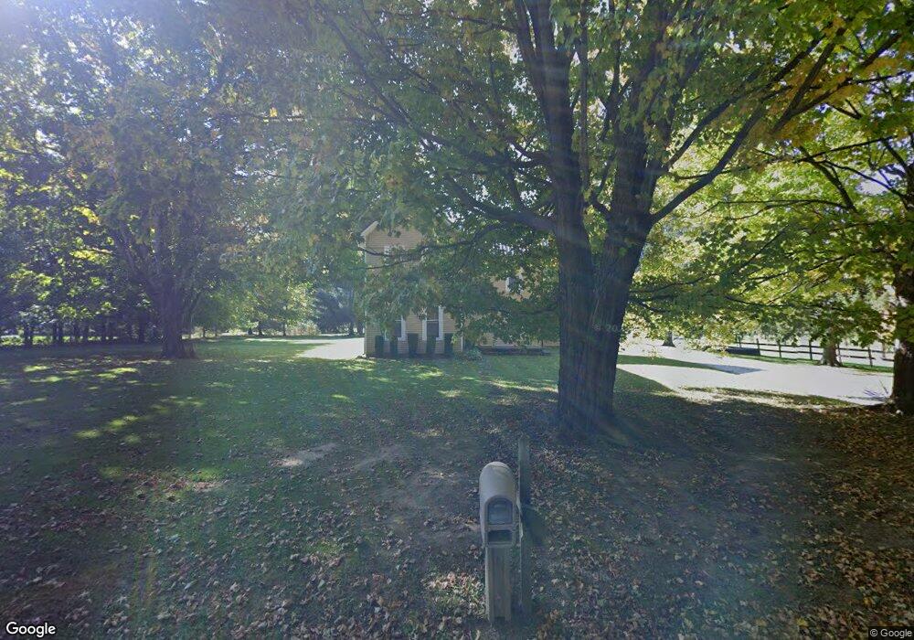
This home is located at 5542 S Fork Rd, Heath, OH 43056 and is currently estimated at $389,829, approximately $141 per square foot. 5542 S Fork Rd is a home located in Licking County with nearby schools including Jackson Intermediate School, Lakewood Middle School, and Lakewood High School.
Ownership History
Date
Name
Owned For
Owner Type
Purchase Details
Closed on
Dec 23, 2010
Sold by
Hartzell Wayne and Hartzell Tonya J
Bought by
Hartzell Robert W and Hartzell Tonya J
Current Estimated Value
Purchase Details
Closed on
Feb 15, 2005
Sold by
City Of Heath
Bought by
Hartzell Wayne and Hartzell Robert W
Home Financials for this Owner
Home Financials are based on the most recent Mortgage that was taken out on this home.
Original Mortgage
$130,000
Outstanding Balance
$79,867
Interest Rate
9.09%
Mortgage Type
Unknown
Estimated Equity
$309,962
Purchase Details
Closed on
Jun 16, 2004
Sold by
Johnson Sherry L
Bought by
Smiths Inc
Purchase Details
Closed on
May 28, 2002
Sold by
Hood Nancy M
Bought by
Johnson Sherry L
Home Financials for this Owner
Home Financials are based on the most recent Mortgage that was taken out on this home.
Original Mortgage
$77,000
Interest Rate
7.07%
Mortgage Type
New Conventional
Create a Home Valuation Report for This Property
The Home Valuation Report is an in-depth analysis detailing your home's value as well as a comparison with similar homes in the area
Home Values in the Area
Average Home Value in this Area
Purchase History
| Date | Buyer | Sale Price | Title Company |
|---|---|---|---|
| Hartzell Robert W | -- | Attorney | |
| Hartzell Wayne | $130,000 | -- | |
| Smiths Inc | $172,000 | -- | |
| Johnson Sherry L | $85,000 | -- |
Source: Public Records
Mortgage History
| Date | Status | Borrower | Loan Amount |
|---|---|---|---|
| Open | Hartzell Wayne | $130,000 | |
| Previous Owner | Johnson Sherry L | $77,000 |
Source: Public Records
Tax History Compared to Growth
Tax History
| Year | Tax Paid | Tax Assessment Tax Assessment Total Assessment is a certain percentage of the fair market value that is determined by local assessors to be the total taxable value of land and additions on the property. | Land | Improvement |
|---|---|---|---|---|
| 2024 | $3,395 | $103,610 | $25,730 | $77,880 |
| 2023 | $3,457 | $103,610 | $25,730 | $77,880 |
| 2022 | $3,559 | $76,690 | $19,810 | $56,880 |
| 2021 | $3,664 | $76,690 | $19,810 | $56,880 |
| 2020 | $3,670 | $76,690 | $19,810 | $56,880 |
| 2019 | $3,202 | $62,620 | $18,870 | $43,750 |
| 2018 | $3,235 | $0 | $0 | $0 |
| 2017 | $2,277 | $0 | $0 | $0 |
| 2016 | $2,142 | $0 | $0 | $0 |
| 2015 | $2,019 | $0 | $0 | $0 |
| 2014 | $3,030 | $0 | $0 | $0 |
| 2013 | $2,109 | $0 | $0 | $0 |
Source: Public Records
Map
Nearby Homes
- 206 Kristen Way W
- 95 Jonathan Dr
- 71 Barb Ave
- 16 Barb Ave
- 301 River Oaks Dr
- 111 Barb Ave
- 1305 Kacey Ct
- Cloverly B Plan at River Oaks
- Anderson Plan at River Oaks
- Allister Plan at River Oaks
- Cloverly C Plan at River Oaks
- 381 Laurel Oaks Ln
- 387 Laurel Oaks Ln
- 399 Laurel Oaks Ln Unit Lot 131
- 232 Heath Rd
- 403 Laurel Oaks Ln Unit Lot 132
- 965 Nadine Dr
- 909 Fieldson Dr
- 878 Oberlin Dr
- 832 Oberlin Dr
- 5552 S Fork Rd
- Lot 22 S Fork Rd
- Lot 20 S Fork Rd
- Lot 21 S Fork Rd
- 0 S Fork Rd
- 5523 S Fork Rd
- 5624 S Fork Rd
- 5521 S Fork Rd
- 5691 S Fork Rd
- 5750 S Fork Rd
- 5775 S Fork Rd
- 5766 S Fork Rd
- 150 Irving Wick Dr E
- 409 Dawn Ln
- 308 Nicholas Dr
- 306 Nicholas Dr
- 309 Nicholas Dr
- 307 Nicholas Dr Unit 46
- 807 Emily Place
- 210 Avalon Dr