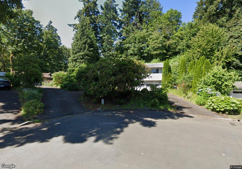
5542 Sinclair St West Linn, OR 97068
Bolton NeighborhoodEstimated Value: $667,000 - $754,000
3
Beds
3
Baths
2,176
Sq Ft
$327/Sq Ft
Est. Value
About This Home
This home is located at 5542 Sinclair St, West Linn, OR 97068 and is currently estimated at $712,312, approximately $327 per square foot. 5542 Sinclair St is a home located in Clackamas County with nearby schools including Bolton Primary School, West Linn High School, and Clackamas Academy of Industrial Sciences (CAIS).
Ownership History
Date
Name
Owned For
Owner Type
Purchase Details
Closed on
Dec 1, 2010
Sold by
Hanby Jeffery R and Hanby Eileen S
Bought by
Blevins Michael R and Blevins Lola
Current Estimated Value
Home Financials for this Owner
Home Financials are based on the most recent Mortgage that was taken out on this home.
Original Mortgage
$216,000
Outstanding Balance
$141,858
Interest Rate
4.18%
Mortgage Type
New Conventional
Estimated Equity
$570,454
Purchase Details
Closed on
Oct 5, 2005
Sold by
Hughes Jean C and Jean C Hughes Trust
Bought by
Hanby Jeffery R and Hanby Eileen S
Create a Home Valuation Report for This Property
The Home Valuation Report is an in-depth analysis detailing your home's value as well as a comparison with similar homes in the area
Home Values in the Area
Average Home Value in this Area
Purchase History
| Date | Buyer | Sale Price | Title Company |
|---|---|---|---|
| Blevins Michael R | $270,000 | Wfg Title | |
| Hanby Jeffery R | $330,000 | Transnation Title Agency Or |
Source: Public Records
Mortgage History
| Date | Status | Borrower | Loan Amount |
|---|---|---|---|
| Open | Blevins Michael R | $216,000 |
Source: Public Records
Tax History Compared to Growth
Tax History
| Year | Tax Paid | Tax Assessment Tax Assessment Total Assessment is a certain percentage of the fair market value that is determined by local assessors to be the total taxable value of land and additions on the property. | Land | Improvement |
|---|---|---|---|---|
| 2025 | $6,794 | $352,547 | -- | -- |
| 2024 | $6,540 | $342,279 | -- | -- |
| 2023 | $6,540 | $332,310 | $0 | $0 |
| 2022 | $6,173 | $322,632 | $0 | $0 |
| 2021 | $5,597 | $299,194 | $0 | $0 |
| 2020 | $5,635 | $290,480 | $0 | $0 |
| 2019 | $5,374 | $282,020 | $0 | $0 |
| 2018 | $5,134 | $273,806 | $0 | $0 |
| 2017 | $4,726 | $254,602 | $0 | $0 |
| 2016 | $4,604 | $247,186 | $0 | $0 |
| 2015 | $4,472 | $239,986 | $0 | $0 |
| 2014 | $4,295 | $232,996 | $0 | $0 |
Source: Public Records
Map
Nearby Homes
- 5390 Grove St
- 5687 River St
- 5089 Territorial Dr
- 909 Center St
- 824 Center St
- 5910 W A St
- 709 10th St
- 4711 Alder St
- 812 Jefferson St
- 401 4th St
- 411 4th St
- 911 9th St
- 4645 Pine St
- 1954 Buck St
- 312 High St
- 911 John Quincy Adams St
- 1870 Hemlock St
- 22691 Oregon City Loop
- 22881 Oregon City Loop
- 6345 Caufield St
- 5540 Sinclair St
- 5546 Sinclair St
- 5543 Sinclair St
- 5621 Cascade St
- 5550 Sinclair St
- 5547 Sinclair St
- 1485 Holly St
- 1475 Holly St
- 1485 Holly St
- 5560 Sinclair St
- 1465 Holly St
- 5551 Sinclair St
- 1459 Holly St Unit D
- 1503 Holly St
- 5625 Cascade St
- 5580 Sinclair St
- 5563 Sinclair St
- 1447 Holly St
- 1513 Holly St
- 1540 Garden St