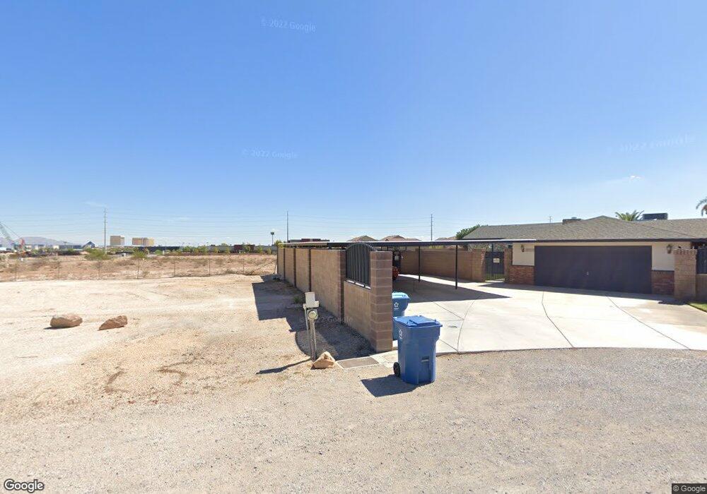
5545 W Oquendo Rd Las Vegas, NV 89118
Estimated Value: $541,000 - $992,000
4
Beds
3
Baths
2,619
Sq Ft
$295/Sq Ft
Est. Value
About This Home
This home is located at 5545 W Oquendo Rd, Las Vegas, NV 89118 and is currently estimated at $772,386, approximately $294 per square foot. 5545 W Oquendo Rd is a home located in Clark County with nearby schools including Helen Jydstrup Elementary School, Grant Sawyer Middle School, and Durango High School.
Ownership History
Date
Name
Owned For
Owner Type
Purchase Details
Closed on
Aug 19, 2005
Sold by
Selman Judy C
Bought by
Selman William J
Current Estimated Value
Home Financials for this Owner
Home Financials are based on the most recent Mortgage that was taken out on this home.
Original Mortgage
$102,000
Interest Rate
5.61%
Mortgage Type
New Conventional
Purchase Details
Closed on
Sep 14, 2001
Sold by
Selman Ernest L and Selman Judy C
Bought by
Selman Judy C and Selman William J
Create a Home Valuation Report for This Property
The Home Valuation Report is an in-depth analysis detailing your home's value as well as a comparison with similar homes in the area
Home Values in the Area
Average Home Value in this Area
Purchase History
| Date | Buyer | Sale Price | Title Company |
|---|---|---|---|
| Selman William J | -- | Commonwealth Title | |
| Selman Judy C | -- | -- |
Source: Public Records
Mortgage History
| Date | Status | Borrower | Loan Amount |
|---|---|---|---|
| Closed | Selman William J | $102,000 |
Source: Public Records
Tax History Compared to Growth
Tax History
| Year | Tax Paid | Tax Assessment Tax Assessment Total Assessment is a certain percentage of the fair market value that is determined by local assessors to be the total taxable value of land and additions on the property. | Land | Improvement |
|---|---|---|---|---|
| 2025 | $3,711 | $178,304 | $73,500 | $104,804 |
| 2024 | $3,604 | $178,304 | $73,500 | $104,804 |
| 2023 | $3,604 | $161,641 | $61,250 | $100,391 |
| 2022 | $3,668 | $147,572 | $54,250 | $93,322 |
| 2021 | $3,397 | $138,855 | $49,000 | $89,855 |
| 2020 | $3,151 | $139,273 | $49,000 | $90,273 |
| 2019 | $2,953 | $133,636 | $43,750 | $89,886 |
| 2018 | $2,818 | $127,837 | $40,250 | $87,587 |
| 2017 | $3,651 | $124,503 | $35,000 | $89,503 |
| 2016 | $2,638 | $118,315 | $28,000 | $90,315 |
| 2015 | $2,633 | $115,379 | $26,250 | $89,129 |
| 2014 | $2,556 | $98,532 | $17,500 | $81,032 |
Source: Public Records
Map
Nearby Homes
- 5332 Avory Peak Ct
- 5990 Viscaya Grove St
- 6210 W Quail Ave
- 5790 Westwind Rd
- 0 S Lindell Rd
- 0 W Patrick Ln Unit 2718906
- 5910 W Post Rd
- 5829 W Patrick Ln
- 5354 Silver Branch Ave
- 5645 Warm Light St
- 5607 W Dewey Dr
- 5880 W Post Rd
- 0 Woodstock
- 6315 Bellisima St
- 5875 W Post Rd
- 6053 Conroe Ct
- 5691 Leaning Oak Ave
- 5461 Dungaree St
- 5801 Exbury Gardens Ct
- 5449 Dungaree St
- 5575 W Oquendo Rd
- 5585 W Oquendo Rd
- 5990 S Lindell Rd
- 5990 Lindell Rd
- 5550 W Oquendo Rd
- 5560 W Oquendo Rd
- 5540 W Oquendo Rd
- 5330 Tavera Cliff Ct
- 5331 Tavera Cliff Ct
- 5959 Viscaya Grove St
- 0 To Be Determined Unit 2555832
- 0 Lindell & Ponderosa Unit 2581724
- 5876 Lindell Rd
- 5969 Viscaya Grove St
- 5395 Ponderosa Way
- 5866 Lindell Rd
- 5981 Viscaya Grove St
- 5365 Ponderosa Way
- 5991 Viscaya Grove St
- 5960 Viscaya Grove St