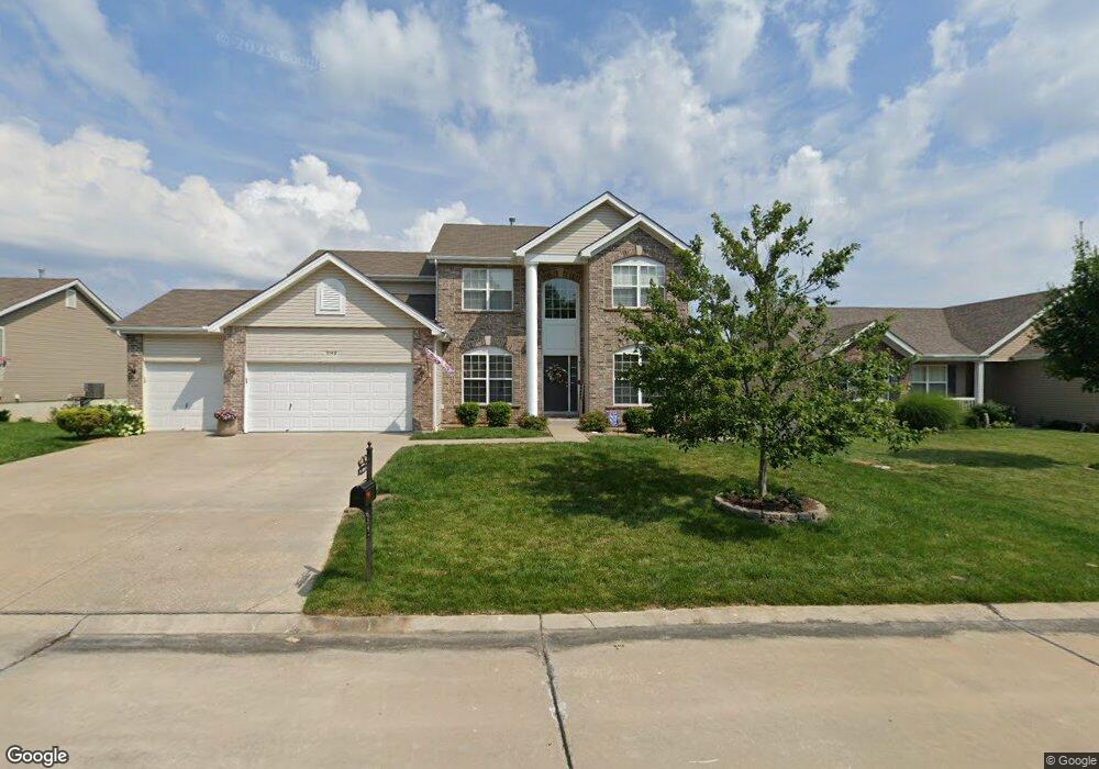
5549 Ashboro Dr Unit 59 Saint Charles, MO 63304
Estimated Value: $499,001 - $558,000
4
Beds
3
Baths
2,800
Sq Ft
$188/Sq Ft
Est. Value
About This Home
This home is located at 5549 Ashboro Dr Unit 59, Saint Charles, MO 63304 and is currently estimated at $526,250, approximately $187 per square foot. 5549 Ashboro Dr Unit 59 is a home located in St. Charles County with nearby schools including Warren Elementary School, Francis Howell Middle School, and Francis Howell Union High School.
Ownership History
Date
Name
Owned For
Owner Type
Purchase Details
Closed on
Feb 23, 2011
Sold by
Mcbride Columbus Pointe Llc
Bought by
Hendrix Ronald R and Hendrix Tara D
Current Estimated Value
Home Financials for this Owner
Home Financials are based on the most recent Mortgage that was taken out on this home.
Original Mortgage
$212,500
Outstanding Balance
$145,063
Interest Rate
4.73%
Mortgage Type
New Conventional
Estimated Equity
$381,187
Create a Home Valuation Report for This Property
The Home Valuation Report is an in-depth analysis detailing your home's value as well as a comparison with similar homes in the area
Home Values in the Area
Average Home Value in this Area
Purchase History
| Date | Buyer | Sale Price | Title Company |
|---|---|---|---|
| Hendrix Ronald R | $252,500 | Dependable Title Llc |
Source: Public Records
Mortgage History
| Date | Status | Borrower | Loan Amount |
|---|---|---|---|
| Open | Hendrix Ronald R | $212,500 |
Source: Public Records
Tax History Compared to Growth
Tax History
| Year | Tax Paid | Tax Assessment Tax Assessment Total Assessment is a certain percentage of the fair market value that is determined by local assessors to be the total taxable value of land and additions on the property. | Land | Improvement |
|---|---|---|---|---|
| 2025 | $4,809 | $83,977 | -- | -- |
| 2023 | $4,807 | $77,431 | $0 | $0 |
| 2022 | $4,377 | $65,405 | $0 | $0 |
| 2021 | $4,306 | $64,278 | $0 | $0 |
| 2020 | $4,247 | $61,361 | $0 | $0 |
| 2019 | $4,229 | $61,361 | $0 | $0 |
| 2018 | $3,962 | $54,887 | $0 | $0 |
| 2017 | $3,931 | $54,887 | $0 | $0 |
| 2016 | $3,856 | $51,782 | $0 | $0 |
| 2015 | $3,822 | $51,782 | $0 | $0 |
| 2014 | $3,506 | $46,056 | $0 | $0 |
Source: Public Records
Map
Nearby Homes
- 5504 Dressel Dr
- 5576 Wavecrest Cir
- 5701 Wrenwyck Place
- 25 Terre Verte Ct
- 232 Maple Point Dr
- 5579 Westerfield Pkwy Unit 8B
- 14 Walnut Hill Ct
- 1209 Crooked Creek Dr
- 0 Universal Design Prairie Bluff Unit MAR24041208
- 1361 Briar Creek Dr
- 301 Switchgrass Landing Ln
- 3009 Bruce Trail Ct
- 831 Ridgetop Cir
- Rosemont Plan at Prairie Bluff - Heritage Collection
- Sierra Plan at Prairie Bluff - Heritage Collection
- Sierra – Universal Design Plan at Prairie Bluff - Heritage Collection
- Pierce Plan at Prairie Bluff - Heritage Collection
- Lancaster Plan at Prairie Bluff - Heritage Collection
- Chesapeake Plan at Prairie Bluff - Heritage Collection
- Windsor Plan at Prairie Bluff - Heritage Collection
- 5549 Ashboro Dr
- 5551 Ashboro Dr
- 5547 Ashboro Dr
- 5514 Emerald Ridge Dr
- 5512 Emerald Place Dr
- 5516 Emerald Place Dr
- 5553 Ashboro Dr
- 5545 Ashboro Dr
- 5550 Ashboro Dr
- 5548 Ashboro Dr
- 5510 Emerald Ridge Dr
- 5552 Ashboro Dr
- 5518 Emerald Ridge Dr
- 5518 Emerald Ridge Dr Unit 76
- 5546 Ashboro Dr
- 5508 Emerald Ridge Dr
- 5555 Ashboro Dr
- 5554 Ashboro Dr
- 5543 Ashboro Dr
- 5520 Emerald Place Dr