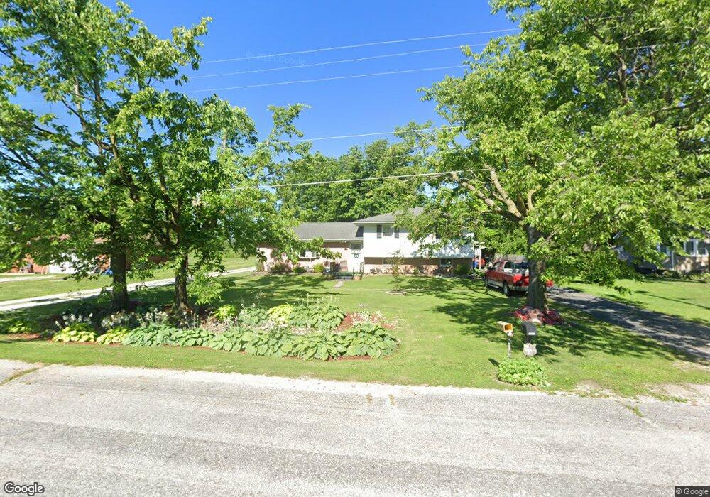
5549 N State Route 159 Edwardsville, IL 62025
Estimated Value: $177,655 - $297,000
3
Beds
2
Baths
728
Sq Ft
$328/Sq Ft
Est. Value
About This Home
This home is located at 5549 N State Route 159, Edwardsville, IL 62025 and is currently estimated at $238,664, approximately $327 per square foot. 5549 N State Route 159 is a home located in Madison County with nearby schools including N.O. Nelson Elementary School, Woodland Elementary School, and Lincoln Middle School.
Ownership History
Date
Name
Owned For
Owner Type
Purchase Details
Closed on
Sep 12, 2003
Sold by
Stephenson Rickey Allen and Funston Sherry Lynn
Bought by
Funston Sherry and Drake Darrell L
Current Estimated Value
Home Financials for this Owner
Home Financials are based on the most recent Mortgage that was taken out on this home.
Original Mortgage
$50,000
Interest Rate
6.44%
Mortgage Type
Purchase Money Mortgage
Create a Home Valuation Report for This Property
The Home Valuation Report is an in-depth analysis detailing your home's value as well as a comparison with similar homes in the area
Home Values in the Area
Average Home Value in this Area
Purchase History
| Date | Buyer | Sale Price | Title Company |
|---|---|---|---|
| Funston Sherry | $120,000 | Community Title & Escrow |
Source: Public Records
Mortgage History
| Date | Status | Borrower | Loan Amount |
|---|---|---|---|
| Closed | Funston Sherry | $50,000 |
Source: Public Records
Tax History Compared to Growth
Tax History
| Year | Tax Paid | Tax Assessment Tax Assessment Total Assessment is a certain percentage of the fair market value that is determined by local assessors to be the total taxable value of land and additions on the property. | Land | Improvement |
|---|---|---|---|---|
| 2024 | $3,290 | $58,370 | $3,630 | $54,740 |
| 2023 | $3,290 | $54,170 | $3,370 | $50,800 |
| 2022 | $3,031 | $49,990 | $3,110 | $46,880 |
| 2021 | $2,703 | $47,040 | $2,930 | $44,110 |
| 2020 | $2,588 | $45,070 | $2,810 | $42,260 |
| 2019 | $2,548 | $44,160 | $2,750 | $41,410 |
| 2018 | $2,797 | $47,140 | $5,670 | $41,470 |
| 2017 | $2,774 | $45,720 | $5,500 | $40,220 |
| 2016 | $2,453 | $45,720 | $5,500 | $40,220 |
| 2015 | $2,166 | $45,720 | $5,500 | $40,220 |
| 2014 | $2,166 | $45,720 | $5,500 | $40,220 |
| 2013 | $2,166 | $45,720 | $5,500 | $40,220 |
Source: Public Records
Map
Nearby Homes
- 0 White Pine Lot 10 Dr Unit MAR24071307
- 0 Ebbets Field Subdv Unit 23019883
- 121 Fox Hill Ct
- 112 Fox Hill Ct
- 101 Fox Hill Ct
- 6613 Fox View Dr
- 6623 Fox View Dr
- 4 Tranquility Ridge
- 0 Dr Unit MAR24071988
- 0 White Pine Lot 15 Dr Unit MAR24072074
- 0 White Pine Lot 13 Dr Unit MAR24072068
- 0 River Birch Lot 24 Dr Unit MAR24072471
- 0 Birchwood Lot 18 Dr Unit MAR24072184
- 0 River Birch Lot 22 Dr Unit MAR24072452
- 0 Birchwood Lot 17 Dr Unit MAR24072183
- 0 White Pine Lot 14 Dr Unit MAR24072070
- 0 White Pine Lot 11 Dr Unit MAR24071944
- 0 Dr Unit MAR24073228
- 0 River Birch Lot 26 Dr Unit MAR24072479
- 0 River Birch Lot 30 Dr Unit MAR24073188
- 5561 N State Route 159
- 5543 N State Route 159
- 5567 N State Route 159
- 5537 N State Route 159
- 5579 N State Route 159
- 5557 N State Route 159
- 5525 N State Route 159
- 6453 Miller Dr
- 6429 Miller Dr
- 6420 Miller Dr
- 6470 Miller Dr
- 6459 Miller Dr
- 0xxxxx Miller Dr
- 6423 Miller Dr
- 6476 Miller Dr
- 6465 Miller Dr
- 6417 Miller Dr
- 5465 N State Route 159
- 5502 N State Route 159
- 6539 Miller Dr