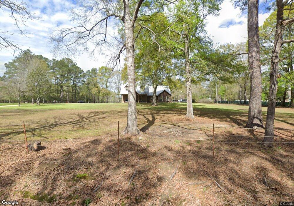
55490 Leonard F Husser Rd Loranger, LA 70446
Estimated Value: $234,000 - $332,000
--
Bed
--
Bath
3,190
Sq Ft
$91/Sq Ft
Est. Value
About This Home
This home is located at 55490 Leonard F Husser Rd, Loranger, LA 70446 and is currently estimated at $289,965, approximately $90 per square foot. 55490 Leonard F Husser Rd is a home located in Tangipahoa Parish with nearby schools including Loranger Elementary School, Loranger Middle School, and Loranger High School.
Ownership History
Date
Name
Owned For
Owner Type
Purchase Details
Closed on
Oct 24, 2005
Sold by
Rick April Lee Barber and Rick Frank Edward
Bought by
Ross Jeramie Ray
Current Estimated Value
Home Financials for this Owner
Home Financials are based on the most recent Mortgage that was taken out on this home.
Original Mortgage
$90,000
Outstanding Balance
$57,832
Interest Rate
9.14%
Mortgage Type
Adjustable Rate Mortgage/ARM
Estimated Equity
$232,133
Create a Home Valuation Report for This Property
The Home Valuation Report is an in-depth analysis detailing your home's value as well as a comparison with similar homes in the area
Home Values in the Area
Average Home Value in this Area
Purchase History
| Date | Buyer | Sale Price | Title Company |
|---|---|---|---|
| Ross Jeramie Ray | $90,000 | None Available |
Source: Public Records
Mortgage History
| Date | Status | Borrower | Loan Amount |
|---|---|---|---|
| Open | Ross Jeramie Ray | $90,000 |
Source: Public Records
Tax History Compared to Growth
Tax History
| Year | Tax Paid | Tax Assessment Tax Assessment Total Assessment is a certain percentage of the fair market value that is determined by local assessors to be the total taxable value of land and additions on the property. | Land | Improvement |
|---|---|---|---|---|
| 2024 | $1,125 | $14,661 | $746 | $13,915 |
| 2023 | $1,127 | $14,613 | $698 | $13,915 |
| 2022 | $1,127 | $14,613 | $698 | $13,915 |
| 2021 | $519 | $14,613 | $698 | $13,915 |
| 2020 | $1,054 | $14,613 | $698 | $13,915 |
| 2019 | $1,055 | $14,613 | $698 | $13,915 |
| 2018 | $1,055 | $14,613 | $698 | $13,915 |
| 2017 | $1,055 | $14,613 | $698 | $13,915 |
| 2016 | $1,055 | $14,613 | $698 | $13,915 |
| 2015 | -- | $698 | $698 | $0 |
| 2014 | -- | $5,045 | $698 | $4,347 |
Source: Public Records
Map
Nearby Homes
- 0 Miles - 45 Acres Ln Unit 2516929
- 12 Louisiana 1062
- 0 Cyprian Tract 3 Rd
- 0 Louisiana 445
- 54146 Highway 445
- 25075 Shorty Wilson Rd
- TRACT 8 Cyprian Rd
- 57273 Briar Patch Cemetary Rd
- 19291 S Saint Charles Ave
- 53384 N Highway 40 Hwy
- Hwy 40 E Unit LotWP001
- La 40 Unit LotWP001
- 54120 Passman Rd
- 54225 Passman Rd
- 53511 Harvest Ln
- 22330 Louisiana 40
- 18190 Wolf Track Way
- 55422 Leonard F Husser Rd
- 55550 Leonard F Husser Rd
- 0 Leonard F Husser Rd
- 0 Leonard F Husser Rd Unit 2300069
- 55501 Leonard F Husser Rd
- 55421 Leonard F Husser Rd
- 22434 Highway 1062
- 22434 Louisiana 1062
- 22424 Highway 1062
- 22466 Highway 1062
- 55378 Leonard F Husser Rd
- 55376 Leonard F Husser Rd
- 22421 Highway 1062
- 22467 Highway 1062
- 22421 Louisiana 1062
- 55441 Leonard F Husser Rd
- 56048 Dohm Rd
- 22220 Highway 1062
- 54002/5400 La Hwy 1062
- 0 Leonard F Husser Rd