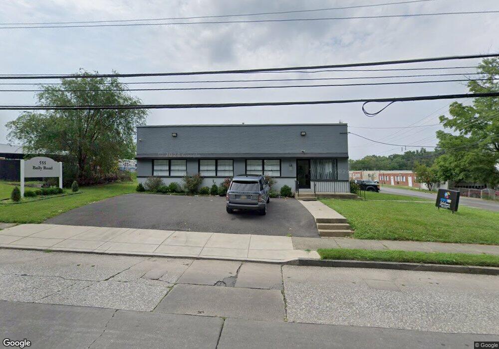
555 Baily Rd Lansdowne, PA 19050
Estimated Value: $591,341
--
Bed
--
Bath
6,000
Sq Ft
$99/Sq Ft
Est. Value
About This Home
This home is located at 555 Baily Rd, Lansdowne, PA 19050 and is currently estimated at $591,341, approximately $98 per square foot. 555 Baily Rd is a home located in Delaware County with nearby schools including Evans Elementary School, Penn Wood Middle School, and Penn Wood High School - Cypress Street Campus.
Ownership History
Date
Name
Owned For
Owner Type
Purchase Details
Closed on
Mar 8, 2021
Sold by
Burke Properties Llc
Bought by
Roels Development Llc
Current Estimated Value
Home Financials for this Owner
Home Financials are based on the most recent Mortgage that was taken out on this home.
Original Mortgage
$315,000
Interest Rate
3.1%
Mortgage Type
Commercial
Purchase Details
Closed on
Nov 23, 2004
Sold by
Finio Catherine M
Bought by
Burke Properties Llc
Home Financials for this Owner
Home Financials are based on the most recent Mortgage that was taken out on this home.
Original Mortgage
$200,000
Interest Rate
5.69%
Mortgage Type
Seller Take Back
Create a Home Valuation Report for This Property
The Home Valuation Report is an in-depth analysis detailing your home's value as well as a comparison with similar homes in the area
Home Values in the Area
Average Home Value in this Area
Purchase History
| Date | Buyer | Sale Price | Title Company |
|---|---|---|---|
| Roels Development Llc | $450,000 | Secured Land Transfer Llc | |
| Burke Properties Llc | $200,000 | -- |
Source: Public Records
Mortgage History
| Date | Status | Borrower | Loan Amount |
|---|---|---|---|
| Previous Owner | Roels Development Llc | $315,000 | |
| Previous Owner | Burke Properties Llc | $200,000 |
Source: Public Records
Tax History Compared to Growth
Tax History
| Year | Tax Paid | Tax Assessment Tax Assessment Total Assessment is a certain percentage of the fair market value that is determined by local assessors to be the total taxable value of land and additions on the property. | Land | Improvement |
|---|---|---|---|---|
| 2025 | $13,790 | $322,950 | $112,240 | $210,710 |
| 2024 | $13,790 | $322,950 | $112,240 | $210,710 |
| 2023 | $12,524 | $322,950 | $112,240 | $210,710 |
| 2022 | $11,942 | $322,950 | $112,240 | $210,710 |
| 2021 | $18,059 | $322,950 | $112,240 | $210,710 |
| 2020 | $11,556 | $185,040 | $86,270 | $98,770 |
| 2019 | $11,352 | $185,040 | $86,270 | $98,770 |
| 2018 | $11,195 | $185,040 | $0 | $0 |
| 2017 | $10,960 | $185,040 | $0 | $0 |
| 2016 | $1,015 | $185,040 | $0 | $0 |
| 2015 | $1,015 | $185,040 | $0 | $0 |
| 2014 | $1,015 | $185,040 | $0 | $0 |
Source: Public Records
Map
Nearby Homes
- 530 Orchard Ave
- 503 Bonsall Ave
- 603 Penn St
- 435 Bonsall Ave
- 702 Cedar Ave
- 201 Elder Ave
- 407 Church Ln
- 711 Yeadon Ave Unit 1
- 722 Yeadon Ave
- 408 S Union Ave
- 137 Elder Ave
- 192 Fairview Ave
- 103 Lincoln Ave
- 536 Cypress St
- 740 Church Ln
- 800 Bullock Ave
- 144 Fairview Ave
- 808 Serrill Ave
- 46 S Maple Ave
- 32 Elder Ave
- 557 Baily Rd
- 546 Commerce Dr
- 501 Baily Rd
- 559 Baily Rd
- 561 Baily Rd
- 544 Commerce Dr
- 463 Baily Rd
- 545-547 Commerce Dr
- 563 Baily Rd
- 544 Brookside Ave
- 542 Brookside Ave
- 540 Brookside Ave
- 565 Baily Rd
- 538 Brookside Ave
- 536 Brookside Ave
- 534 Brookside Ave
- 532 Brookside Ave
- 567 Baily Rd
- 530 Brookside Ave
- 461 Baily Rd