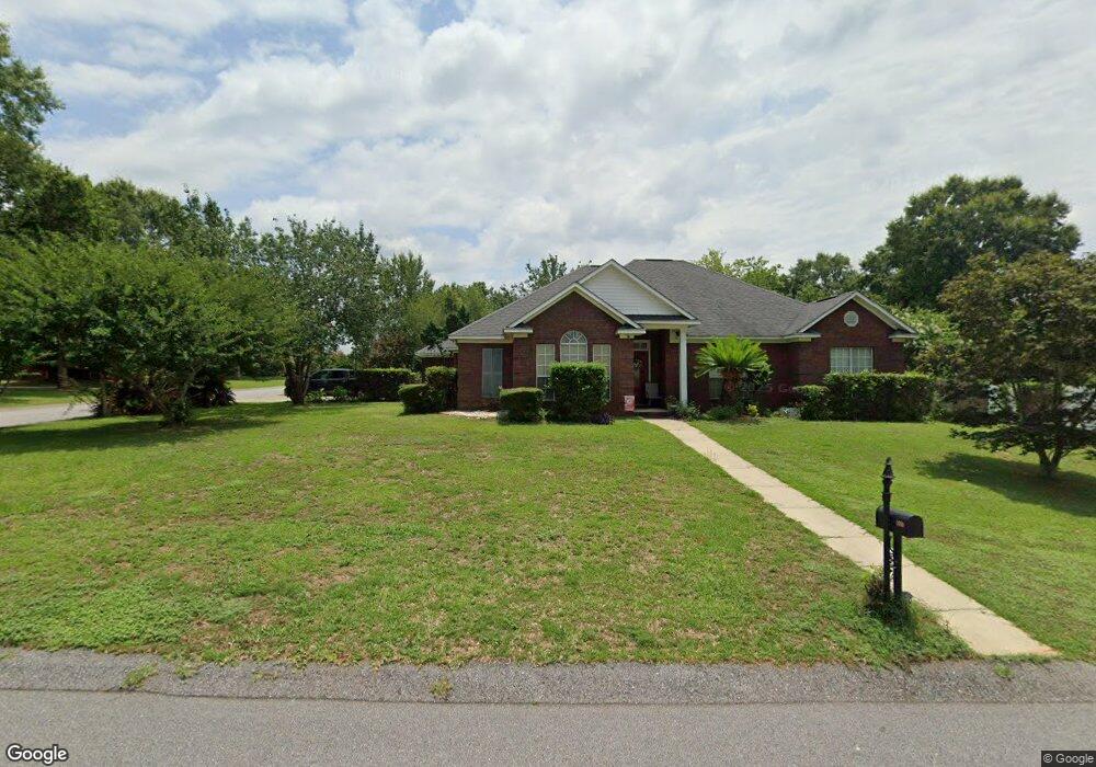
555 Briarcliff Dr W Mobile, AL 36608
Pierce Creek NeighborhoodEstimated Value: $275,725 - $346,000
3
Beds
2
Baths
2,117
Sq Ft
$144/Sq Ft
Est. Value
About This Home
This home is located at 555 Briarcliff Dr W, Mobile, AL 36608 and is currently estimated at $304,681, approximately $143 per square foot. 555 Briarcliff Dr W is a home located in Mobile County with nearby schools including Elsie Collier Elementary School, Bernice J Causey Middle School, and Baker High School.
Ownership History
Date
Name
Owned For
Owner Type
Purchase Details
Closed on
Feb 16, 2001
Sold by
Forwood Brothers Builders Inc
Bought by
Franklin Joe J and Franklin Yolanda F
Current Estimated Value
Home Financials for this Owner
Home Financials are based on the most recent Mortgage that was taken out on this home.
Original Mortgage
$172,380
Outstanding Balance
$61,474
Interest Rate
6.91%
Mortgage Type
VA
Estimated Equity
$243,207
Purchase Details
Closed on
Nov 20, 2000
Sold by
Forwood Ted
Bought by
Forwood Brothers Builders Inc
Home Financials for this Owner
Home Financials are based on the most recent Mortgage that was taken out on this home.
Original Mortgage
$136,000
Interest Rate
7.82%
Mortgage Type
Purchase Money Mortgage
Create a Home Valuation Report for This Property
The Home Valuation Report is an in-depth analysis detailing your home's value as well as a comparison with similar homes in the area
Home Values in the Area
Average Home Value in this Area
Purchase History
| Date | Buyer | Sale Price | Title Company |
|---|---|---|---|
| Franklin Joe J | -- | -- | |
| Forwood Brothers Builders Inc | -- | Surety Land Title Inc |
Source: Public Records
Mortgage History
| Date | Status | Borrower | Loan Amount |
|---|---|---|---|
| Open | Franklin Joe J | $172,380 | |
| Previous Owner | Forwood Brothers Builders Inc | $136,000 |
Source: Public Records
Tax History Compared to Growth
Tax History
| Year | Tax Paid | Tax Assessment Tax Assessment Total Assessment is a certain percentage of the fair market value that is determined by local assessors to be the total taxable value of land and additions on the property. | Land | Improvement |
|---|---|---|---|---|
| 2024 | -- | $24,960 | $4,500 | $20,460 |
| 2023 | $947 | $23,510 | $4,500 | $19,010 |
| 2022 | $972 | $21,410 | $4,500 | $16,910 |
| 2021 | $930 | $20,550 | $4,500 | $16,050 |
| 2020 | $939 | $20,740 | $4,500 | $16,240 |
| 2019 | $933 | $20,620 | $0 | $0 |
| 2018 | $954 | $21,060 | $0 | $0 |
| 2017 | $997 | $20,500 | $0 | $0 |
| 2016 | $1,025 | $22,520 | $0 | $0 |
| 2013 | $1,013 | $21,340 | $0 | $0 |
Source: Public Records
Map
Nearby Homes
- 9943 Wedgefield Blvd
- 9879 Maxwell Run
- 9996 Wedgefield Ct
- 0 Lifeline Ct Unit 7621162
- 355 Dykes Rd
- 9795 Maxwell Run
- 0 Browning Place Ct Unit 7487969
- 9760 Maxwell Run
- 10228 Summerlake Ct
- 9841 Shadow Wood Dr
- 9950 Breckenridge Dr N
- 9721 Royal Woods Dr N
- 790 Trailwood Dr E
- 9751 Pine Knoll Rd
- 11900 Airport Blvd
- 395 Norton Rd
- 789 Royal Woods Dr W Unit 7
- 120 Dykes Rd S
- 750 Hale Rd
- 10372 Heirloom Rd S
- 565 Briarcliff Dr W
- 10027 Briarcliff Dr N
- 9995 Briarcliff Dr N
- 10035 Briarcliff Dr N
- 10014 Briarcliff Dr N
- 575 Briarcliff Dr W
- 10024 Briarcliff Dr N
- 10004 Briarcliff Dr N
- 10034 Briarcliff Dr N
- 9985 Briarcliff Dr N
- 10045 Briarcliff Dr N
- 9994 Briarcliff Dr N
- 585 Briarcliff Dr W
- 556 Briarcliff Dr W
- 566 Briarcliff Dr W
- 10044 Briarcliff Dr N
- 10028 Briarcliff Dr S
- 576 Briarcliff Dr W
- 9975 Briarcliff Dr N
- 10055 Briarcliff Dr N