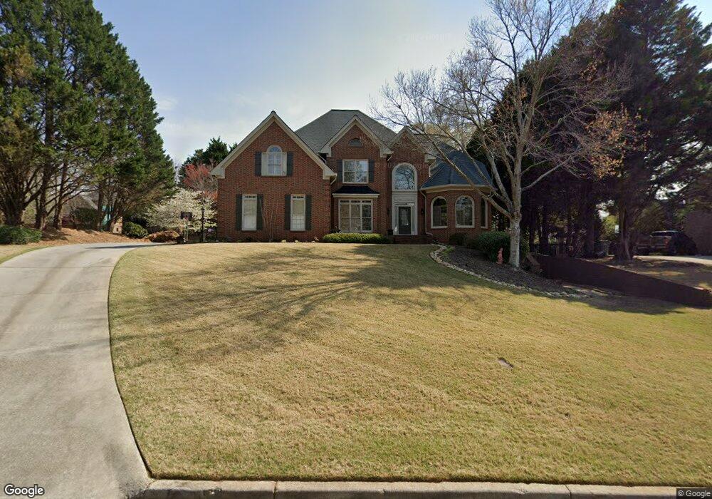
555 Croydon Ln Unit 9 Alpharetta, GA 30022
Doublegate NeighborhoodEstimated Value: $929,245 - $1,144,000
4
Beds
4
Baths
3,736
Sq Ft
$269/Sq Ft
Est. Value
About This Home
This home is located at 555 Croydon Ln Unit 9, Alpharetta, GA 30022 and is currently estimated at $1,005,811, approximately $269 per square foot. 555 Croydon Ln Unit 9 is a home located in Fulton County with nearby schools including State Bridge Crossing Elementary School, Autrey Mill Middle School, and Johns Creek High School.
Ownership History
Date
Name
Owned For
Owner Type
Purchase Details
Closed on
Mar 24, 1998
Sold by
Dagostino James E and Dagostino Stephanie D
Bought by
Jones Marion D and Jones Caroldene M
Current Estimated Value
Home Financials for this Owner
Home Financials are based on the most recent Mortgage that was taken out on this home.
Original Mortgage
$279,900
Outstanding Balance
$50,888
Interest Rate
6.95%
Mortgage Type
New Conventional
Estimated Equity
$954,923
Purchase Details
Closed on
Apr 8, 1996
Sold by
Dean Cowart Homes Inc
Bought by
Agostino James E Stephanie D
Create a Home Valuation Report for This Property
The Home Valuation Report is an in-depth analysis detailing your home's value as well as a comparison with similar homes in the area
Home Values in the Area
Average Home Value in this Area
Purchase History
| Date | Buyer | Sale Price | Title Company |
|---|---|---|---|
| Jones Marion D | $349,900 | -- | |
| Agostino James E Stephanie D | $322,000 | -- |
Source: Public Records
Mortgage History
| Date | Status | Borrower | Loan Amount |
|---|---|---|---|
| Open | Jones Marion D | $279,900 | |
| Closed | Agostino James E Stephanie D | $0 |
Source: Public Records
Tax History Compared to Growth
Tax History
| Year | Tax Paid | Tax Assessment Tax Assessment Total Assessment is a certain percentage of the fair market value that is determined by local assessors to be the total taxable value of land and additions on the property. | Land | Improvement |
|---|---|---|---|---|
| 2025 | $6,580 | $356,760 | $109,560 | $247,200 |
| 2023 | $6,920 | $245,160 | $48,120 | $197,040 |
| 2022 | $6,294 | $226,680 | $42,880 | $183,800 |
| 2021 | $6,268 | $240,440 | $44,840 | $195,600 |
| 2020 | $6,307 | $224,880 | $49,440 | $175,440 |
| 2019 | $751 | $204,000 | $44,600 | $159,400 |
| 2018 | $6,009 | $199,240 | $43,560 | $155,680 |
| 2017 | $6,244 | $199,240 | $43,560 | $155,680 |
| 2016 | $6,227 | $203,960 | $37,120 | $166,840 |
| 2015 | $6,295 | $203,960 | $37,120 | $166,840 |
| 2014 | $5,984 | $183,160 | $31,600 | $151,560 |
Source: Public Records
Map
Nearby Homes
- 10265 Minion Ct Unit 27
- 10281 Midway Ave
- 10296 Quadrant Ct Unit 76
- 230 Skidaway Ct
- 9950 Farmbrook Ln
- 720 Buttercup Trace
- 510 Winston Croft Cir Unit 56
- 512 Winston Croft Cir Unit 57
- 504 Winston Croft Cir Unit 54
- 1007 Crown Oak St Unit 45
- 1007 Crown Oak St
- 1003 Crown Oak St Unit 43
- 1005 Crown Oak St Unit 44
- 1011 Crown Oak St Unit 47
- 455 Oak Laurel Ct
- 10570 Bridgemor Dr
- 230 Pinebridge Ct
- 144 Wards Crossing Way
- 10275 Groomsbridge Rd
- 565 Croydon Ln
- 545 Croydon Ln
- 250 Gaitskell Ln
- 910 Circassian Ct
- 260 Gaitskell Ln
- 540 Croydon Ln Unit 10
- 240 Gaitskell Ln Unit 12
- 575 Croydon Ln
- 550 Croydon Ln
- 535 Croydon Ln
- 270 Gaitskell Ln
- 0 Circassian Ct Unit 7131837
- 0 Circassian Ct Unit 8072926
- 0 Circassian Ct Unit 8753129
- 530 Croydon Ln Unit X
- 230 Gaitskell Ln Unit XII
- 560 Croydon Ln Unit X
- 920 Circassian Ct Unit X
- 585 Croydon Ln
- 245 Gaitskell Ln