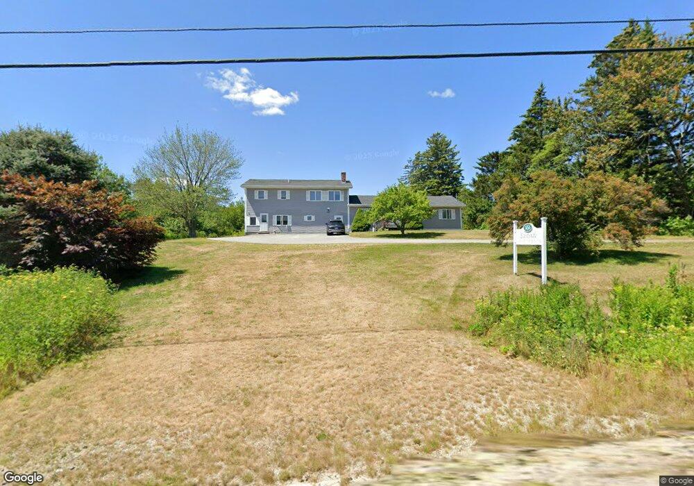
555 E Side Rd Addison, ME 04606
Estimated Value: $158,000 - $289,000
6
Beds
3
Baths
2,508
Sq Ft
$95/Sq Ft
Est. Value
About This Home
This home is located at 555 E Side Rd, Addison, ME 04606 and is currently estimated at $239,333, approximately $95 per square foot. 555 E Side Rd is a home located in Washington County.
Ownership History
Date
Name
Owned For
Owner Type
Purchase Details
Closed on
Feb 8, 2024
Sold by
Joyce E Fickett T E and Joyce Fickett
Bought by
Leighton Rentals Llc
Current Estimated Value
Home Financials for this Owner
Home Financials are based on the most recent Mortgage that was taken out on this home.
Original Mortgage
$225,000
Outstanding Balance
$206,005
Interest Rate
5.87%
Mortgage Type
Stand Alone Refi Refinance Of Original Loan
Estimated Equity
$33,328
Purchase Details
Closed on
Aug 1, 2006
Sold by
Severance Roger E and Severance Monica L
Bought by
Fickett Richard L and Fickett Joyce E
Create a Home Valuation Report for This Property
The Home Valuation Report is an in-depth analysis detailing your home's value as well as a comparison with similar homes in the area
Purchase History
| Date | Buyer | Sale Price | Title Company |
|---|---|---|---|
| Leighton Rentals Llc | $75,000 | None Available | |
| Leighton Rentals Llc | $75,000 | None Available | |
| Fickett Richard L | -- | -- |
Source: Public Records
Mortgage History
| Date | Status | Borrower | Loan Amount |
|---|---|---|---|
| Open | Leighton Rentals Llc | $225,000 |
Source: Public Records
Tax History
| Year | Tax Paid | Tax Assessment Tax Assessment Total Assessment is a certain percentage of the fair market value that is determined by local assessors to be the total taxable value of land and additions on the property. | Land | Improvement |
|---|---|---|---|---|
| 2025 | $2,399 | $124,300 | $28,500 | $95,800 |
| 2024 | $2,327 | $124,300 | $28,500 | $95,800 |
| 2023 | $2,140 | $124,300 | $28,500 | $95,800 |
| 2022 | $2,040 | $122,900 | $27,100 | $95,800 |
| 2021 | $2,040 | $122,900 | $27,100 | $95,800 |
| 2020 | $371 | $122,900 | $27,100 | $95,800 |
| 2019 | $1,970 | $122,900 | $27,100 | $95,800 |
| 2018 | $30 | $122,900 | $27,100 | $95,800 |
| 2017 | $178 | $122,900 | $27,100 | $95,800 |
| 2016 | $1,819 | $124,600 | $27,100 | $97,500 |
| 2015 | $1,788 | $124,600 | $27,100 | $97,500 |
| 2014 | $1,670 | $124,600 | $27,100 | $97,500 |
| 2013 | $1,578 | $126,200 | $27,100 | $99,100 |
Source: Public Records
Map
Nearby Homes
- M20L2 E Side Rd
- Lot 13 Reef Point Rd
- Lot 12 Reef Point Rd
- 29 Reef Point Rd
- 16 & 18 Nelson Way
- 780 E Side Rd
- 337 W Side Rd
- Lot #7 Highland Rd
- 100 Hardwood Point
- 251 Ripley Neck Rd
- 361 Water St
- M17L21 Basin Rd
- 386 Indian River Rd
- Lot 15-5 Fort Williams Rd
- Lot # 15-2 Fort Williams Rd
- Lot B Fort Williams Rd
- M5L42 Hook Rd
- Lot 25-3 Flat Bay Dr
- 139 Wilson District Rd
- 330 Point St
- 549 E Side Rd
- 550 E Side Rd
- 544 E Side Rd
- LOT 37A E Side Rd
- 536 E Side Rd
- 579 E Side Rd
- 524 E Side Rd
- 520 E Side Rd
- Lot 5 E East Side Rd
- 34 Hells Hill Rd
- 30 Hells Hill Rd
- Lot 13A E Side Rd
- 0 E Side Rd Unit 1549986
- 0 E Side Rd Unit 1549987
- 0 E Side Rd Unit 1549988
- 0 E Side Rd Unit 757401
- 0 E Side Rd Unit 757379
- 0 E Side Rd Unit 622837
- 0 E Side Rd Unit 596123
- 0 E Side Rd Unit 309415
Your Personal Tour Guide
Ask me questions while you tour the home.