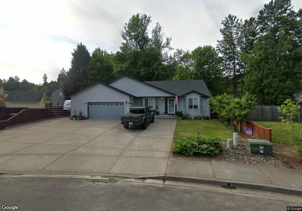
555 Embassy Loop Woodland, WA 98674
Estimated Value: $493,214 - $659,000
3
Beds
2
Baths
1,952
Sq Ft
$288/Sq Ft
Est. Value
About This Home
This home is located at 555 Embassy Loop, Woodland, WA 98674 and is currently estimated at $562,304, approximately $288 per square foot. 555 Embassy Loop is a home located in Cowlitz County with nearby schools including Woodland High School.
Ownership History
Date
Name
Owned For
Owner Type
Purchase Details
Closed on
Nov 11, 2009
Sold by
Morris Mary E
Bought by
Tompkins Diane L
Current Estimated Value
Home Financials for this Owner
Home Financials are based on the most recent Mortgage that was taken out on this home.
Original Mortgage
$220,924
Outstanding Balance
$142,995
Interest Rate
4.83%
Mortgage Type
FHA
Estimated Equity
$419,309
Purchase Details
Closed on
Oct 22, 2009
Sold by
Morris Benjamin W
Bought by
Morris Mary E
Home Financials for this Owner
Home Financials are based on the most recent Mortgage that was taken out on this home.
Original Mortgage
$220,924
Outstanding Balance
$142,995
Interest Rate
4.83%
Mortgage Type
FHA
Estimated Equity
$419,309
Create a Home Valuation Report for This Property
The Home Valuation Report is an in-depth analysis detailing your home's value as well as a comparison with similar homes in the area
Home Values in the Area
Average Home Value in this Area
Purchase History
| Date | Buyer | Sale Price | Title Company |
|---|---|---|---|
| Tompkins Diane L | $225,000 | Stewart Title | |
| Morris Mary E | -- | Stewart Title |
Source: Public Records
Mortgage History
| Date | Status | Borrower | Loan Amount |
|---|---|---|---|
| Open | Tompkins Diane L | $220,924 | |
| Closed | Morris Mary E | $220,924 |
Source: Public Records
Tax History Compared to Growth
Tax History
| Year | Tax Paid | Tax Assessment Tax Assessment Total Assessment is a certain percentage of the fair market value that is determined by local assessors to be the total taxable value of land and additions on the property. | Land | Improvement |
|---|---|---|---|---|
| 2024 | $4,284 | $435,510 | $72,490 | $363,020 |
| 2023 | $3,999 | $425,290 | $72,490 | $352,800 |
| 2022 | $3,679 | $402,610 | $72,490 | $330,120 |
| 2021 | $4,012 | $348,590 | $65,900 | $282,690 |
| 2020 | $3,574 | $352,900 | $65,880 | $287,020 |
| 2019 | $3,072 | $309,118 | $65,880 | $243,238 |
| 2018 | $3,192 | $306,710 | $65,880 | $240,830 |
| 2017 | $2,684 | $274,460 | $65,880 | $208,580 |
| 2016 | $2,477 | $238,840 | $61,000 | $177,840 |
| 2015 | $2,360 | $216,560 | $61,000 | $155,560 |
| 2013 | -- | $179,360 | $54,760 | $124,600 |
Source: Public Records
Map
Nearby Homes
- 2216 Statesman Dr Unit Lot 46
- 2214 Statesman Dr Unit Lot 45
- 2210 Statesman Dr Unit 44
- 2220 Ash St Unit Lot 24
- 369 Gun Club Rd Unit 117
- 369 Gun Club Rd Unit 53
- 369 Gun Club Rd Unit 70
- 369 Gun Club Rd Unit 114
- 369 Gun Club Rd Unit 101
- 369 Gun Club Rd Unit 48
- 2271 Ash St Unit Lot 92
- 2233 Ash St Unit Lot 84
- 2229 Ash St Unit Lot 83
- 605 Gun Club Rd
- 2257 Ash St Unit Lot 88
- 2245 Ash St Unit Lot 86
- 2249 Ash St Unit Lot 87
- 2211 Mccracken Rd Unit Lot 10
- 2231 Mccracken Rd Unit LOT 8
- 2248 Ash St Unit Lot 19
- 545 Embassy Loop
- 565 Embassy Loop
- 570 Gun Club Rd
- 560 Gun Club Rd
- 580 Gun Club Rd
- 575 Embassy Loop
- 535 Embassy Loop
- 534 Embassy Loop
- 590 Gun Club Rd
- 540 Gun Club Rd
- 585 Embassy Loop
- 525 Embassy Loop
- 580 Embassy Loop
- 524 Embassy Loop
- 530 Gun Club Rd
- 595 Embassy Loop
- 2042 Ambassador Ave
- 2052 Ambassador Ave
- 515 Embassy Loop