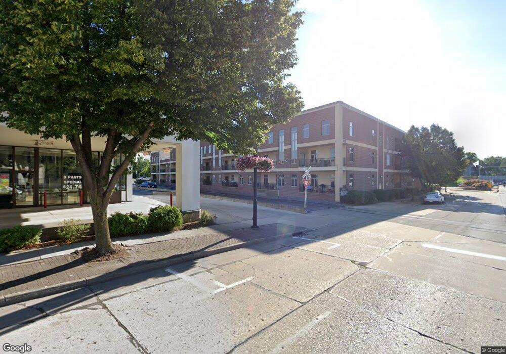
555 Main Ave Unit 112 de Pere, WI 54115
Estimated Value: $247,000 - $255,000
4
Beds
4
Baths
2,250
Sq Ft
$112/Sq Ft
Est. Value
About This Home
This home is located at 555 Main Ave Unit 112, de Pere, WI 54115 and is currently estimated at $251,009, approximately $111 per square foot. 555 Main Ave Unit 112 is a home located in Brown County with nearby schools including Westwood Elementary School, West De Pere Middle School, and West De Pere High School.
Ownership History
Date
Name
Owned For
Owner Type
Purchase Details
Closed on
Nov 11, 2004
Sold by
N E W Developers Llc
Bought by
Minten Susan A
Current Estimated Value
Home Financials for this Owner
Home Financials are based on the most recent Mortgage that was taken out on this home.
Original Mortgage
$80,078
Outstanding Balance
$35,831
Interest Rate
4.75%
Mortgage Type
Unknown
Estimated Equity
$215,178
Create a Home Valuation Report for This Property
The Home Valuation Report is an in-depth analysis detailing your home's value as well as a comparison with similar homes in the area
Home Values in the Area
Average Home Value in this Area
Purchase History
| Date | Buyer | Sale Price | Title Company |
|---|---|---|---|
| Minten Susan A | -- | Evans Title Companies |
Source: Public Records
Mortgage History
| Date | Status | Borrower | Loan Amount |
|---|---|---|---|
| Open | Minten Susan A | $80,078 |
Source: Public Records
Tax History
| Year | Tax Paid | Tax Assessment Tax Assessment Total Assessment is a certain percentage of the fair market value that is determined by local assessors to be the total taxable value of land and additions on the property. | Land | Improvement |
|---|---|---|---|---|
| 2025 | $2,933 | $213,200 | $12,000 | $201,200 |
| 2024 | $2,679 | $193,600 | $12,000 | $181,600 |
| 2023 | $3,045 | $212,300 | $12,000 | $200,300 |
| 2022 | $3,326 | $206,100 | $12,000 | $194,100 |
| 2021 | $2,436 | $142,100 | $10,000 | $132,100 |
| 2020 | $2,418 | $129,200 | $10,000 | $119,200 |
| 2019 | $2,192 | $119,600 | $10,000 | $109,600 |
| 2018 | $2,150 | $112,800 | $10,000 | $102,800 |
| 2017 | $1,695 | $86,800 | $10,000 | $76,800 |
| 2016 | $1,692 | $86,800 | $10,000 | $76,800 |
| 2015 | $2,069 | $96,400 | $10,000 | $86,400 |
| 2014 | $2,386 | $96,400 | $10,000 | $86,400 |
| 2013 | $2,386 | $96,400 | $10,000 | $86,400 |
Source: Public Records
Map
Nearby Homes
- 555 Main Ave Unit 111
- 555 Main Ave Unit 206
- 412 Fort Howard Ave
- 735 Morning Glory Ln
- 911 S 7th St
- 814 3rd St
- 1109 S 6th St
- 762 Saint Joseph St
- 416 Lansdowne St
- 389 Willie Mays Cir
- 400 Battery Ave
- 308 S Superior St
- 1129 Suburban Dr
- 417 Fulton St
- 2380 Scheuring Rd
- 2374 Scheuring Rd
- 2386 Scheuring Rd
- 2392 Scheuring Rd
- 801 S Erie St
- 1258 Cornflower Ct
- 555 Main Ave Unit 216
- 555 Main Ave Unit 215
- 555 Main Ave Unit 214
- 555 Main Ave Unit 213
- 555 Main Ave Unit 212
- 555 Main Ave Unit 211
- 555 Main Ave Unit 210
- 555 Main Ave Unit 209
- 555 Main Ave Unit 208
- 555 Main Ave Unit 205
- 555 Main Ave Unit 204
- 555 Main Ave Unit 203
- 555 Main Ave Unit 202
- 555 Main Ave Unit 201
- 555 Main Ave Unit 116
- 555 Main Ave Unit 115
- 555 Main Ave Unit 114
- 555 Main Ave Unit 113
- 555 Main Ave Unit 109
- 555 Main Ave Unit 108
Your Personal Tour Guide
Ask me questions while you tour the home.