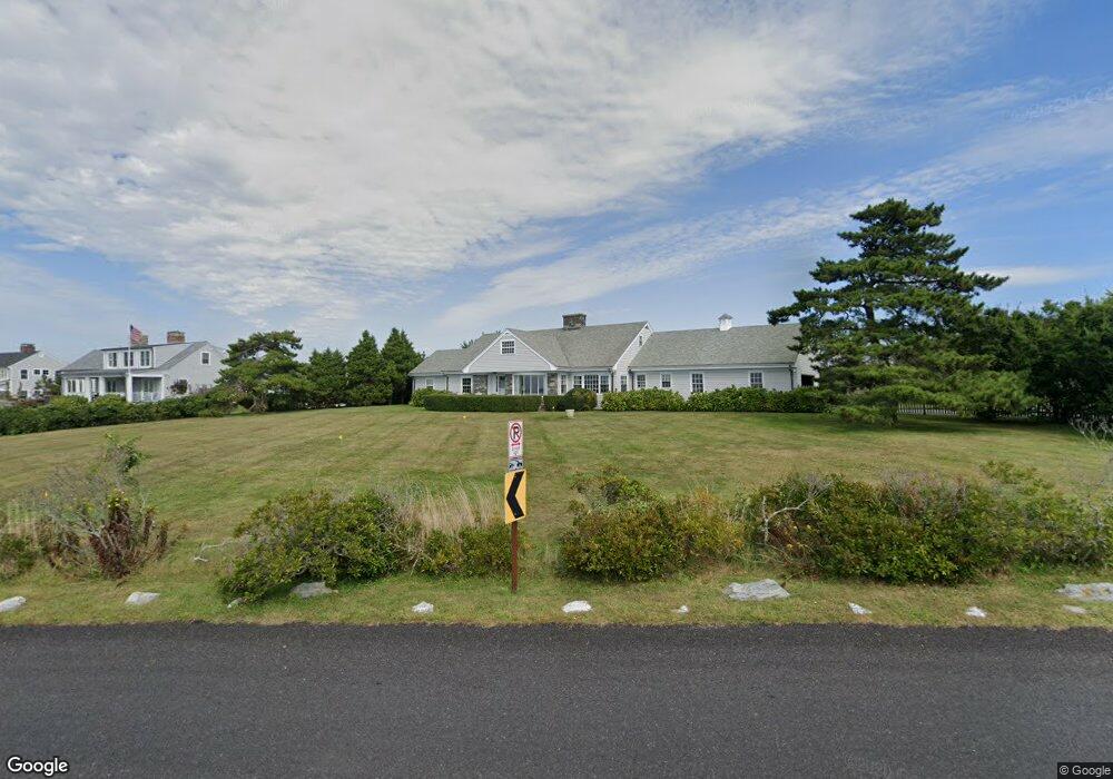
555 Ocean Ave Newport, RI 02840
Ocean Drive NeighborhoodEstimated Value: $4,671,099 - $5,498,000
5
Beds
5
Baths
2,850
Sq Ft
$1,764/Sq Ft
Est. Value
About This Home
This home is located at 555 Ocean Ave, Newport, RI 02840 and is currently estimated at $5,027,366, approximately $1,763 per square foot. 555 Ocean Ave is a home located in Newport County with nearby schools including Rogers High School.
Ownership History
Date
Name
Owned For
Owner Type
Purchase Details
Closed on
May 26, 2016
Sold by
Egan John J
Bought by
Bgc Ocean Dr Partners
Current Estimated Value
Purchase Details
Closed on
Jun 11, 2013
Sold by
Egan John J
Bought by
John J Egan Jr Ret
Create a Home Valuation Report for This Property
The Home Valuation Report is an in-depth analysis detailing your home's value as well as a comparison with similar homes in the area
Home Values in the Area
Average Home Value in this Area
Purchase History
| Date | Buyer | Sale Price | Title Company |
|---|---|---|---|
| Bgc Ocean Dr Partners | -- | -- | |
| John J Egan Jr Ret | -- | -- |
Source: Public Records
Tax History Compared to Growth
Tax History
| Year | Tax Paid | Tax Assessment Tax Assessment Total Assessment is a certain percentage of the fair market value that is determined by local assessors to be the total taxable value of land and additions on the property. | Land | Improvement |
|---|---|---|---|---|
| 2025 | $52,541 | $6,046,800 | $5,131,500 | $915,300 |
| 2024 | $49,705 | $6,046,800 | $5,131,500 | $915,300 |
| 2023 | $31,031 | $3,128,100 | $2,547,500 | $580,600 |
| 2022 | $30,061 | $3,128,100 | $2,547,500 | $580,600 |
| 2021 | $28,584 | $3,063,700 | $2,547,500 | $516,200 |
| 2020 | $25,310 | $2,462,100 | $2,382,700 | $79,400 |
| 2019 | $27,772 | $2,701,600 | $2,382,700 | $318,900 |
| 2018 | $26,989 | $2,701,600 | $2,382,700 | $318,900 |
| 2017 | $28,368 | $2,530,600 | $2,171,500 | $359,100 |
| 2016 | $27,659 | $2,530,600 | $2,171,500 | $359,100 |
| 2015 | $27,002 | $2,530,600 | $2,171,500 | $359,100 |
| 2014 | $22,749 | $1,886,300 | $1,449,300 | $437,000 |
Source: Public Records
Map
Nearby Homes
- 41 Castle Hill Ave
- 65 Ridge Rd Unit P37
- 15 Hammersmith Rd Unit 31
- 127 Harrison Ave Unit 10
- 112 Harrison Ave Unit B
- 112 Harrison Ave
- 7 Clarkes Village Rd
- 111 Harrison Ave Unit 9
- 11 Ocean Heights Rd
- 382 Beavertail Rd
- 21 Bonnet View Dr
- 30 Bonnet View Dr
- 46 Chastellux Ave Unit M6
- 73 Old Fort Rd Unit 75
- 91 Houston Ave
- 39 Walcott Ave
- 41 Walcott Ave
- 70 Carroll Ave Unit 510
- 104 Howland Ave
- 26 Atlantic St