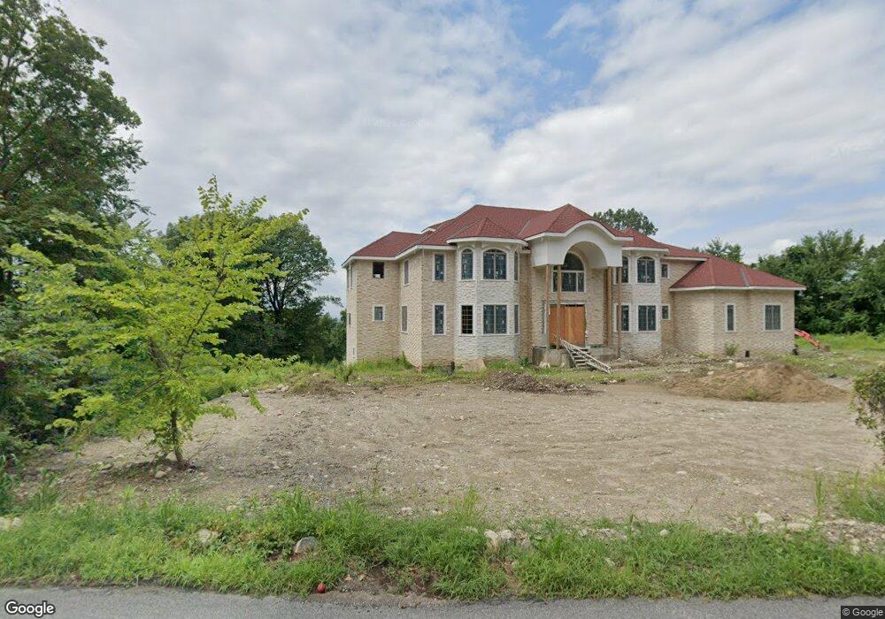
555 Ridge Rd Wilbraham, MA 01095
Estimated Value: $1,034,000 - $1,667,000
5
Beds
7
Baths
6,081
Sq Ft
$217/Sq Ft
Est. Value
About This Home
This home is located at 555 Ridge Rd, Wilbraham, MA 01095 and is currently estimated at $1,319,506, approximately $216 per square foot. 555 Ridge Rd is a home located in Hampden County with nearby schools including Minnechaug Regional High School and Wilbraham & Monson Academy.
Ownership History
Date
Name
Owned For
Owner Type
Purchase Details
Closed on
Jan 20, 2021
Sold by
Bates Mark
Bought by
Patel Rakeshkumar V and Patel Falguniben J
Current Estimated Value
Home Financials for this Owner
Home Financials are based on the most recent Mortgage that was taken out on this home.
Original Mortgage
$184,920
Outstanding Balance
$164,338
Interest Rate
2.6%
Mortgage Type
Purchase Money Mortgage
Estimated Equity
$1,155,169
Purchase Details
Closed on
Aug 2, 1993
Sold by
West Multiban
Bought by
Bates Mark
Create a Home Valuation Report for This Property
The Home Valuation Report is an in-depth analysis detailing your home's value as well as a comparison with similar homes in the area
Home Values in the Area
Average Home Value in this Area
Purchase History
| Date | Buyer | Sale Price | Title Company |
|---|---|---|---|
| Patel Rakeshkumar V | $276,000 | None Available | |
| Bates Mark | $55,000 | -- | |
| Bates Mark | $55,000 | -- |
Source: Public Records
Mortgage History
| Date | Status | Borrower | Loan Amount |
|---|---|---|---|
| Open | Patel Rakeshkumar V | $184,920 | |
| Closed | Patel Rakeshkumar V | $184,920 |
Source: Public Records
Tax History Compared to Growth
Tax History
| Year | Tax Paid | Tax Assessment Tax Assessment Total Assessment is a certain percentage of the fair market value that is determined by local assessors to be the total taxable value of land and additions on the property. | Land | Improvement |
|---|---|---|---|---|
| 2025 | $17,360 | $970,900 | $258,700 | $712,200 |
| 2024 | $4,675 | $252,700 | $252,700 | $0 |
| 2023 | $5,178 | $252,700 | $252,700 | $0 |
| 2022 | $5,178 | $252,700 | $252,700 | $0 |
| 2021 | $2,549 | $111,000 | $111,000 | $0 |
| 2020 | $2,484 | $111,000 | $111,000 | $0 |
| 2019 | $2,420 | $111,000 | $111,000 | $0 |
| 2018 | $2,513 | $111,000 | $111,000 | $0 |
| 2017 | $2,442 | $111,000 | $111,000 | $0 |
| 2016 | $2,652 | $122,800 | $122,800 | $0 |
| 2015 | $2,564 | $122,800 | $122,800 | $0 |
Source: Public Records
Map
Nearby Homes
- 474 Mountain Rd
- 12 Highridge Rd
- 474-480 Mountain Rd
- 6 Hilltop Park
- 603 Glendale Rd
- 20 Old Orchard Rd
- 2 Bayberry Dr Unit 51
- 68 Monson Rd
- 17 Peak Rd
- 8 Patriot Ridge Ln
- 28 Decorie Dr
- 2 Vista Rd
- 182 Mountain Rd
- 79 High Pine Cir
- 69 High Pine Cir
- 733 Monson Rd
- 54 High Pine Cir
- 60 Lakeshore Dr
- 35 Lake Dr
- 4 Hillcrest Dr