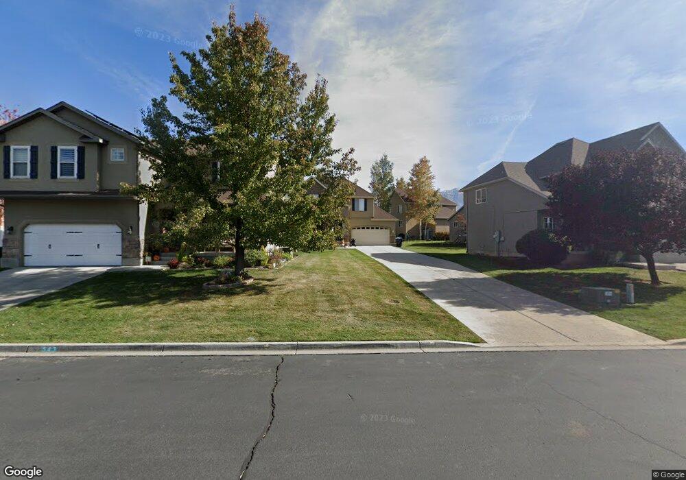
555 S 430 E Pleasant Grove, UT 84062
Estimated Value: $539,000 - $598,000
3
Beds
3
Baths
2,699
Sq Ft
$212/Sq Ft
Est. Value
About This Home
This home is located at 555 S 430 E, Pleasant Grove, UT 84062 and is currently estimated at $571,419, approximately $211 per square foot. 555 S 430 E is a home located in Utah County with nearby schools including Central Elementary School, Pleasant Grove Junior High School, and Pleasant Grove High School.
Ownership History
Date
Name
Owned For
Owner Type
Purchase Details
Closed on
Jun 24, 2020
Sold by
Jones Christian Corry
Bought by
Jones Christian
Current Estimated Value
Home Financials for this Owner
Home Financials are based on the most recent Mortgage that was taken out on this home.
Original Mortgage
$278,500
Outstanding Balance
$246,869
Interest Rate
3.2%
Mortgage Type
New Conventional
Estimated Equity
$324,550
Purchase Details
Closed on
Jun 28, 2017
Sold by
Grove Pleasant
Bought by
Jones Christian Corry
Home Financials for this Owner
Home Financials are based on the most recent Mortgage that was taken out on this home.
Original Mortgage
$280,250
Interest Rate
4.02%
Purchase Details
Closed on
Jun 27, 2017
Sold by
Jones Christan Corry
Bought by
Jones Christian Corry and Jones Breanna
Home Financials for this Owner
Home Financials are based on the most recent Mortgage that was taken out on this home.
Original Mortgage
$280,250
Interest Rate
4.02%
Purchase Details
Closed on
Apr 26, 2013
Sold by
Connell Kasey Layne and Carnel Anna Marie
Bought by
Jensen Ryan
Home Financials for this Owner
Home Financials are based on the most recent Mortgage that was taken out on this home.
Original Mortgage
$208,650
Interest Rate
3.25%
Mortgage Type
FHA
Purchase Details
Closed on
Dec 12, 2011
Sold by
Chang Derek
Bought by
Connell Kasey Layne and Carnel Anna Marie
Purchase Details
Closed on
Jun 27, 2011
Sold by
Recontrust Company Na
Bought by
Gustafson Ryan M
Purchase Details
Closed on
May 23, 2011
Sold by
Bac Home Loans Servicing Lp
Bought by
Federal Home Loan Mortgage Corporation
Purchase Details
Closed on
May 6, 2011
Sold by
Chang Sheri
Bought by
Chang Derek
Purchase Details
Closed on
Aug 9, 2006
Sold by
Chang Derek
Bought by
Chang Derek and Chang Sheri
Home Financials for this Owner
Home Financials are based on the most recent Mortgage that was taken out on this home.
Original Mortgage
$27,750
Interest Rate
6.76%
Mortgage Type
Stand Alone Second
Create a Home Valuation Report for This Property
The Home Valuation Report is an in-depth analysis detailing your home's value as well as a comparison with similar homes in the area
Home Values in the Area
Average Home Value in this Area
Purchase History
| Date | Buyer | Sale Price | Title Company |
|---|---|---|---|
| Jones Christian | -- | Eagle Pointe Title Ins Agcy | |
| Jones Christian Corry | -- | Access Title Co | |
| Jones Christian Corry | -- | Land Title Guarantee Co | |
| Jensen Ryan | -- | Pinnacle Title | |
| Connell Kasey Layne | -- | Us Title Insurance Agency | |
| Gustafson Ryan M | -- | Guardian Title Company Of Ut | |
| Federal Home Loan Mortgage Corporation | -- | Accommodation | |
| Bac Home Loans Servicing Lp | $218,500 | Accommodation | |
| Chang Derek | -- | Us Title Insurance Agency | |
| Chang Derek | -- | Accommodation | |
| Chang Derek | -- | First American Title Insuran |
Source: Public Records
Mortgage History
| Date | Status | Borrower | Loan Amount |
|---|---|---|---|
| Open | Jones Christian | $278,500 | |
| Closed | Jones Christian Corry | $280,250 | |
| Previous Owner | Jensen Ryan | $208,650 | |
| Previous Owner | Chang Derek | $27,750 | |
| Previous Owner | Chang Derek | $222,050 |
Source: Public Records
Tax History Compared to Growth
Tax History
| Year | Tax Paid | Tax Assessment Tax Assessment Total Assessment is a certain percentage of the fair market value that is determined by local assessors to be the total taxable value of land and additions on the property. | Land | Improvement |
|---|---|---|---|---|
| 2025 | $2,054 | $274,340 | $171,700 | $327,100 |
| 2024 | $2,054 | $245,135 | $0 | $0 |
| 2023 | $2,019 | $246,675 | $0 | $0 |
| 2022 | $1,960 | $238,260 | $0 | $0 |
| 2021 | $1,725 | $319,200 | $123,200 | $196,000 |
| 2020 | $1,665 | $302,200 | $110,000 | $192,200 |
| 2019 | $1,557 | $292,200 | $100,000 | $192,200 |
| 2018 | $1,590 | $282,200 | $90,000 | $192,200 |
| 2017 | $1,434 | $135,465 | $0 | $0 |
| 2016 | $1,297 | $118,250 | $0 | $0 |
| 2015 | $1,210 | $104,500 | $0 | $0 |
| 2014 | $1,142 | $97,735 | $0 | $0 |
Source: Public Records
Map
Nearby Homes
- 543 S 430 E
- 461 E Apple Grove Ln
- 451 E Apple Grove Ln
- 567 S 430 E
- 583 S 430 E
- 467 E Apple Grove Ln
- 452 E 500 S
- 442 E 500 S
- 475 E Apple Grove Ln
- 574 S 430 E
- 483 E Apple Grove Ln
- 558 S 430 E
- 466 E Apple Grove Ln
- 419 E Apple Grove Ln
- 456 E Apple Grove Ln
- 452 E Apple Grove Ln
- 418 E 500 S
- 474 E Apple Grove Ln
- 444 E Apple Grove Ln
- 472 E 500 S