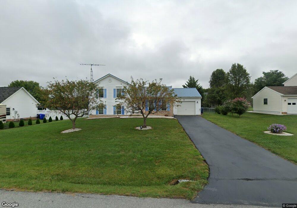
555 Tall Cedar Ln Greencastle, PA 17225
Estimated Value: $250,000 - $265,000
--
Bed
--
Bath
1,166
Sq Ft
$221/Sq Ft
Est. Value
About This Home
This home is located at 555 Tall Cedar Ln, Greencastle, PA 17225 and is currently estimated at $257,473, approximately $220 per square foot. 555 Tall Cedar Ln is a home located in Franklin County with nearby schools including Greencastle-Antrim Primary School, Greencastle-Antrim Elementary School, and Greencastle-Antrim Middle School.
Ownership History
Date
Name
Owned For
Owner Type
Purchase Details
Closed on
Sep 17, 2021
Sold by
Schuchman Timothy L and Schuchman Trina J
Bought by
Schuchman Timothy L and Schuchman Nichole M
Current Estimated Value
Home Financials for this Owner
Home Financials are based on the most recent Mortgage that was taken out on this home.
Original Mortgage
$198,921
Outstanding Balance
$180,733
Interest Rate
2.7%
Mortgage Type
FHA
Estimated Equity
$76,740
Purchase Details
Closed on
Apr 5, 2021
Sold by
Schuchman Timothy L and Estate Of William R Schuchman
Bought by
Schuchman Timothy L
Create a Home Valuation Report for This Property
The Home Valuation Report is an in-depth analysis detailing your home's value as well as a comparison with similar homes in the area
Home Values in the Area
Average Home Value in this Area
Purchase History
| Date | Buyer | Sale Price | Title Company |
|---|---|---|---|
| Schuchman Timothy L | $230,000 | A Plus Settlement Svcs Inc | |
| Schuchman Timothy L | -- | None Available |
Source: Public Records
Mortgage History
| Date | Status | Borrower | Loan Amount |
|---|---|---|---|
| Open | Schuchman Timothy L | $198,921 |
Source: Public Records
Tax History Compared to Growth
Tax History
| Year | Tax Paid | Tax Assessment Tax Assessment Total Assessment is a certain percentage of the fair market value that is determined by local assessors to be the total taxable value of land and additions on the property. | Land | Improvement |
|---|---|---|---|---|
| 2025 | $3,127 | $18,690 | $2,700 | $15,990 |
| 2024 | $2,770 | $18,250 | $2,700 | $15,550 |
| 2023 | $2,737 | $18,250 | $2,700 | $15,550 |
| 2022 | $2,737 | $18,250 | $2,700 | $15,550 |
| 2021 | $2,684 | $18,250 | $2,700 | $15,550 |
| 2020 | $2,614 | $18,250 | $2,700 | $15,550 |
| 2019 | $2,555 | $18,250 | $2,700 | $15,550 |
| 2018 | $2,527 | $18,250 | $2,700 | $15,550 |
| 2017 | $2,464 | $18,250 | $2,700 | $15,550 |
| 2016 | $523 | $18,250 | $2,700 | $15,550 |
| 2015 | $487 | $18,250 | $2,700 | $15,550 |
| 2014 | $487 | $18,250 | $2,700 | $15,550 |
Source: Public Records
Map
Nearby Homes
- 431 Leitersburg St
- 823 Buchanan Trail E
- 674 Lohman Ave
- 775 Lohman Ave
- 34.77 Acres Red Oak Estate S
- 0 Molly Pitcher Hwy Unit PAFL178468
- 0 Molly Pitcher Hwy Unit PAFL2030380
- 0 Molly Pitcher Hwy Unit PAFL178444
- 271 E Baltimore St
- 602 Brookview Dr
- 480 S Carlisle St
- 45 W Dahlgren St
- 231 N Allison St Unit 1
- 11498 Nicole Dr
- 101 N Carlisle St
- 763 Joy Dr
- 148 N Carlisle St
- 560 Meadowview Cir
- 375 Carolle St
- 1631 Buchanan Trail E
- 541 Tall Cedar Ln
- 567 Tall Cedar Ln
- 0 Tall Cedar Ln
- 11787 Waxwing Dr
- 11795 Waxwing Dr
- 11775 Waxwing Dr
- 575 Tall Cedar Ln
- 521 Tall Cedar Ln
- 560 Tall Cedar Ln
- 11817 Waxwing Dr
- 572 Tall Cedar Ln
- 11769 Waxwing Dr
- 547 Leitersburg Rd
- 11869 Waxwing Dr
- 509 Tall Cedar Ln
- 528 Tall Cedar Ln
- 567 Leitersburg Rd
- 569 Leitersburg Rd
- 11784 Waxwing Dr
- 11792 Waxwing Dr