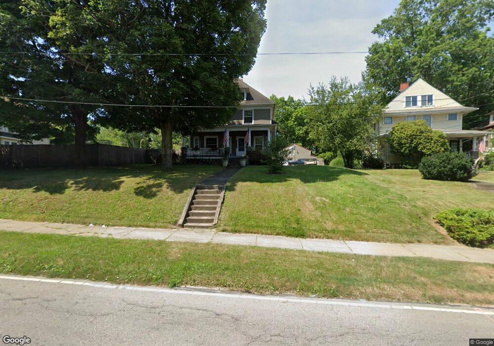
555 Tod Ave NW Warren, OH 44485
Amvets NeighborhoodEstimated Value: $61,000 - $106,917
3
Beds
1
Bath
1,872
Sq Ft
$45/Sq Ft
Est. Value
About This Home
This home is located at 555 Tod Ave NW, Warren, OH 44485 and is currently estimated at $83,979, approximately $44 per square foot. 555 Tod Ave NW is a home located in Trumbull County with nearby schools including Warren G. Harding High School, Willard PK-8 School, and Steam Academy of Warren.
Ownership History
Date
Name
Owned For
Owner Type
Purchase Details
Closed on
Sep 2, 2003
Sold by
Mcguirk Demarys M
Bought by
Federal National Mortgage Association
Current Estimated Value
Purchase Details
Closed on
Mar 11, 2002
Sold by
Bullock Marian B
Bought by
Mcguirk Demarys M
Purchase Details
Closed on
Apr 30, 1999
Sold by
Natale Kathleen A
Bought by
Mcguirk Demarys M and Bullock Marian B
Home Financials for this Owner
Home Financials are based on the most recent Mortgage that was taken out on this home.
Original Mortgage
$56,030
Interest Rate
7.05%
Purchase Details
Closed on
Feb 5, 1999
Sold by
Biviano William R and Lea James D
Bought by
Natale Kathleen A
Purchase Details
Closed on
Jan 1, 1990
Bought by
James D Lea
Create a Home Valuation Report for This Property
The Home Valuation Report is an in-depth analysis detailing your home's value as well as a comparison with similar homes in the area
Home Values in the Area
Average Home Value in this Area
Purchase History
| Date | Buyer | Sale Price | Title Company |
|---|---|---|---|
| Federal National Mortgage Association | $38,000 | -- | |
| Mcguirk Demarys M | -- | -- | |
| Mcguirk Demarys M | $56,500 | -- | |
| Natale Kathleen A | $15,000 | -- | |
| James D Lea | -- | -- |
Source: Public Records
Mortgage History
| Date | Status | Borrower | Loan Amount |
|---|---|---|---|
| Previous Owner | Mcguirk Demarys M | $56,030 |
Source: Public Records
Tax History Compared to Growth
Tax History
| Year | Tax Paid | Tax Assessment Tax Assessment Total Assessment is a certain percentage of the fair market value that is determined by local assessors to be the total taxable value of land and additions on the property. | Land | Improvement |
|---|---|---|---|---|
| 2024 | $1,147 | $22,650 | $4,660 | $17,990 |
| 2023 | $1,147 | $22,650 | $4,660 | $17,990 |
| 2022 | $913 | $14,080 | $4,660 | $9,420 |
| 2021 | $914 | $14,080 | $4,660 | $9,420 |
| 2020 | $915 | $14,080 | $4,660 | $9,420 |
| 2019 | $933 | $13,620 | $4,660 | $8,960 |
| 2018 | $929 | $13,620 | $4,660 | $8,960 |
| 2017 | $915 | $13,620 | $4,660 | $8,960 |
| 2016 | $915 | $14,110 | $6,200 | $7,910 |
| 2015 | $910 | $14,110 | $6,200 | $7,910 |
| 2014 | $904 | $14,110 | $6,200 | $7,910 |
| 2013 | $905 | $14,880 | $6,200 | $8,680 |
Source: Public Records
Map
Nearby Homes
- 600 Parkman Rd NW
- 970 Tod Ave NW
- 806 Parkman Rd NW
- 983 Garden St NW
- 666 Dickey Ave NW
- 561 South St SW
- 1056 Orlo Dr NW
- 1166 Raymond St NW
- 855 Adams Ave NW
- 759 Tod Ave SW
- 360 Freeman St NW
- 555 Hall St NW
- 428 Waverly Ave NE
- 1325 Moncrest Dr NW
- 1447 Grove Ave NW
- 1459 West Ave NW
- 1530 Vernon Ave NW
- 433 Olive Ave NE Unit 435
- 442 Belmont Ave NE
- 783 Packard St NW
- 531 533 Tod Ave
- 531 Tod Ave NW
- 567 Tod Ave NW
- 521 Tod Ave NW
- 579 Tod Ave NW
- 580 Tod Ave NW
- 846 Hunter St NW
- 589 Tod Ave NW
- 840 Hunter St NW
- 848 Hunter St NW Unit 440
- 848 Hunter St NW
- 856 Hunter St NW
- 597 Tod Ave NW
- 864 Hunter St NW
- 874 Hunter St NW
- 607 Tod Ave NW
- 821 Hunter St NW
- 829 Hunter St NW
- 884 Hunter St NW
- 610 Tod Ave NW