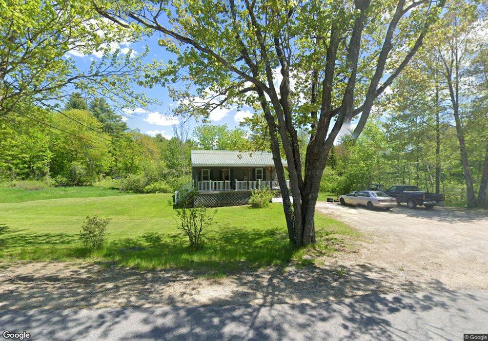
555 West Rd Bowdoin, ME 04287
Estimated Value: $274,000 - $340,000
2
Beds
1
Bath
825
Sq Ft
$372/Sq Ft
Est. Value
About This Home
This home is located at 555 West Rd, Bowdoin, ME 04287 and is currently estimated at $306,827, approximately $371 per square foot. 555 West Rd is a home with nearby schools including Mt Ararat High School.
Create a Home Valuation Report for This Property
The Home Valuation Report is an in-depth analysis detailing your home's value as well as a comparison with similar homes in the area
Home Values in the Area
Average Home Value in this Area
Tax History Compared to Growth
Tax History
| Year | Tax Paid | Tax Assessment Tax Assessment Total Assessment is a certain percentage of the fair market value that is determined by local assessors to be the total taxable value of land and additions on the property. | Land | Improvement |
|---|---|---|---|---|
| 2025 | $2,754 | $258,600 | $107,700 | $150,900 |
| 2024 | $2,508 | $258,600 | $107,700 | $150,900 |
| 2023 | $2,015 | $110,700 | $55,900 | $54,800 |
| 2022 | $1,904 | $112,640 | $55,900 | $56,740 |
| 2021 | $1,923 | $115,840 | $55,900 | $59,940 |
| 2020 | $1,853 | $115,840 | $55,900 | $59,940 |
| 2019 | $1,830 | $115,840 | $55,900 | $59,940 |
| 2018 | $1,749 | $115,840 | $55,900 | $59,940 |
| 2017 | $1,738 | $115,840 | $55,900 | $59,940 |
| 2016 | $1,703 | $115,840 | $55,900 | $59,940 |
| 2015 | $1,743 | $119,400 | $55,900 | $63,500 |
| 2014 | $1,660 | $119,400 | $55,900 | $63,500 |
| 2013 | $1,552 | $119,400 | $55,900 | $63,500 |
Source: Public Records
Map
Nearby Homes
- 38 Moore Dr
- 144 Keay Rd
- 11 Dustin Dr
- 25 Litchfield Rd
- 113 Beaver Rd
- 376 Bowdoinham Rd
- 219 Dead River Rd
- 31 Samsons' Way
- 202 Bowdoinham Rd
- Lot 14 Dead River Rd
- 0 Academy Rd Unit 1502594
- R01L73 & M8l32 Marsh Rd
- 41 Patriot Ln
- 466 Middle Rd
- 1338 Meadow Rd
- 62 Birchwood Dr
- 33 Bush Ln
- 41 Hidden Pond Rd
- Lot B2 Academy Rd
- Lot B1 Academy Rd