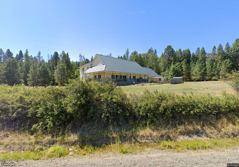
5550 Upper Peoh Point Rd Cle Elum, WA 98922
Estimated Value: $915,000 - $1,413,000
3
Beds
3
Baths
4,796
Sq Ft
$252/Sq Ft
Est. Value
About This Home
This home is located at 5550 Upper Peoh Point Rd, Cle Elum, WA 98922 and is currently estimated at $1,209,565, approximately $252 per square foot. 5550 Upper Peoh Point Rd is a home located in Kittitas County with nearby schools including Cle Elum Roslyn Elementary School, Walter Strom Middle School, and Cle Elum Roslyn High School.
Ownership History
Date
Name
Owned For
Owner Type
Purchase Details
Closed on
Mar 27, 2008
Sold by
Lasswell Frederick R and Lasswell Chung Tsu
Bought by
Ristine Stephen and Thorson Mary Jane
Current Estimated Value
Create a Home Valuation Report for This Property
The Home Valuation Report is an in-depth analysis detailing your home's value as well as a comparison with similar homes in the area
Home Values in the Area
Average Home Value in this Area
Purchase History
| Date | Buyer | Sale Price | Title Company |
|---|---|---|---|
| Ristine Stephen | $210,000 | None Available |
Source: Public Records
Tax History Compared to Growth
Tax History
| Year | Tax Paid | Tax Assessment Tax Assessment Total Assessment is a certain percentage of the fair market value that is determined by local assessors to be the total taxable value of land and additions on the property. | Land | Improvement |
|---|---|---|---|---|
| 2025 | $6,897 | $1,169,120 | $178,850 | $990,270 |
| 2023 | $6,897 | $1,028,420 | $138,850 | $889,570 |
| 2022 | $5,910 | $817,840 | $103,850 | $713,990 |
| 2021 | $6,089 | $804,030 | $103,850 | $700,180 |
| 2019 | $4,593 | $603,130 | $68,850 | $534,280 |
| 2018 | $3,983 | $496,270 | $68,850 | $427,420 |
| 2017 | $3,983 | $496,270 | $68,850 | $427,420 |
| 2016 | $3,995 | $496,270 | $68,850 | $427,420 |
| 2015 | $3,712 | $496,270 | $68,850 | $427,420 |
| 2013 | -- | $432,020 | $78,850 | $353,170 |
Source: Public Records
Map
Nearby Homes
- 181 Elk Rd
- 1721 Forest Ridge Dr
- 31 Forest Ridge Dr
- 500 Colfax Rd
- 1481 Casassa Rd
- 6280 Lower Peoh Point Rd
- 1810 Casassa Rd
- 451 Aspen Springs Rd
- 741 McDonald Rd
- 21 Two Springs Rd
- 61 - 341 Tetons Ln
- 211 Indian Hill Rd
- 290 2 Spring Rd
- 1290 Rodeo Rd
- 8607 Upper Peoh Point Rd
- 621 Rodeo Rd
- 891 Rodeo Rd
- 61 Tom and Nita Rd
- 1208 Rodeo Rd
- 2781 970
- 5390 Upper Peoh Point Rd
- 101 Elk Haven Rd
- 5741 Upper Peoh Point Rd
- 5750 Upper Peoh Point Rd
- 141 Stag Rd
- 203 Elk Haven Rd
- 120 Elk Haven Rd
- 5230 Upper Peoh Point Rd
- 230 Markovich Rd
- 5401 Upper Peoh Point Rd
- 230 Stag Rd
- 0 Markovich Rd Unit 1332073
- 0 Markovich Rd Unit 838786
- 0 Markovich Rd Unit 1214170
- 5931 Upper Peoh Point Rd
- 203 Markovich Rd
- 150 Stag Rd
- 14 Dakota Heights Dr
- 0 Stag Rd