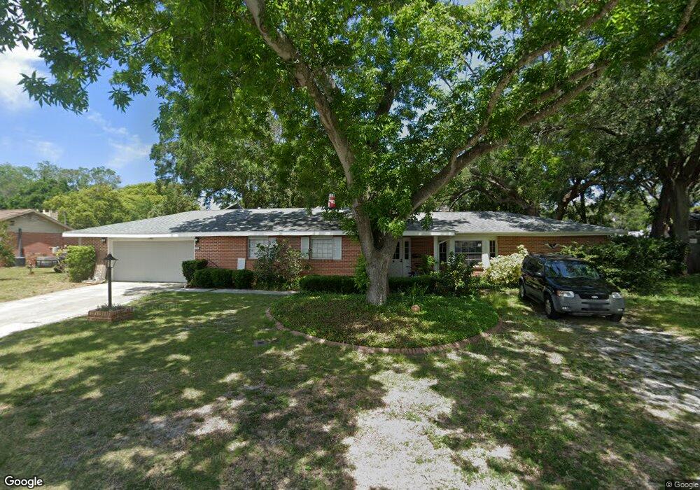
5551 Tennessee Ave New Port Richey, FL 34652
Downtown New Port Richey NeighborhoodEstimated Value: $384,000 - $519,000
4
Beds
3
Baths
2,894
Sq Ft
$159/Sq Ft
Est. Value
About This Home
This home is located at 5551 Tennessee Ave, New Port Richey, FL 34652 and is currently estimated at $459,412, approximately $158 per square foot. 5551 Tennessee Ave is a home located in Pasco County with nearby schools including Richey Elementary School, Gulf Middle School, and Gulf High School.
Ownership History
Date
Name
Owned For
Owner Type
Purchase Details
Closed on
Jun 11, 2014
Sold by
Lidbom Roy A and Lidbom Nelda Jo
Bought by
Gerakios Mary M and Gerakios Manuel George
Current Estimated Value
Home Financials for this Owner
Home Financials are based on the most recent Mortgage that was taken out on this home.
Original Mortgage
$164,350
Outstanding Balance
$125,757
Interest Rate
4.36%
Mortgage Type
New Conventional
Estimated Equity
$333,655
Create a Home Valuation Report for This Property
The Home Valuation Report is an in-depth analysis detailing your home's value as well as a comparison with similar homes in the area
Home Values in the Area
Average Home Value in this Area
Purchase History
| Date | Buyer | Sale Price | Title Company |
|---|---|---|---|
| Gerakios Mary M | $173,000 | Keystone Title Agency Inc |
Source: Public Records
Mortgage History
| Date | Status | Borrower | Loan Amount |
|---|---|---|---|
| Open | Gerakios Mary M | $164,350 |
Source: Public Records
Tax History Compared to Growth
Tax History
| Year | Tax Paid | Tax Assessment Tax Assessment Total Assessment is a certain percentage of the fair market value that is determined by local assessors to be the total taxable value of land and additions on the property. | Land | Improvement |
|---|---|---|---|---|
| 2025 | $2,571 | $146,660 | -- | -- |
| 2024 | $2,571 | $142,530 | -- | -- |
| 2023 | $2,511 | $138,380 | $0 | $0 |
| 2022 | $2,319 | $134,350 | $0 | $0 |
| 2021 | $2,256 | $130,440 | $67,500 | $62,940 |
| 2020 | $2,232 | $128,640 | $40,500 | $88,140 |
| 2019 | $2,176 | $125,750 | $0 | $0 |
| 2018 | $2,135 | $123,414 | $0 | $0 |
| 2017 | $2,112 | $123,414 | $0 | $0 |
| 2016 | $1,993 | $118,390 | $0 | $0 |
| 2015 | $2,012 | $117,567 | $30,060 | $87,507 |
| 2014 | $1,834 | $113,276 | $30,060 | $83,216 |
Source: Public Records
Map
Nearby Homes
- 5827 Rio Dr
- 5649 Oak Ridge Ave
- 5646 Oak Ridge Ave
- 5728 River Bluff Dr Unit Lot 8
- 5732 River Bluff Dr Unit Lot 7
- 5750 Georgia Ave
- 6046 River Rd
- 5633 Charles St
- 6105 & 6107 Adams St
- 5627 Ferguson Ct Unit 1303
- 5649 Tidalwave Dr
- 5645 Townhouse Dr
- 5640 Ferguson Ct Unit 2203
- 10840 State Road 52
- 5421 Gulf Dr
- 5800 Madison St
- 5436 Amy Ln
- 0 Main St Unit MFRTB8414402
- 6033 Illinois Ave
- 5100 South Rd
- 5603 Tennessee Ave
- 5535 Tennessee Ave
- 5609 Tennessee Ave
- 5552 Wyoming Ave
- 5534 Wyoming Ave
- 5550 Tennessee Ave
- 5608 Wyoming Ave
- 5604 Tennessee Ave
- 5528 Wyoming Ave
- 5536 Tennessee Ave
- 5525 Tennessee Ave
- 5617 Tennessee Ave
- 5610 Tennessee Ave
- 5520 Wyoming Ave
- 5530 Tennessee Ave
- 5618 Wyoming Ave
- 5616 Tennessee Ave
- 5627 Tennessee Ave
- 5515 Tennessee Ave
- 5524 Tennessee Ave