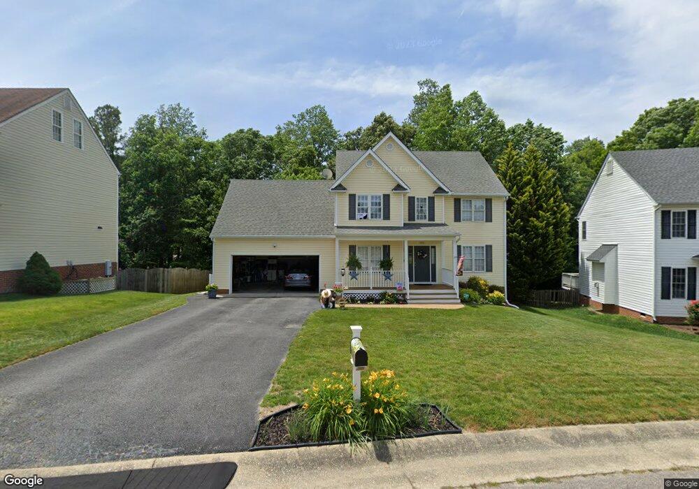
5554 Charter Oak Dr Chesterfield, VA 23832
Estimated Value: $416,842 - $428,000
4
Beds
3
Baths
2,110
Sq Ft
$200/Sq Ft
Est. Value
About This Home
This home is located at 5554 Charter Oak Dr, Chesterfield, VA 23832 and is currently estimated at $422,211, approximately $200 per square foot. 5554 Charter Oak Dr is a home located in Chesterfield County with nearby schools including Thelma Crenshaw Elementary School, Bailey Bridge Middle School, and Manchester High.
Ownership History
Date
Name
Owned For
Owner Type
Purchase Details
Closed on
May 10, 2005
Sold by
Charter Homes Inc
Bought by
Austin Tracy
Current Estimated Value
Home Financials for this Owner
Home Financials are based on the most recent Mortgage that was taken out on this home.
Original Mortgage
$182,300
Outstanding Balance
$94,747
Interest Rate
5.79%
Mortgage Type
New Conventional
Estimated Equity
$327,464
Create a Home Valuation Report for This Property
The Home Valuation Report is an in-depth analysis detailing your home's value as well as a comparison with similar homes in the area
Home Values in the Area
Average Home Value in this Area
Purchase History
| Date | Buyer | Sale Price | Title Company |
|---|---|---|---|
| Austin Tracy | $227,950 | -- |
Source: Public Records
Mortgage History
| Date | Status | Borrower | Loan Amount |
|---|---|---|---|
| Open | Austin Tracy | $182,300 |
Source: Public Records
Tax History Compared to Growth
Tax History
| Year | Tax Paid | Tax Assessment Tax Assessment Total Assessment is a certain percentage of the fair market value that is determined by local assessors to be the total taxable value of land and additions on the property. | Land | Improvement |
|---|---|---|---|---|
| 2025 | $3,359 | $374,600 | $72,000 | $302,600 |
| 2024 | $3,359 | $368,800 | $70,000 | $298,800 |
| 2023 | $3,089 | $339,500 | $65,000 | $274,500 |
| 2022 | $2,885 | $313,600 | $63,000 | $250,600 |
| 2021 | $2,753 | $282,800 | $61,000 | $221,800 |
| 2020 | $2,546 | $268,000 | $61,000 | $207,000 |
| 2019 | $2,454 | $258,300 | $61,000 | $197,300 |
| 2018 | $2,361 | $248,500 | $61,000 | $187,500 |
| 2017 | $2,252 | $234,600 | $60,000 | $174,600 |
| 2016 | $2,190 | $228,100 | $60,000 | $168,100 |
| 2015 | $2,112 | $217,400 | $60,000 | $157,400 |
| 2014 | $2,055 | $211,500 | $60,000 | $151,500 |
Source: Public Records
Map
Nearby Homes
- 5618 Burnage Ct
- 10524 Sunne Ct
- 5412 Qualla Trace Ln
- 5406 Qualla Trace Ln
- 5731 Hereld Green Dr
- 5402 Qualla Trace Terrace
- 5400 Qualla Trace Ln
- 5407 Qualla Trace Ln
- 5430 Solaris Dr
- Maxwell Plan at Qualla Trace - Smart Living
- Newton Plan at Qualla Trace - Smart Living
- Edison Plan at Qualla Trace - Smart Living
- King Plan at Qualla Trace - Smart Living
- Curie Plan at Qualla Trace - Smart Living
- 10709 Solaris Ct
- 10508 Rollingway Ct
- 10718 Genlou Rd
- 5124 Rollingway Rd
- 5213 Oakforest Dr
- 5313 Qualla Rd
- 5548 Charter Oak Dr
- 5600 Charter Oak Dr
- 9730 Family Ln
- 5542 Charter Oak Dr
- 5549 Charter Oak Dr
- 5601 Charter Oak Dr
- 0 Stockport Charter Place
- 9740 Family Ln
- 5618 Charter Oak Dr
- 5536 Charter Oak Dr
- 5537 Charter Oak Dr
- 5607 Charter Oak Dr
- 5536 Stockport Charter Place
- 9624 Dunroming Rd
- 9721 Family Ln
- 5613 Charter Oak Dr
- 9625 Dunroming Rd
- 5530 Charter Oak Dr
- 5624 Charter Oak Dr
- 9731 Family Ln