Estimated Value: $205,000 - $368,000
Studio
1
Bath
1,593
Sq Ft
$167/Sq Ft
Est. Value
About This Home
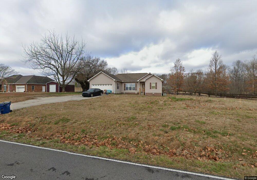
This home is located at 5555 Simpson Point Rd, Grant, AL 35747 and is currently estimated at $265,983, approximately $166 per square foot. 5555 Simpson Point Rd is a home located in Marshall County with nearby schools including Kate Duncan Smith DAR Elementary School, Kate Duncan Smith DAR Middle School, and Kate Duncan Smith DAR High School.
Ownership History
Date
Name
Owned For
Owner Type
Purchase Details
Closed on
Jun 24, 2021
Sold by
Jacks and Anna
Bought by
Jacks Paul
Current Estimated Value
Home Financials for this Owner
Home Financials are based on the most recent Mortgage that was taken out on this home.
Original Mortgage
$110,000
Interest Rate
3.56%
Mortgage Type
New Conventional
Purchase Details
Closed on
Aug 23, 2017
Sold by
Jacks Paul
Bought by
Jacks Paul and Jacks Anna
Home Financials for this Owner
Home Financials are based on the most recent Mortgage that was taken out on this home.
Original Mortgage
$115,028
Interest Rate
3.75%
Mortgage Type
FHA
Purchase Details
Closed on
Mar 31, 2008
Sold by
Troup Ronnie and Troup Teresa
Bought by
Jacks Paul
Home Financials for this Owner
Home Financials are based on the most recent Mortgage that was taken out on this home.
Original Mortgage
$102,000
Interest Rate
6.22%
Mortgage Type
New Conventional
Purchase Details
Closed on
Aug 14, 2007
Sold by
Brewer Burwyn J
Bought by
Troup Ronnie and Troup Teresa
Create a Home Valuation Report for This Property
The Home Valuation Report is an in-depth analysis detailing your home's value as well as a comparison with similar homes in the area
Purchase History
| Date | Buyer | Sale Price | Title Company |
|---|---|---|---|
| Jacks Paul | $110,000 | Servicelink | |
| Jacks Paul | -- | None Available | |
| Jacks Paul | -- | None Available | |
| Troup Ronnie | $17,000 | None Available |
Source: Public Records
Mortgage History
| Date | Status | Borrower | Loan Amount |
|---|---|---|---|
| Previous Owner | Jacks Paul | $110,000 | |
| Previous Owner | Jacks Paul | $115,028 | |
| Previous Owner | Jacks Paul | $102,000 |
Source: Public Records
Tax History
| Year | Tax Paid | Tax Assessment Tax Assessment Total Assessment is a certain percentage of the fair market value that is determined by local assessors to be the total taxable value of land and additions on the property. | Land | Improvement |
|---|---|---|---|---|
| 2024 | $639 | $14,440 | $0 | $0 |
| 2023 | $602 | $14,220 | $660 | $13,560 |
| 2022 | $604 | $14,500 | $0 | $0 |
| 2021 | $585 | $14,000 | $0 | $0 |
| 2020 | $494 | $11,580 | $0 | $0 |
| 2017 | $446 | $11,200 | $0 | $0 |
| 2015 | -- | $11,440 | $0 | $0 |
| 2014 | -- | $11,440 | $0 | $0 |
Source: Public Records
Map
Nearby Homes
- 3219 Simpson Point Rd
- Lot 5 White Elephant Rd
- 1169 Honeycomb Rd
- 89 Bearden Dr
- 2216 White Elephant Rd
- 15 Shin Point Rd
- .80 Honeycomb Rd
- 7905 Simpson Point Rd
- 1885 White Elephant Rd
- 36 Randles Rd
- 1520 White Elephant Rd
- 247 Raulston Ln
- 8.7 acres Cathedral Caverns Hwy
- 2.90 acres-Lot2 Cathedral Caverns Hwy
- 2.90 acres-Lot1 Cathedral Caverns Hwy
- 2.95 acres-Lot3 Cathedral Caverns Hwy
- 2.25 acres-Lot4 Cathedral Caverns Hwy
- 1821 Simpson Point Rd
- 0 Honeycomb Rd Unit RTC3071170
- 0 Honeycomb Rd Unit 522693
- 5523 Simpson Point Rd
- 5579 Simpson Point Rd
- 5615 Simpson Point Rd
- 5721 Simpson Point Rd
- 690 Whitaker Rd
- 41 Cherokee Ridge
- 5359 Simpson Point Rd
- 5743 Simpson Point Rd
- 10.3 Acres Cherokee Ridge Rd
- 3.1 Acres Cherokee Ridge Rd
- 644 Whitaker Rd
- 5850 Simpson Point Rd
- 244 Cherokee Ridge Rd
- 244 Cherokee Ridge
- 612 Brewer Cir
- 612 Brewer Cir
- 5180 Simpson Point Rd
- 400 Whitaker Rd
- 415 Brewer Cir
- 5110 Simpson Point Rd
Your Personal Tour Guide
Ask me questions while you tour the home.