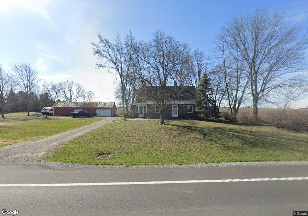
5555 State Route 12 W Pandora, OH 45877
Estimated Value: $183,809 - $256,000
3
Beds
2
Baths
952
Sq Ft
$226/Sq Ft
Est. Value
About This Home
This home is located at 5555 State Route 12 W, Pandora, OH 45877 and is currently estimated at $214,952, approximately $225 per square foot. 5555 State Route 12 W is a home located in Putnam County with nearby schools including Pandora-Gilboa Elementary School, Pandora-Gilboa Middle School, and Pandora-Gilboa High School.
Ownership History
Date
Name
Owned For
Owner Type
Purchase Details
Closed on
Jan 23, 2024
Sold by
Fischer Craig Francis
Bought by
Fischer Craig Francis and Fischer Gloria Jane
Current Estimated Value
Purchase Details
Closed on
Sep 15, 2020
Sold by
Basinger Brion and Basinger Elaine
Bought by
Fischer Craig Francis and Fischer Gloria Jane
Home Financials for this Owner
Home Financials are based on the most recent Mortgage that was taken out on this home.
Original Mortgage
$136,800
Interest Rate
2.8%
Mortgage Type
New Conventional
Purchase Details
Closed on
Feb 27, 2019
Sold by
Basinger Wallace D
Bought by
Basinger Brion
Purchase Details
Closed on
Jun 20, 2008
Sold by
Bassinger Wallace D and Basinger Joan M
Bought by
Basinger Wallace D and Basinger Joan M
Create a Home Valuation Report for This Property
The Home Valuation Report is an in-depth analysis detailing your home's value as well as a comparison with similar homes in the area
Home Values in the Area
Average Home Value in this Area
Purchase History
| Date | Buyer | Sale Price | Title Company |
|---|---|---|---|
| Fischer Craig Francis | -- | None Listed On Document | |
| Fischer Craig Francis | -- | None Listed On Document | |
| Fischer Craig Francis | $171,000 | None Available | |
| Basinger Brion | -- | None Available | |
| Basinger Wallace D | -- | Attorney |
Source: Public Records
Mortgage History
| Date | Status | Borrower | Loan Amount |
|---|---|---|---|
| Previous Owner | Fischer Craig Francis | $136,800 |
Source: Public Records
Tax History Compared to Growth
Tax History
| Year | Tax Paid | Tax Assessment Tax Assessment Total Assessment is a certain percentage of the fair market value that is determined by local assessors to be the total taxable value of land and additions on the property. | Land | Improvement |
|---|---|---|---|---|
| 2024 | $1,188 | $42,760 | $7,820 | $34,940 |
| 2023 | $1,248 | $31,970 | $4,490 | $27,480 |
| 2022 | $1,223 | $31,970 | $4,491 | $27,479 |
| 2021 | $1,225 | $31,970 | $4,491 | $27,479 |
| 2020 | $1,224 | $28,550 | $5,050 | $23,500 |
| 2019 | $689 | $27,590 | $4,490 | $23,100 |
| 2018 | $673 | $27,590 | $4,490 | $23,100 |
| 2017 | $676 | $27,590 | $4,490 | $23,100 |
| 2016 | $676 | $28,550 | $5,050 | $23,500 |
| 2015 | $683 | $28,550 | $5,050 | $23,500 |
| 2014 | $670 | $28,550 | $5,050 | $23,500 |
| 2013 | $626 | $28,550 | $5,050 | $23,500 |
Source: Public Records
Map
Nearby Homes
- 208 E Monroe St
- 101 Maplewood Dr
- 704 Sherman St
- 17429 Road 5
- 8160 Columbus Grove-Bluffton Rd
- 10755 Bixel Rd
- 349 Sycamore Ct
- 110 Magnolia Ln
- 182 Sunset Dr
- 152 Chestnut Ln
- 0 Columbus Grove-Bluffton Rd
- 204 S Broadway St
- 205 S Broadway St
- 209 Willow Bend Dr
- 222 Grove St
- 212 S Lawn Ave
- 11242 Ottawa Dr
- 217 Grove St
- 222 N Lawn Ave
- 430 S Jackson St
- 5473 State Route 12 W
- 404 W Washington St
- 5467 State Route 12 W
- 5476 State Route 12 W
- 305 W Washington St
- 301 W Main St
- 303 W Washington St
- 213 W Main St
- 208 W Main St
- 205 W Washington St
- 395 Hilty Dr
- 206 W Main St
- 207 W Main St
- 103 N Pearl St
- 105 N Pearl St
- 106 Pearl St
- 103 Pearl St
- 101 Pearl St
- 108 S Pearl St