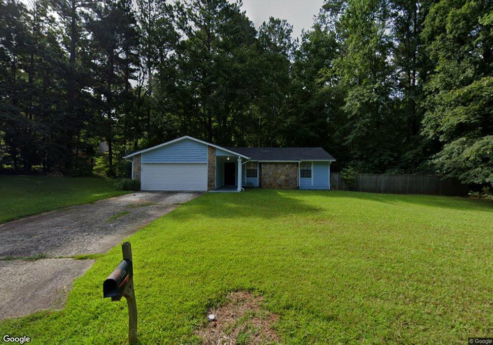
5556 Liberty Rd Unit 1 Union City, GA 30291
Estimated Value: $213,000 - $252,000
3
Beds
2
Baths
1,372
Sq Ft
$170/Sq Ft
Est. Value
About This Home
This home is located at 5556 Liberty Rd Unit 1, Union City, GA 30291 and is currently estimated at $233,260, approximately $170 per square foot. 5556 Liberty Rd Unit 1 is a home located in Fulton County with nearby schools including Liberty Point Elementary School, Camp Creek Middle School, and Langston Hughes High School.
Ownership History
Date
Name
Owned For
Owner Type
Purchase Details
Closed on
May 25, 2000
Sold by
Sec Of Va
Bought by
Gibson Paul and Gibson Evelyn
Current Estimated Value
Home Financials for this Owner
Home Financials are based on the most recent Mortgage that was taken out on this home.
Original Mortgage
$60,000
Outstanding Balance
$20,728
Interest Rate
8.14%
Mortgage Type
VA
Estimated Equity
$212,532
Purchase Details
Closed on
Jul 6, 1999
Sold by
Homeside Lending Inc
Bought by
Va
Create a Home Valuation Report for This Property
The Home Valuation Report is an in-depth analysis detailing your home's value as well as a comparison with similar homes in the area
Home Values in the Area
Average Home Value in this Area
Purchase History
| Date | Buyer | Sale Price | Title Company |
|---|---|---|---|
| Gibson Paul | $62,000 | -- | |
| Va | -- | -- | |
| Homeside Lending Inc | $63,278 | -- |
Source: Public Records
Mortgage History
| Date | Status | Borrower | Loan Amount |
|---|---|---|---|
| Open | Gibson Paul | $60,000 |
Source: Public Records
Tax History Compared to Growth
Tax History
| Year | Tax Paid | Tax Assessment Tax Assessment Total Assessment is a certain percentage of the fair market value that is determined by local assessors to be the total taxable value of land and additions on the property. | Land | Improvement |
|---|---|---|---|---|
| 2025 | $920 | $60,400 | $18,920 | $41,480 |
| 2023 | $1,814 | $64,280 | $22,120 | $42,160 |
| 2022 | $1,169 | $44,440 | $14,320 | $30,120 |
| 2021 | $1,337 | $33,160 | $8,880 | $24,280 |
| 2020 | $912 | $32,800 | $8,800 | $24,000 |
| 2019 | $1,036 | $24,520 | $6,280 | $18,240 |
| 2018 | $540 | $19,120 | $3,440 | $15,680 |
| 2017 | $558 | $19,120 | $3,440 | $15,680 |
| 2016 | $559 | $22,520 | $5,480 | $17,040 |
| 2015 | $1,013 | $22,520 | $5,480 | $17,040 |
| 2014 | $408 | $13,320 | $2,240 | $11,080 |
Source: Public Records
Map
Nearby Homes
- 0 Lakeside Dr Unit 22475152
- 0 Lakeside Dr Unit 7515650
- 0 Lower Dixie Lake Rd Unit 22475153
- 0 Lower Dixie Lake Rd Unit 7515143
- 5910 Rock Rd
- 6200 Ward Rd
- 5856 Rock Rd
- 0 Highpoint Rd Unit 10553938
- 5900 Union Woods Way
- 5135 Hilltop Dr
- 0 Ward Rd Unit 7174145
- 0 Ward Rd Unit 20102427
- 0 Simpson Ave Unit 7532980
- 3227 Diamond Bluff
- 6024 Diamond Ln
- 6000 Diamond Ln
- 4458 Manor Hill Dr
- 000 Highpoint Rd
- 99 Highpoint Rd
- 4695 Ravenwood Loop
- 5556 Liberty Rd
- 5544 Hall Cir
- 5570 Liberty Rd
- 5553 Liberty Rd
- 5540 Liberty Rd Unit 1
- 5561 Liberty Rd
- 5532 Hall Cir
- 5580 Liberty Rd
- 5543 Liberty Rd Unit 1
- 5539 Hall Cir
- 0 Liberty Rd Unit 7280220
- 0 Liberty Rd Unit 3238212
- 0 Liberty Rd Unit 8393926
- 0 Liberty Rd Unit 8143620
- 0 Liberty Rd Unit 7543837
- 0 Liberty Rd Unit 8295295
- 0 Liberty Rd
- 5974 Armour Dr
- 5590 Liberty Rd Unit 1
- 0 Lakeside Dr