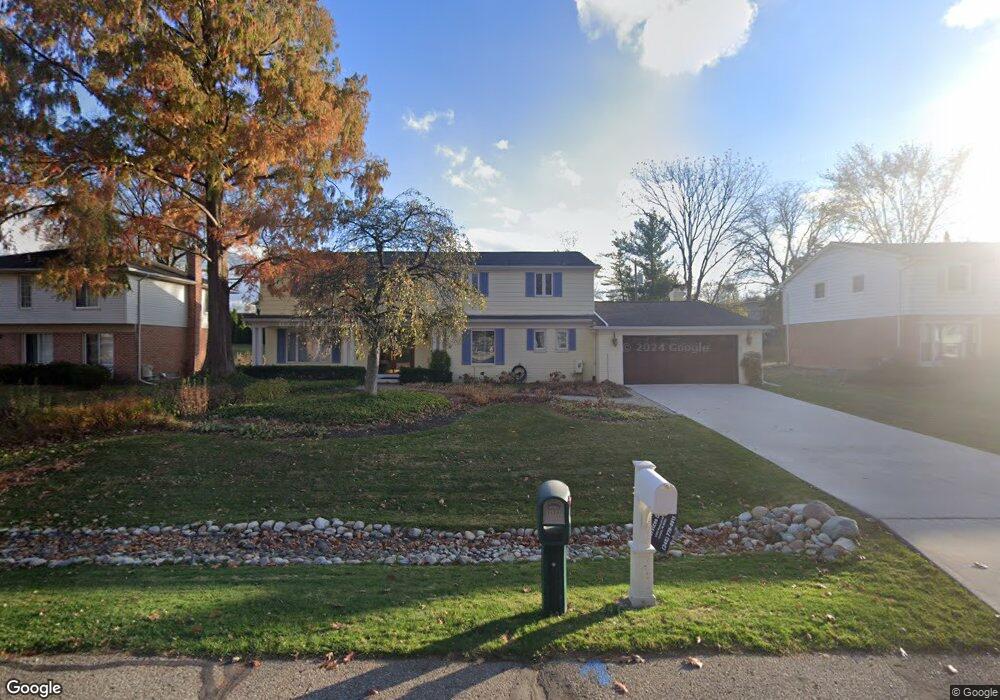
5557 Haverhill West Bloomfield, MI 48322
Estimated Value: $446,533 - $503,000
4
Beds
3
Baths
3,046
Sq Ft
$152/Sq Ft
Est. Value
About This Home
This home is located at 5557 Haverhill, West Bloomfield, MI 48322 and is currently estimated at $463,383, approximately $152 per square foot. 5557 Haverhill is a home located in Oakland County with nearby schools including Wood Creek Elementary School, Warner Upper Elementary School, and Bloomfield Maples Montessori.
Ownership History
Date
Name
Owned For
Owner Type
Purchase Details
Closed on
Aug 22, 2024
Sold by
Dee Dee Hoffman Revocable Trust and Klayman Brian
Bought by
Hoffman Matthew I
Current Estimated Value
Purchase Details
Closed on
Feb 12, 2016
Sold by
Hoffman Ellen M and Hoffman Dee
Bought by
Hoffman Ellen M and Dee Dee Hoffman Revocable Trus
Purchase Details
Closed on
Aug 6, 2009
Sold by
Allegheny Casualty Company
Bought by
Hoffman Ellen M
Purchase Details
Closed on
Jul 2, 2007
Sold by
Hoffman Ellen M
Bought by
Allegheny Casualty Co and Motor City Bail Bonds Inc
Create a Home Valuation Report for This Property
The Home Valuation Report is an in-depth analysis detailing your home's value as well as a comparison with similar homes in the area
Home Values in the Area
Average Home Value in this Area
Purchase History
| Date | Buyer | Sale Price | Title Company |
|---|---|---|---|
| Hoffman Matthew I | -- | None Listed On Document | |
| Hoffman Matthew I | -- | None Listed On Document | |
| Hoffman Ellen M | -- | Attorney | |
| Hoffman Ellen M | -- | None Available | |
| Allegheny Casualty Co | $100,000 | None Available |
Source: Public Records
Tax History Compared to Growth
Tax History
| Year | Tax Paid | Tax Assessment Tax Assessment Total Assessment is a certain percentage of the fair market value that is determined by local assessors to be the total taxable value of land and additions on the property. | Land | Improvement |
|---|---|---|---|---|
| 2024 | $2,245 | $192,310 | $0 | $0 |
| 2022 | $2,163 | $161,660 | $39,990 | $121,670 |
| 2021 | $3,996 | $151,800 | $0 | $0 |
| 2020 | $2,046 | $152,610 | $39,850 | $112,760 |
| 2018 | $3,911 | $142,980 | $28,880 | $114,100 |
| 2015 | -- | $109,720 | $0 | $0 |
| 2014 | -- | $98,720 | $0 | $0 |
| 2011 | -- | $91,670 | $0 | $0 |
Source: Public Records
Map
Nearby Homes
- 7335 Coach Ln
- 7421 Heather Heath
- 7251 N Briarcliff Knoll Dr
- 7477 Heather Heath
- 6882 Post Oak Dr
- 7431 N Briarcliff Knoll Dr
- 30515 W 14 Mile Rd
- 30475 W 14 Mile Rd Unit 80
- 6843 Leslee Crest Dr
- 5312 Cambourne Place
- 7477 Gramercy Cir Unit 17
- 7479 Gramercy Cir Unit 16
- 7507 Gramercy Cir
- 32615 Briarcrest Knoll
- 7209 Stonebrook Rd
- 6564 Alderley Way
- 4392 Gateway Cir Unit 59
- 5241 S Pebblecreek Rd
- 6545 Post Oak Dr
- 6651 Hearthside Ct Unit 1