Estimated Value: $240,000 - $294,804
3
Beds
2
Baths
1,245
Sq Ft
$206/Sq Ft
Est. Value
About This Home
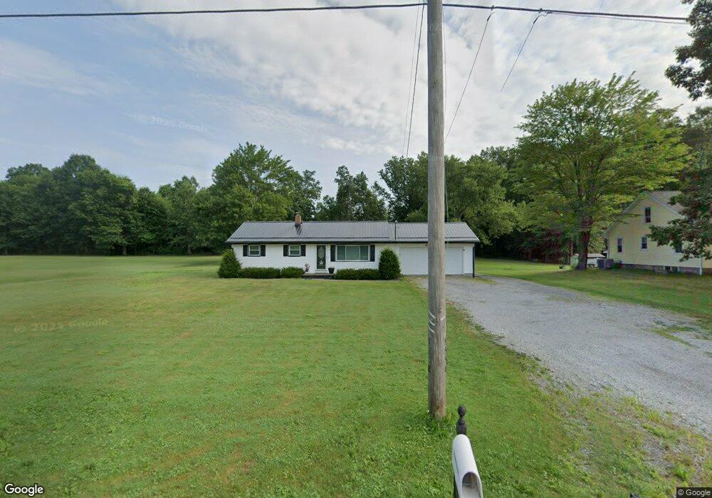
This home is located at 5558 W South Range Rd, Salem, OH 44460 and is currently estimated at $256,201, approximately $205 per square foot. 5558 W South Range Rd is a home located in Mahoning County with nearby schools including South Range Elementary School, South Range Middle School, and South Range High School.
Ownership History
Date
Name
Owned For
Owner Type
Purchase Details
Closed on
Feb 10, 2021
Sold by
Durr Scott and Estate Of Samuel G Durr Sr
Bought by
Royea Ralph and Royea Kimberlee
Current Estimated Value
Home Financials for this Owner
Home Financials are based on the most recent Mortgage that was taken out on this home.
Original Mortgage
$150,000
Interest Rate
2.73%
Mortgage Type
New Conventional
Purchase Details
Closed on
May 25, 1964
Bought by
Durr Samuel G and Durr Gail L
Create a Home Valuation Report for This Property
The Home Valuation Report is an in-depth analysis detailing your home's value as well as a comparison with similar homes in the area
Home Values in the Area
Average Home Value in this Area
Purchase History
| Date | Buyer | Sale Price | Title Company |
|---|---|---|---|
| Royea Ralph | $150,000 | None Available | |
| Durr Samuel G | -- | -- |
Source: Public Records
Mortgage History
| Date | Status | Borrower | Loan Amount |
|---|---|---|---|
| Previous Owner | Royea Ralph | $150,000 |
Source: Public Records
Tax History Compared to Growth
Tax History
| Year | Tax Paid | Tax Assessment Tax Assessment Total Assessment is a certain percentage of the fair market value that is determined by local assessors to be the total taxable value of land and additions on the property. | Land | Improvement |
|---|---|---|---|---|
| 2024 | $2,564 | $74,700 | $22,310 | $52,390 |
| 2023 | $2,633 | $74,700 | $22,310 | $52,390 |
| 2022 | $2,926 | $54,470 | $14,220 | $40,250 |
| 2021 | $2,890 | $54,300 | $14,050 | $40,250 |
| 2020 | $2,401 | $54,300 | $14,050 | $40,250 |
| 2019 | $2,055 | $45,990 | $14,050 | $31,940 |
| 2018 | $2,063 | $45,990 | $14,050 | $31,940 |
| 2017 | $2,060 | $45,990 | $14,050 | $31,940 |
| 2016 | $2,198 | $47,640 | $14,720 | $32,920 |
| 2015 | $2,120 | $47,640 | $14,720 | $32,920 |
| 2014 | $2,163 | $47,640 | $14,720 | $32,920 |
| 2013 | $2,148 | $47,640 | $14,720 | $32,920 |
Source: Public Records
Map
Nearby Homes
- 6604 W Middletown Rd
- 12157 Columbiana Canfield Rd
- 11375 Fox Run Ln
- 7060 W South Range Rd
- 7145 W South Range Rd
- 11158 Detwiler Rd
- 3555 W South Range Rd
- 10396 Detwiler Rd
- 3079 W South Range Rd
- 10473 Lisbon Rd
- 13752 Columbiana Canfield Rd
- 9256 Columbiana Canfield Rd
- 2680 W South Range Rd
- 315 Walnut St
- 9974 New Buffalo Rd
- 8570 W Pine Lake Rd
- 520 Washington St
- 615 Boston St
- 6605 Covington Cove
- 9501 New Buffalo Rd
- 5538 W South Range Rd
- 5538 S Range Rd
- 5510 W South Range Rd
- 5620 W South Range Rd
- 5607 W South Range Rd
- 5450 W South Range Rd
- 5665 W South Range Rd
- 5631 W South Range Rd
- 5710 W South Range Rd
- 5380 W South Range Rd
- 5816 W South Range Rd
- 5310 W South Range Rd
- 5396 W South Range Rd
- 11780 Green Beaver Rd
- 12065 Washingtonville Rd
- 11860 Green Beaver Rd
- 5107 W South Range Rd
- 6017 W South Range Rd
- 11770 Green Beaver Rd
- 11755 Washingtonville Rd