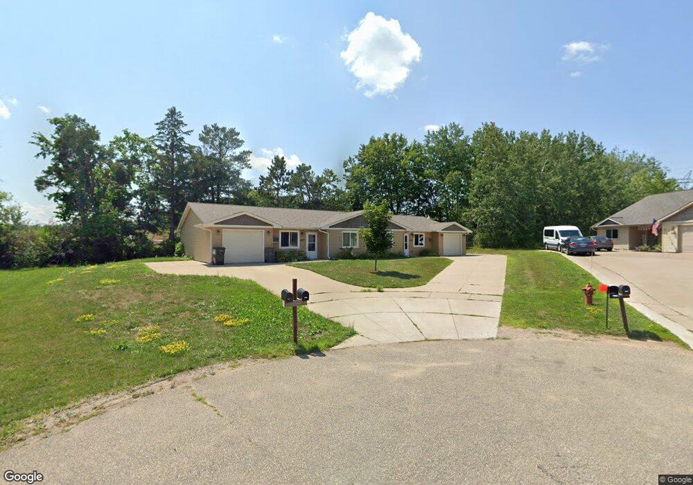
5559 Cyndi Ct Eau Claire, WI 54703
Estimated Value: $360,000 - $411,138
3
Beds
2
Baths
2,394
Sq Ft
$163/Sq Ft
Est. Value
About This Home
This home is located at 5559 Cyndi Ct, Eau Claire, WI 54703 and is currently estimated at $391,035, approximately $163 per square foot. 5559 Cyndi Ct is a home with nearby schools including Sherman Elementary School, Delong Middle School, and North High School.
Ownership History
Date
Name
Owned For
Owner Type
Purchase Details
Closed on
Nov 30, 2016
Sold by
Bfgh Rental Properties Llc
Bought by
Mack Brett M and Mack Heather A
Current Estimated Value
Purchase Details
Closed on
Sep 5, 2012
Sold by
B F G H Rental Properties Llc
Bought by
B F G H Rental Properties Llc
Purchase Details
Closed on
Sep 4, 2012
Sold by
West Ridge Park Peter Hoffman Llc
Bought by
Bfgh Rental Properties Llc
Purchase Details
Closed on
Feb 8, 2012
Sold by
Hoffman Peter
Bought by
West Ridge Park Peter Hoffman Llc
Purchase Details
Closed on
Jan 12, 2012
Sold by
Hagen Stuart A
Bought by
West Ridge Park Stuart A Hagen Llc
Purchase Details
Closed on
Jan 10, 2012
Sold by
Mogensen John S
Bought by
West Ridge Park John S Mogensen Llc
Purchase Details
Closed on
Dec 30, 2011
Sold by
West Ridge Park Ltd
Bought by
Hoffman David and Hoffman Peter
Create a Home Valuation Report for This Property
The Home Valuation Report is an in-depth analysis detailing your home's value as well as a comparison with similar homes in the area
Home Values in the Area
Average Home Value in this Area
Purchase History
| Date | Buyer | Sale Price | Title Company |
|---|---|---|---|
| Mack Brett M | $221,000 | -- | |
| B F G H Rental Properties Llc | -- | None Available | |
| Bfgh Rental Properties Llc | $27,900 | None Available | |
| West Ridge Park Peter Hoffman Llc | -- | None Available | |
| West Ridge Park David Hoffman Llc | -- | None Available | |
| West Ridge Park Stuart A Hagen Llc | -- | None Available | |
| West Ridge Park John S Mogensen Llc | -- | None Available | |
| Hoffman David | -- | None Available |
Source: Public Records
Tax History Compared to Growth
Tax History
| Year | Tax Paid | Tax Assessment Tax Assessment Total Assessment is a certain percentage of the fair market value that is determined by local assessors to be the total taxable value of land and additions on the property. | Land | Improvement |
|---|---|---|---|---|
| 2024 | $6,388 | $322,000 | $35,000 | $287,000 |
| 2023 | $5,846 | $322,000 | $35,000 | $287,000 |
| 2022 | $5,682 | $322,000 | $35,000 | $287,000 |
| 2021 | $5,576 | $322,000 | $35,000 | $287,000 |
| 2020 | $4,751 | $240,100 | $26,000 | $214,100 |
| 2019 | $4,775 | $240,100 | $26,000 | $214,100 |
| 2018 | $4,680 | $240,100 | $26,000 | $214,100 |
| 2017 | $4,903 | $217,000 | $26,000 | $191,000 |
| 2016 | $4,981 | $219,000 | $28,000 | $191,000 |
| 2014 | -- | $219,000 | $28,000 | $191,000 |
| 2013 | -- | $28,000 | $28,000 | $0 |
Source: Public Records
Map
Nearby Homes
- 4039 John Hart Place
- 4028 Mill Run Rd
- 3943 Mill Run Rd
- 4122 Mill Run Rd
- 5221 Stonewood Dr Unit 13
- 4119 Mill Run Ct Unit 1
- 4230 Mill Ridge Cir
- 3536 W Folsom St Unit 64
- 3536 W Folsom St Unit 63
- 3536 W Folsom St Unit 61
- 3490 Creek Ridge Dr
- 1996 Tucker Trail
- 3453 Creek Ridge Dr
- 8103 W Folsom St
- 3720 W Cameron St
- Lot 7,8 & 9 33rd St
- 3411 Rosewood Ln
- 3359 Vineyard St
- 3206 Rosewood Ln
- 1 Acre Rosewood Ln
- 5560 Cyndi Ct
- 5543 Cyndi Ct
- 5540 Cyndi Ct
- 5521 Cyndi Ct
- 5557 Cyndi Ct Unit 1 & 2
- 5557 Cyndi Ct Unit 5557/5559
- Lot 75 Cyndi Ct
- Lot 77 Cyndi Ct
- Lot 78 Cyndi Ct
- Lot 74 Cyndi Ct
- Lot 79 Cyndi Ct
- 5514 Cyndi Ct
- 5515 Cyndi Ct
- 3640 Flynn Place
- 5523 Normandale Dr
- 5506 Cyndi Ct
- 5565 Normandale Dr
- 5551 Normandale Dr