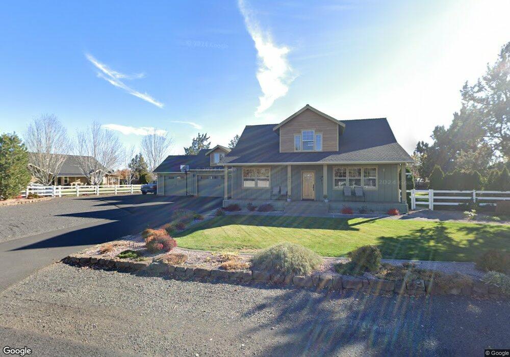
556 Angus Ct Terrebonne, OR 97760
Estimated Value: $608,000 - $809,000
4
Beds
3
Baths
2,188
Sq Ft
$320/Sq Ft
Est. Value
About This Home
This home is located at 556 Angus Ct, Terrebonne, OR 97760 and is currently estimated at $701,132, approximately $320 per square foot. 556 Angus Ct is a home located in Deschutes County with nearby schools including Terrebonne Community School, Elton Gregory Middle School, and Redmond High School.
Ownership History
Date
Name
Owned For
Owner Type
Purchase Details
Closed on
Jan 29, 2008
Sold by
Collins Ben
Bought by
Mcvey Stanley B and Mcvey Patricia A
Current Estimated Value
Home Financials for this Owner
Home Financials are based on the most recent Mortgage that was taken out on this home.
Original Mortgage
$110,000
Outstanding Balance
$69,494
Interest Rate
6.09%
Mortgage Type
Unknown
Estimated Equity
$631,638
Purchase Details
Closed on
Mar 16, 2006
Sold by
Angus Acres Lp
Bought by
Collins Ben
Home Financials for this Owner
Home Financials are based on the most recent Mortgage that was taken out on this home.
Original Mortgage
$45,000
Interest Rate
6.19%
Mortgage Type
Credit Line Revolving
Create a Home Valuation Report for This Property
The Home Valuation Report is an in-depth analysis detailing your home's value as well as a comparison with similar homes in the area
Home Values in the Area
Average Home Value in this Area
Purchase History
| Date | Buyer | Sale Price | Title Company |
|---|---|---|---|
| Mcvey Stanley B | $366,000 | First Amer Title Ins Co Or | |
| Collins Ben | $130,000 | Western Title & Escrow Co |
Source: Public Records
Mortgage History
| Date | Status | Borrower | Loan Amount |
|---|---|---|---|
| Open | Mcvey Stanley B | $110,000 | |
| Previous Owner | Collins Ben | $45,000 |
Source: Public Records
Tax History Compared to Growth
Tax History
| Year | Tax Paid | Tax Assessment Tax Assessment Total Assessment is a certain percentage of the fair market value that is determined by local assessors to be the total taxable value of land and additions on the property. | Land | Improvement |
|---|---|---|---|---|
| 2024 | $4,412 | $264,980 | -- | -- |
| 2023 | $4,206 | $257,270 | $0 | $0 |
| 2022 | $3,745 | $242,510 | $0 | $0 |
| 2021 | $3,744 | $235,450 | $0 | $0 |
| 2020 | $3,563 | $235,450 | $0 | $0 |
| 2019 | $3,396 | $228,600 | $0 | $0 |
| 2018 | $3,315 | $221,950 | $0 | $0 |
| 2017 | $3,241 | $215,490 | $0 | $0 |
| 2016 | $3,203 | $209,220 | $0 | $0 |
| 2015 | $3,103 | $203,130 | $0 | $0 |
| 2014 | $3,022 | $197,220 | $0 | $0 |
Source: Public Records
Map
Nearby Homes
- 9270 16th St
- 409 G Ave
- 603 Foss Dr
- 765 F Ave
- 983 Foss Dr
- 8955 NE 5th St
- 9328 NE 5th St
- 1405 Majestic Rock Dr
- 847 C Ave
- 1605 F Ave
- 8335 NW 4th St
- 8590 NW 3rd St
- 637 NE Smith Rock Way
- 10219 NE Vineyard Way
- 711 NE Good Pasture Loop
- 10436 NE Sage Ln
- 8195 NW 18th St
- 9191 NW 19th St
- 10444 NE Vineyard Way
- 271 NE Good Pasture Loop Unit LH 49