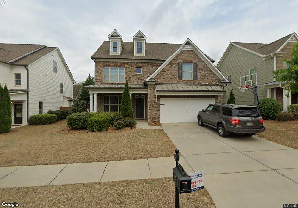
556 Branyan Trail Unit 108 Alpharetta, GA 30004
Estimated Value: $886,000 - $971,000
4
Beds
4
Baths
2,912
Sq Ft
$316/Sq Ft
Est. Value
About This Home
This home is located at 556 Branyan Trail Unit 108, Alpharetta, GA 30004 and is currently estimated at $921,469, approximately $316 per square foot. 556 Branyan Trail Unit 108 is a home located in Fulton County with nearby schools including Crabapple Crossing Elementary School, Northwestern Middle School, and Milton High School.
Ownership History
Date
Name
Owned For
Owner Type
Purchase Details
Closed on
May 31, 2018
Sold by
Child Joshua
Bought by
Reid John D and Reid Lisa M
Current Estimated Value
Home Financials for this Owner
Home Financials are based on the most recent Mortgage that was taken out on this home.
Original Mortgage
$350,000
Outstanding Balance
$302,691
Interest Rate
4.5%
Mortgage Type
New Conventional
Estimated Equity
$618,778
Purchase Details
Closed on
May 24, 2013
Sold by
Child Joshua
Bought by
Child Joshua and Child Lindsay
Home Financials for this Owner
Home Financials are based on the most recent Mortgage that was taken out on this home.
Original Mortgage
$345,092
Interest Rate
3.43%
Mortgage Type
New Conventional
Purchase Details
Closed on
Aug 21, 2012
Sold by
Shf Crabapple Llc
Bought by
Tpg Homes At Crabapple Llc
Create a Home Valuation Report for This Property
The Home Valuation Report is an in-depth analysis detailing your home's value as well as a comparison with similar homes in the area
Home Values in the Area
Average Home Value in this Area
Purchase History
| Date | Buyer | Sale Price | Title Company |
|---|---|---|---|
| Reid John D | $516,000 | -- | |
| Child Joshua | -- | -- | |
| Child Joshua | $355,765 | -- | |
| Tpg Homes At Crabapple Llc | $265,000 | -- |
Source: Public Records
Mortgage History
| Date | Status | Borrower | Loan Amount |
|---|---|---|---|
| Open | Reid John D | $350,000 | |
| Previous Owner | Child Joshua | $345,092 |
Source: Public Records
Tax History Compared to Growth
Tax History
| Year | Tax Paid | Tax Assessment Tax Assessment Total Assessment is a certain percentage of the fair market value that is determined by local assessors to be the total taxable value of land and additions on the property. | Land | Improvement |
|---|---|---|---|---|
| 2025 | $793 | $347,000 | $97,760 | $249,240 |
| 2023 | $8,888 | $314,880 | $48,120 | $266,760 |
| 2022 | $4,160 | $220,640 | $41,880 | $178,760 |
| 2021 | $4,087 | $177,360 | $41,400 | $135,960 |
| 2020 | $4,198 | $185,000 | $32,280 | $152,720 |
| 2019 | $744 | $182,800 | $59,880 | $122,920 |
| 2018 | $5,039 | $178,520 | $58,480 | $120,040 |
| 2017 | $4,186 | $143,480 | $32,520 | $110,960 |
| 2016 | $4,187 | $143,480 | $32,520 | $110,960 |
| 2015 | $4,883 | $143,480 | $32,520 | $110,960 |
| 2014 | $4,078 | $133,040 | $30,160 | $102,880 |
Source: Public Records
Map
Nearby Homes
- 507 Branyan Trail
- 257 Lask Ln
- 249 Lask Ln
- 245 Lask Ln
- 237 Lask Ln
- 233 Lask Ln
- 216 Lask Ln
- 1950 Heritage Walk
- 143 Nakomis Place
- 13125 Morningpark Cir
- 13025 Morningpark Cir
- 13015 Morningpark Cir Unit 1
- 12440 Brookhill Crossing Ln
- 12575 Broadwell Rd
- 12474 Broadwell Rd
- 12857 Waterside Dr
- 666 Abbey Ct
- 12842 Waterside Dr Unit 2
- 12455 Broadwell Rd Unit 201
- 12455 Broadwell Rd Unit 202
- 556 Branyan Trail
- 552 Branyan Trail
- 12677 Lecoma Trace
- 548 Branyan Trail
- 548 Branyan Trail
- 12673 Lacoma Trace
- 12673 Lecoma Trace
- 564 Branyan Trail
- 12669 Lecoma Trace
- 555 Branyan Trail
- 12681 Lecoma Trace
- 551 Branyan Trail
- 568 Branyan Trail
- 544 Branyan Trail
- 563 Branyan Trail
- 12685 Lecoma Trace
- 547 Branyan Trail
- 543 Branyan Trail
- 572 Branyan Trail
- 12661 Lecoma Trace