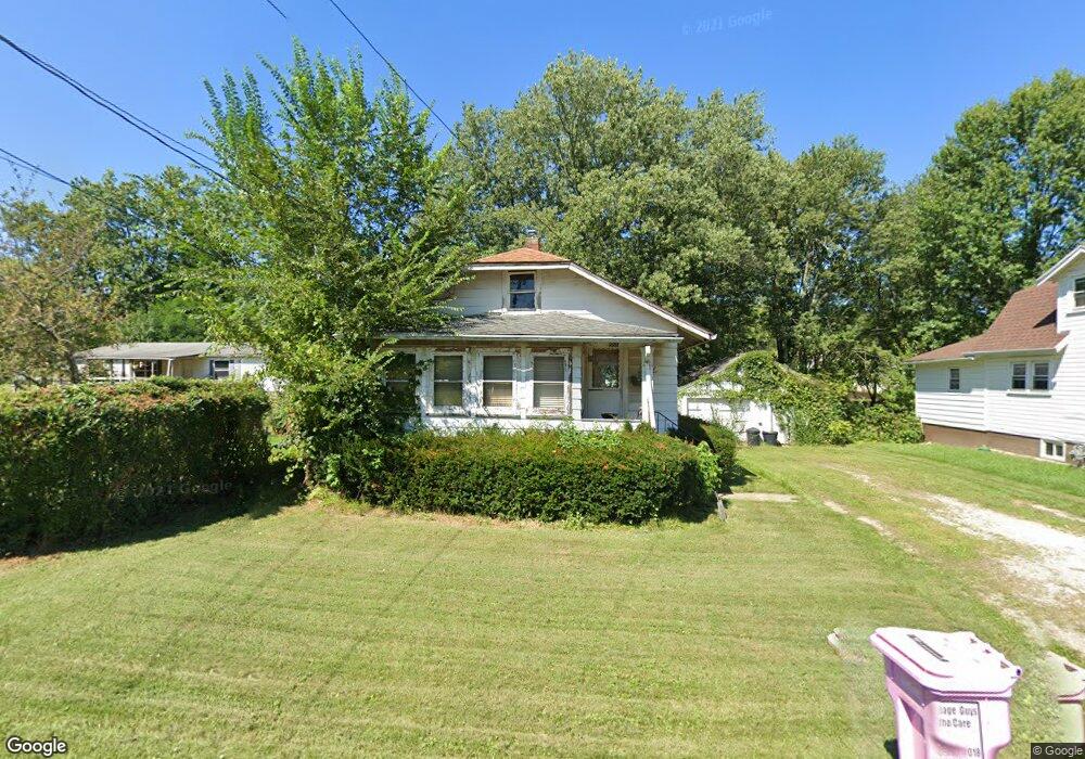
556 Burns St Mansfield, OH 44903
Estimated Value: $63,549 - $75,000
2
Beds
1
Bath
705
Sq Ft
$99/Sq Ft
Est. Value
About This Home
This home is located at 556 Burns St, Mansfield, OH 44903 and is currently estimated at $69,637, approximately $98 per square foot. 556 Burns St is a home located in Richland County with nearby schools including Foundation Academy, Mansfield Elective Academy, and Goal Digital Academy.
Create a Home Valuation Report for This Property
The Home Valuation Report is an in-depth analysis detailing your home's value as well as a comparison with similar homes in the area
Home Values in the Area
Average Home Value in this Area
Tax History Compared to Growth
Tax History
| Year | Tax Paid | Tax Assessment Tax Assessment Total Assessment is a certain percentage of the fair market value that is determined by local assessors to be the total taxable value of land and additions on the property. | Land | Improvement |
|---|---|---|---|---|
| 2024 | $468 | $9,780 | $2,050 | $7,730 |
| 2023 | $468 | $9,780 | $2,050 | $7,730 |
| 2022 | $531 | $9,300 | $1,860 | $7,440 |
| 2021 | $535 | $9,300 | $1,860 | $7,440 |
| 2020 | $547 | $9,300 | $1,860 | $7,440 |
| 2019 | $606 | $9,300 | $1,860 | $7,440 |
| 2018 | $598 | $9,300 | $1,860 | $7,440 |
| 2017 | $615 | $9,300 | $1,860 | $7,440 |
| 2016 | $647 | $10,020 | $2,950 | $7,070 |
| 2015 | $647 | $10,020 | $2,950 | $7,070 |
| 2014 | $610 | $10,020 | $2,950 | $7,070 |
| 2012 | $246 | $10,540 | $3,100 | $7,440 |
Source: Public Records
Map
Nearby Homes
- 512 Burns St
- 0 State Route 314 Unit 9069650
- 0 State Route 314 Unit 9067316
- 0 State Route 314 Unit 225021979
- 0 Highway 30
- 426 Mcpherson St
- 269 Parkway Dr
- 0 Voegele Ave Unit Lot 6048, 6049, 6
- 283 Bulkley Ave
- 237 Helen Ave
- 641 Averill Ave
- 371 Bell St
- 212 Penn Ave
- 362-364 W 6th St
- 185 Rowland Ave
- 526 Bowman St
- 170 Western Ave
- 743 Bowman St
- 156 Buckingham Ave Unit 158
- 120 Gettings Place