Estimated Value: $271,000 - $356,000
3
Beds
3
Baths
2,370
Sq Ft
$135/Sq Ft
Est. Value
About This Home
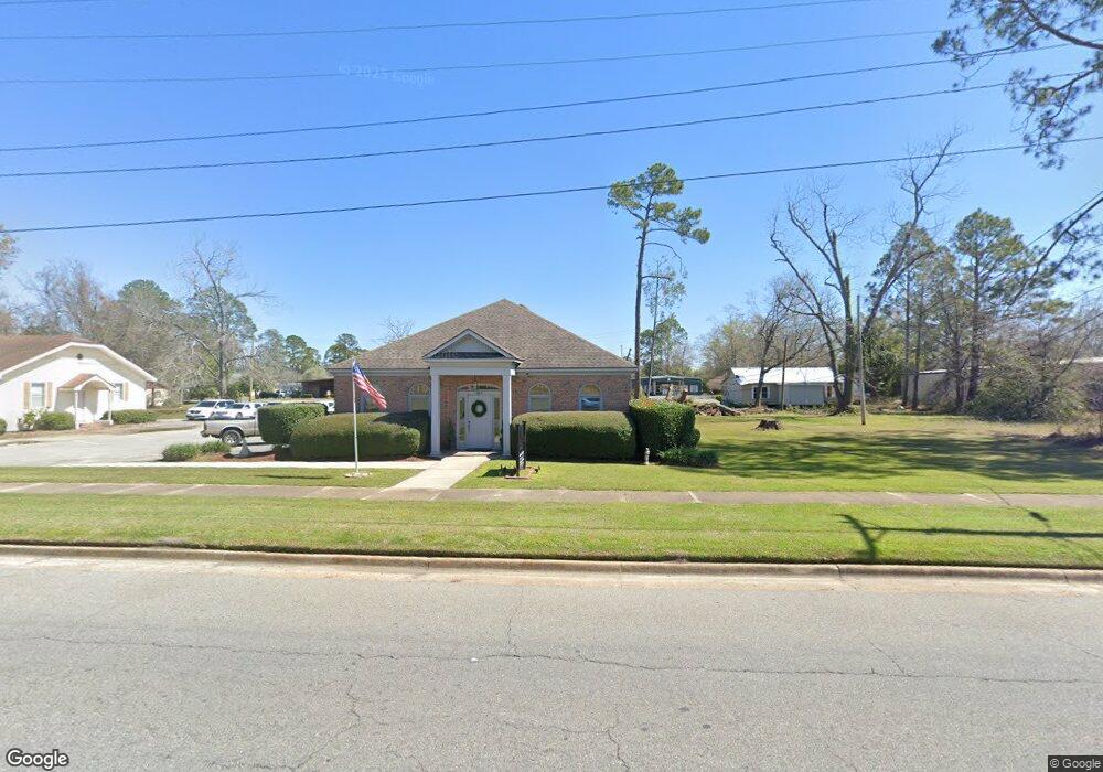
This home is located at 556 Cox Still Rd, Adel, GA 31620 and is currently estimated at $320,539, approximately $135 per square foot. 556 Cox Still Rd is a home located in Cook County with nearby schools including Cook Primary School, Cook Elementary School, and Cook County Middle School.
Ownership History
Date
Name
Owned For
Owner Type
Purchase Details
Closed on
Sep 5, 2019
Sold by
Conger Hardin Rhonda
Bought by
Danforth William F
Current Estimated Value
Purchase Details
Closed on
Jul 25, 2019
Sold by
Hardin Clint
Bought by
Hardin Rhonda C
Purchase Details
Closed on
Feb 3, 2006
Sold by
Mackie Matthew Corey
Bought by
Mackie Matthew Corey and Mackie Sara C
Create a Home Valuation Report for This Property
The Home Valuation Report is an in-depth analysis detailing your home's value as well as a comparison with similar homes in the area
Home Values in the Area
Average Home Value in this Area
Purchase History
| Date | Buyer | Sale Price | Title Company |
|---|---|---|---|
| Danforth William F | -- | -- | |
| Hardin Rhonda C | -- | -- | |
| Mackie Matthew Corey | -- | -- | |
| Mackie Matthew Corey | -- | -- |
Source: Public Records
Tax History Compared to Growth
Tax History
| Year | Tax Paid | Tax Assessment Tax Assessment Total Assessment is a certain percentage of the fair market value that is determined by local assessors to be the total taxable value of land and additions on the property. | Land | Improvement |
|---|---|---|---|---|
| 2024 | $3,206 | $119,004 | $7,343 | $111,661 |
| 2023 | $2,863 | $106,284 | $7,343 | $98,941 |
| 2022 | $2,687 | $99,737 | $6,556 | $93,181 |
| 2021 | $2,496 | $86,457 | $6,556 | $79,901 |
| 2020 | $2,496 | $86,457 | $6,556 | $79,901 |
| 2019 | $2,498 | $86,457 | $6,556 | $79,901 |
| 2018 | $2,500 | $86,457 | $6,556 | $79,901 |
| 2017 | $2,500 | $86,457 | $6,556 | $79,901 |
| 2016 | $2,504 | $86,457 | $6,556 | $79,901 |
| 2015 | $2,509 | $86,457 | $6,556 | $79,901 |
| 2014 | $2,513 | $86,457 | $6,556 | $79,901 |
| 2013 | -- | $86,457 | $6,556 | $79,901 |
Source: Public Records
Map
Nearby Homes
- 625 Coxstill Rd
- 901 E 4th St
- 315 Newton Dr
- 701 Gloria St
- 322 Magnolia Dr
- 1306 Bear Creek Rd
- 1402 Bear Creek Rd
- 418 E 3rd St
- 1377 Hutchinson Parrish Rd
- 211 S Gordon Ave
- 304 E 3rd St
- 415 E 8th St
- 2302 Thomas St
- 93 Oak Forrest Dr
- 804 S Forrest Ave
- 2601 Massee Post Rd
- 2503 Dianne St
- 2603 Dianne St
- 806 S Forrest Ave
- 808 Laurel Ave