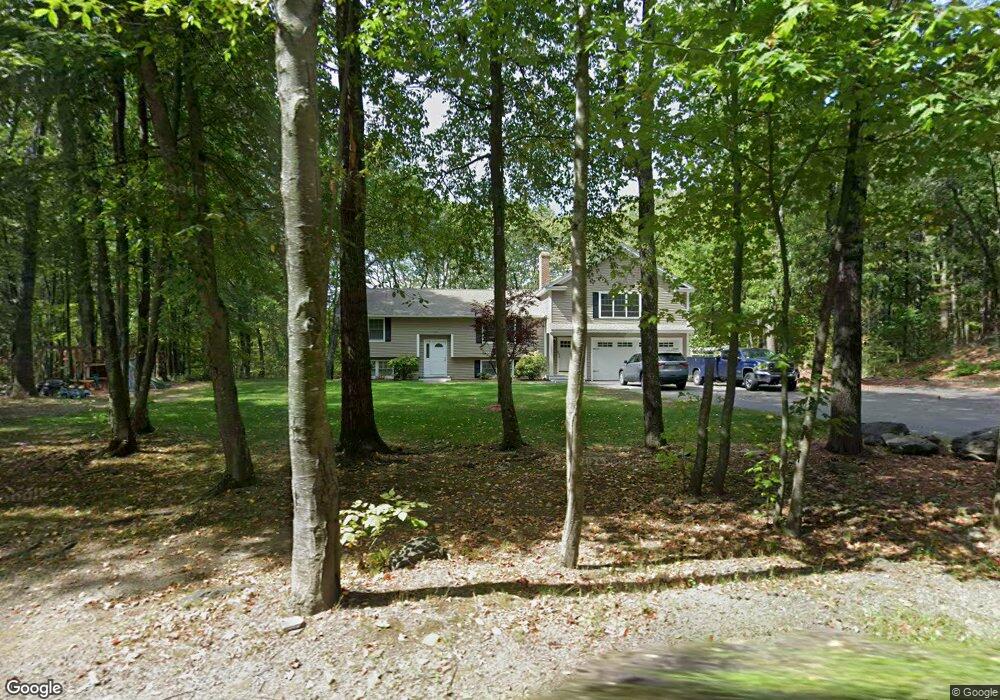
556 Flat Hill Rd Lunenburg, MA 01462
Estimated Value: $474,000 - $583,000
2
Beds
1
Bath
1,677
Sq Ft
$311/Sq Ft
Est. Value
About This Home
This home is located at 556 Flat Hill Rd, Lunenburg, MA 01462 and is currently estimated at $522,188, approximately $311 per square foot. 556 Flat Hill Rd is a home located in Worcester County with nearby schools including Lunenburg Primary School and Lunenburg High School.
Ownership History
Date
Name
Owned For
Owner Type
Purchase Details
Closed on
Jul 8, 2008
Sold by
Doherty James P
Bought by
Doherty James P and Banks Allison M
Current Estimated Value
Home Financials for this Owner
Home Financials are based on the most recent Mortgage that was taken out on this home.
Original Mortgage
$194,500
Outstanding Balance
$125,095
Interest Rate
6.01%
Mortgage Type
Purchase Money Mortgage
Estimated Equity
$397,093
Purchase Details
Closed on
Jun 15, 2007
Sold by
Stjohn Philip R Est and Crain John Edward
Bought by
Doherty James P
Home Financials for this Owner
Home Financials are based on the most recent Mortgage that was taken out on this home.
Original Mortgage
$190,000
Interest Rate
6.19%
Mortgage Type
Purchase Money Mortgage
Create a Home Valuation Report for This Property
The Home Valuation Report is an in-depth analysis detailing your home's value as well as a comparison with similar homes in the area
Home Values in the Area
Average Home Value in this Area
Purchase History
| Date | Buyer | Sale Price | Title Company |
|---|---|---|---|
| Doherty James P | -- | -- | |
| Doherty James P | $190,000 | -- |
Source: Public Records
Mortgage History
| Date | Status | Borrower | Loan Amount |
|---|---|---|---|
| Open | Doherty James P | $194,500 | |
| Previous Owner | Doherty James P | $190,000 |
Source: Public Records
Tax History Compared to Growth
Tax History
| Year | Tax Paid | Tax Assessment Tax Assessment Total Assessment is a certain percentage of the fair market value that is determined by local assessors to be the total taxable value of land and additions on the property. | Land | Improvement |
|---|---|---|---|---|
| 2025 | $6,337 | $441,300 | $141,200 | $300,100 |
| 2024 | $5,933 | $420,800 | $133,200 | $287,600 |
| 2023 | $4,752 | $325,000 | $121,100 | $203,900 |
| 2022 | $4,456 | $259,200 | $101,000 | $158,200 |
| 2020 | $4,120 | $227,400 | $100,800 | $126,600 |
| 2019 | $4,018 | $215,100 | $95,000 | $120,100 |
| 2018 | $3,897 | $197,800 | $95,000 | $102,800 |
| 2017 | $3,808 | $190,600 | $90,700 | $99,900 |
| 2016 | $3,559 | $181,500 | $86,300 | $95,200 |
| 2015 | $3,190 | $174,100 | $81,900 | $92,200 |
Source: Public Records
Map
Nearby Homes
- 11 Longwood Dr
- 878 Flat Hill Rd
- 110 Burrage St
- 45 Spring St
- 330 Arbor St
- 659 Reservoir Rd
- 166 Elmwood Rd
- 2 Oakes Landing
- 1790 Massachusetts Ave Unit 25
- 1790 Massachusetts Ave Unit 22
- 12 Hazen Rd
- 802 Reservoir Rd
- 9 Winter Hill Rd
- 828 Lancaster Ave
- 61 Parker Rd
- 49 Parker Rd
- 12 Easter Brook Rd
- 4 Hill Ln
- 4 Ambrose Way Unit 4
- 7 Ambrose Way Unit 5
- 568 Flat Hill Rd
- 554 Flat Hill Rd
- 543 Flat Hill Rd
- 586 Flat Hill Rd
- 555 Flat Hill Rd
- 561 Flat Hill Rd
- 609 Flat Hill Rd
- 511 Flat Hill Rd
- 511 Flat Hill Rd Unit SF
- 595 Flat Hill Rd
- 521 Flat Hill Rd
- 598 Flat Hill Rd
- 393 Burrage St
- 508 Flat Hill Rd
- 601 Flat Hill Rd
- 607 Flat Hill Rd
- 607 Flat Hill Rd Unit 607
- 411 Burrage St
- 371 Burrage St
- 491 Flat Hill Rd