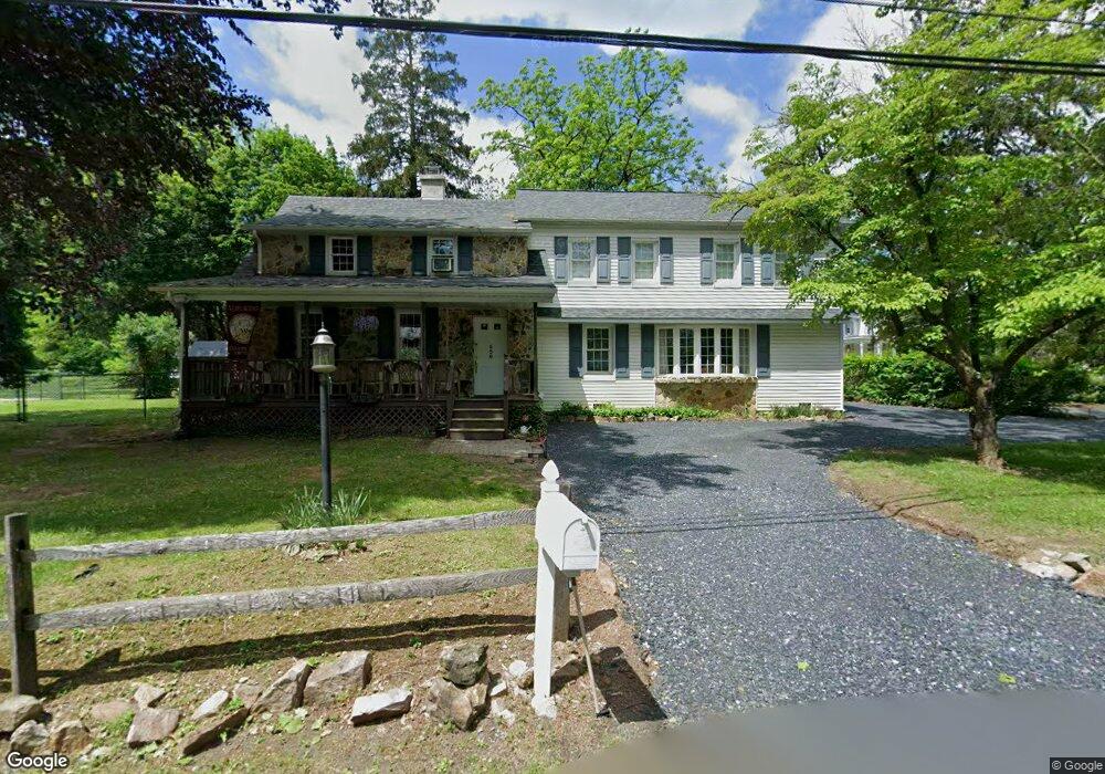
556 Franklin St Alburtis, PA 18011
Lower Macungie Township West NeighborhoodEstimated Value: $539,447 - $693,000
3
Beds
3
Baths
3,596
Sq Ft
$177/Sq Ft
Est. Value
About This Home
This home is located at 556 Franklin St, Alburtis, PA 18011 and is currently estimated at $635,362, approximately $176 per square foot. 556 Franklin St is a home located in Lehigh County with nearby schools including Alburtis Elementary School, Lower Macungie Middle School, and Emmaus High School.
Ownership History
Date
Name
Owned For
Owner Type
Purchase Details
Closed on
May 27, 2010
Sold by
Fuller Francee and Stoneback Scott R
Bought by
Stoneback Scott R and Fuller Francee
Current Estimated Value
Purchase Details
Closed on
Aug 3, 1998
Sold by
Fuller Francee
Bought by
Stoneback Scott R and Fuller Francee
Purchase Details
Closed on
Nov 26, 1975
Bought by
Stoneback Scott R and Fulle Francee E
Create a Home Valuation Report for This Property
The Home Valuation Report is an in-depth analysis detailing your home's value as well as a comparison with similar homes in the area
Home Values in the Area
Average Home Value in this Area
Purchase History
| Date | Buyer | Sale Price | Title Company |
|---|---|---|---|
| Stoneback Scott R | -- | -- | |
| Stoneback Scott R | -- | -- | |
| Stoneback Scott R | -- | -- |
Source: Public Records
Tax History Compared to Growth
Tax History
| Year | Tax Paid | Tax Assessment Tax Assessment Total Assessment is a certain percentage of the fair market value that is determined by local assessors to be the total taxable value of land and additions on the property. | Land | Improvement |
|---|---|---|---|---|
| 2025 | $9,046 | $308,100 | $30,800 | $277,300 |
| 2024 | $8,815 | $308,100 | $30,800 | $277,300 |
| 2023 | $8,407 | $308,100 | $30,800 | $277,300 |
| 2022 | $8,230 | $308,100 | $277,300 | $30,800 |
| 2021 | $8,076 | $308,100 | $30,800 | $277,300 |
| 2020 | $8,008 | $308,100 | $30,800 | $277,300 |
| 2019 | $1,980 | $308,100 | $30,800 | $277,300 |
| 2018 | $7,873 | $308,100 | $30,800 | $277,300 |
| 2017 | $7,754 | $308,100 | $30,800 | $277,300 |
| 2016 | -- | $308,100 | $30,800 | $277,300 |
| 2015 | -- | $308,100 | $30,800 | $277,300 |
| 2014 | -- | $308,100 | $30,800 | $277,300 |
Source: Public Records
Map
Nearby Homes
- 428 Thomas St
- 317 Lockridge Ln
- 121 S Main St Unit 123
- 241 Flint Hill Rd
- 354 W 2nd St
- 3371 Mathews Ln
- 31 Barbara Dr
- 0 Clauss Hunt Knight Dr Unit 10 Units 763578
- 1108 S Barbara Dr
- 6903 Lincoln Dr
- 7318 Sauerkraut Ln Unit E
- 7230 Pioneer Dr
- 6875 Pioneer Dr
- 6709 Mountain Rd
- 8312 Mertztown Rd
- 0 Mountain Lot 1
- 7528 Buttercup Rd
- 6405 Robin Rd
- 2845 Donegal Dr
- 2840 Donegal Dr
- 566 Franklin St
- 588 Franklin St
- 110 Fort Sumpter Rd
- 550 Thomas St
- 600 Franklin St
- 562 Thomas St
- 475 Thomas St
- 574 Thomas St
- 526 Franklin St
- 461 Franklin St
- 482 Franklin St
- 470 Franklin St
- 588 Thomas St
- 567 Thomas St
- 626 Franklin St
- 655 Franklin St
- 468 Franklin St
- 469 Thomas St
- 686 Franklin St
- 630 Franklin St