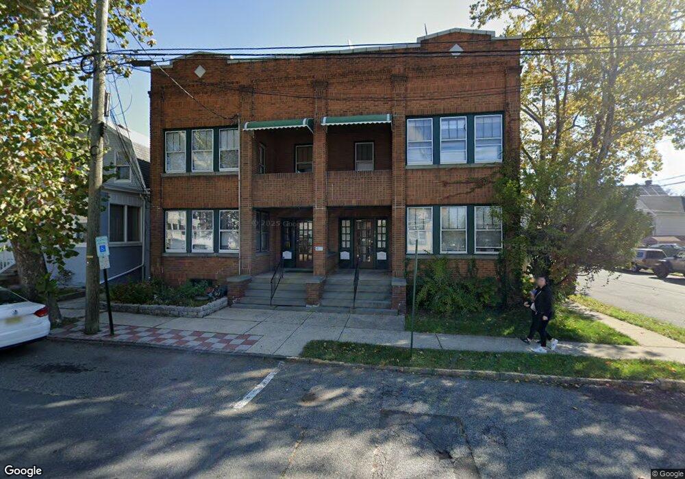
556 Groom St Perth Amboy, NJ 08861
Amboy Avenue NeighborhoodEstimated Value: $540,000 - $916,000
--
Bed
--
Bath
5,072
Sq Ft
$141/Sq Ft
Est. Value
About This Home
This home is located at 556 Groom St, Perth Amboy, NJ 08861 and is currently estimated at $713,249, approximately $140 per square foot. 556 Groom St is a home located in Middlesex County with nearby schools including Perth Amboy High School, Middlesex County STEM Charter School, and Academy for Urban Leadership Charter School.
Ownership History
Date
Name
Owned For
Owner Type
Purchase Details
Closed on
Feb 21, 2023
Sold by
Brandafi Emil and Brandafi Natalia
Bought by
Groom & Lawrie Llc
Current Estimated Value
Purchase Details
Closed on
Jun 21, 2019
Sold by
Brandafi Emil
Bought by
Brandafi Emil and Brandafi Natalia
Create a Home Valuation Report for This Property
The Home Valuation Report is an in-depth analysis detailing your home's value as well as a comparison with similar homes in the area
Home Values in the Area
Average Home Value in this Area
Purchase History
| Date | Buyer | Sale Price | Title Company |
|---|---|---|---|
| Groom & Lawrie Llc | -- | -- | |
| Groom & Lawrie Llc | -- | None Listed On Document | |
| Brandafi Emil | -- | None Available | |
| Brandafi Emil | -- | None Available |
Source: Public Records
Tax History Compared to Growth
Tax History
| Year | Tax Paid | Tax Assessment Tax Assessment Total Assessment is a certain percentage of the fair market value that is determined by local assessors to be the total taxable value of land and additions on the property. | Land | Improvement |
|---|---|---|---|---|
| 2025 | $14,783 | $490,000 | $108,000 | $382,000 |
| 2024 | $14,754 | $490,000 | $108,000 | $382,000 |
| 2023 | $14,754 | $490,000 | $108,000 | $382,000 |
| 2022 | $14,578 | $490,000 | $108,000 | $382,000 |
| 2021 | $14,594 | $490,000 | $108,000 | $382,000 |
| 2020 | $14,592 | $490,000 | $108,000 | $382,000 |
| 2019 | $14,646 | $490,000 | $108,000 | $382,000 |
| 2018 | $14,519 | $490,000 | $108,000 | $382,000 |
| 2017 | $14,489 | $490,000 | $108,000 | $382,000 |
| 2016 | $14,112 | $490,000 | $108,000 | $382,000 |
| 2015 | $14,210 | $490,000 | $108,000 | $382,000 |
| 2014 | $14,298 | $490,000 | $108,000 | $382,000 |
Source: Public Records
Map
Nearby Homes
- 569 Cornell St
- 599 Pacific Ave
- 438 Lawrie St
- 461 Lawrie St
- 649 Cornell St
- 399 Compton Ave
- 389 Jeffries St
- 552 Compton Ave
- 448 Baker Place
- 376 Barclay St
- 359 Neville St
- 689 Mary St
- 397 Washington St
- 720 Donald Ave
- 646 Johnstone St
- 744 Donald Ave
- 752 Donald Ave
- 676 Johnstone St
- 303 Holly Dr
- 306 Holly Dr Unit 306
- 560 Groom St
- 462 Compton Ave
- 462 Compton Ave Unit 1
- 462 Compton Ave Unit 1st Floor
- 462 Compton Ave Unit 3
- 462 Compton Ave Unit 2
- 462 Compton Ave Unit Third Floor
- 562 Groom St
- 564 Groom St
- 458 Compton Ave
- 566 Groom St
- 534 Groom St
- 532 Groom St
- 559 Groom St
- 456 Compton Ave
- 561 Groom St
- 528 Groom St
- 455 Brace Ave
- 452 Compton Ave
- 477 Brace Ave