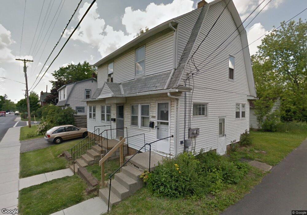
556 Maple St Mansfield, OH 44906
Estimated Value: $84,567 - $125,000
2
Beds
2
Baths
1,456
Sq Ft
$71/Sq Ft
Est. Value
About This Home
This home is located at 556 Maple St, Mansfield, OH 44906 and is currently estimated at $103,142, approximately $70 per square foot. 556 Maple St is a home located in Richland County with nearby schools including Goal Digital Academy, St. Peter's Elementary/Montessori School, and Discovery School.
Ownership History
Date
Name
Owned For
Owner Type
Purchase Details
Closed on
Jul 13, 2009
Sold by
Heckert J Rick and Uhde Sally K
Bought by
Nemeth Frank Z and Nemeth Frank
Current Estimated Value
Home Financials for this Owner
Home Financials are based on the most recent Mortgage that was taken out on this home.
Original Mortgage
$26,000
Outstanding Balance
$16,647
Interest Rate
4.94%
Mortgage Type
Purchase Money Mortgage
Estimated Equity
$86,495
Create a Home Valuation Report for This Property
The Home Valuation Report is an in-depth analysis detailing your home's value as well as a comparison with similar homes in the area
Home Values in the Area
Average Home Value in this Area
Purchase History
| Date | Buyer | Sale Price | Title Company |
|---|---|---|---|
| Nemeth Frank Z | $26,000 | Chicago Title |
Source: Public Records
Mortgage History
| Date | Status | Borrower | Loan Amount |
|---|---|---|---|
| Open | Nemeth Frank Z | $26,000 |
Source: Public Records
Tax History
| Year | Tax Paid | Tax Assessment Tax Assessment Total Assessment is a certain percentage of the fair market value that is determined by local assessors to be the total taxable value of land and additions on the property. | Land | Improvement |
|---|---|---|---|---|
| 2024 | $693 | $14,480 | $3,170 | $11,310 |
| 2023 | $693 | $14,480 | $3,170 | $11,310 |
| 2022 | $665 | $11,640 | $2,580 | $9,060 |
| 2021 | $670 | $11,640 | $2,580 | $9,060 |
| 2020 | $685 | $11,640 | $2,580 | $9,060 |
| 2019 | $759 | $11,640 | $2,580 | $9,060 |
| 2018 | $749 | $11,640 | $2,580 | $9,060 |
| 2017 | $729 | $11,640 | $2,580 | $9,060 |
| 2016 | $561 | $8,680 | $2,740 | $5,940 |
| 2015 | $561 | $8,680 | $2,740 | $5,940 |
| 2014 | $528 | $8,680 | $2,740 | $5,940 |
| 2012 | $426 | $9,130 | $2,880 | $6,250 |
Source: Public Records
Map
Nearby Homes
- 133 Stewart Ave S
- 126 Dawson Ave
- 189 Westwood Ave
- 116 Stewart Ave S
- 108 Stewart Ave S
- 71 Dawson Ave
- 455 Marion Ave
- 24 Stewart Ave S
- 31 Parkwood Blvd
- 31 Bartley Ave
- 158 Vennum Ave
- 30 Douglas Ave
- 679 Coleman Rd
- 135 Fairlawn Ave
- 129 Fairlawn Ave
- 143 Fairlawn Ave
- 51 Lind Ave
- 686 Barnard Ave
- 183 Carpenter Rd
- 458 W West Dickson Ave
- 556 1/2 Maple St
- 145 Stewart Ave S
- 151 Stewart Ave S
- 143 Stewart Ave S
- 555 Maple St
- 150 Dawson Ave
- 146 Dawson Ave
- 137 Stewart Ave S
- 142 Dawson Ave
- 563 Maple St
- 136 Dawson Ave
- 567 Maple St
- 571 Maple St
- 547 Maple St
- 134 Dawson Ave
- 148 Stewart Ave S
- 127 Stewart Ave S
- 146 Stewart Ave S
- 575 Maple St
- 539 Maple St
Your Personal Tour Guide
Ask me questions while you tour the home.