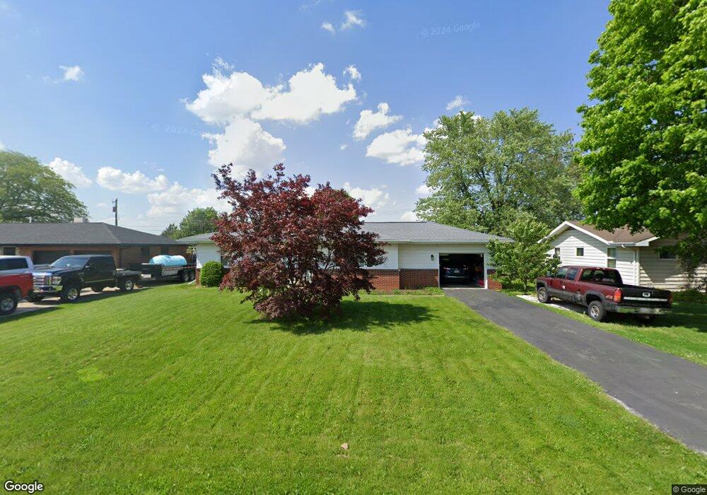
556 Northcrest Ave Fremont, OH 43420
Estimated Value: $138,048 - $155,000
3
Beds
1
Bath
960
Sq Ft
$150/Sq Ft
Est. Value
About This Home
This home is located at 556 Northcrest Ave, Fremont, OH 43420 and is currently estimated at $144,012, approximately $150 per square foot. 556 Northcrest Ave is a home located in Sandusky County with nearby schools including Fremont Ross High School, St. Ann Catholic School, and Bishop Hoffman Catholic School - This is St Joe's School now.
Ownership History
Date
Name
Owned For
Owner Type
Purchase Details
Closed on
Jan 28, 1998
Sold by
Bruce Martha J
Bought by
Gressman Darin F
Current Estimated Value
Home Financials for this Owner
Home Financials are based on the most recent Mortgage that was taken out on this home.
Original Mortgage
$78,850
Outstanding Balance
$14,157
Interest Rate
7.16%
Mortgage Type
New Conventional
Estimated Equity
$129,855
Create a Home Valuation Report for This Property
The Home Valuation Report is an in-depth analysis detailing your home's value as well as a comparison with similar homes in the area
Home Values in the Area
Average Home Value in this Area
Purchase History
| Date | Buyer | Sale Price | Title Company |
|---|---|---|---|
| Gressman Darin F | $83,000 | -- |
Source: Public Records
Mortgage History
| Date | Status | Borrower | Loan Amount |
|---|---|---|---|
| Open | Gressman Darin F | $78,850 |
Source: Public Records
Tax History Compared to Growth
Tax History
| Year | Tax Paid | Tax Assessment Tax Assessment Total Assessment is a certain percentage of the fair market value that is determined by local assessors to be the total taxable value of land and additions on the property. | Land | Improvement |
|---|---|---|---|---|
| 2024 | $1,514 | $40,250 | $11,410 | $28,840 |
| 2023 | $1,514 | $32,210 | $9,140 | $23,070 |
| 2022 | $1,288 | $32,210 | $9,140 | $23,070 |
| 2021 | $1,329 | $32,210 | $9,140 | $23,070 |
| 2020 | $1,284 | $30,600 | $9,140 | $21,460 |
| 2019 | $1,282 | $30,600 | $9,140 | $21,460 |
| 2018 | $1,284 | $30,600 | $9,140 | $21,460 |
| 2017 | $1,206 | $28,640 | $9,140 | $19,500 |
| 2016 | $1,063 | $28,640 | $9,140 | $19,500 |
| 2015 | $1,045 | $28,640 | $9,140 | $19,500 |
| 2014 | $1,033 | $26,960 | $9,000 | $17,960 |
| 2013 | $1,011 | $26,960 | $9,000 | $17,960 |
Source: Public Records
Map
Nearby Homes
- 0 Sean Dr
- Outlot A Sean Dr
- 2219 Oak Harbor Rd
- 1730 Port Clinton Rd Unit 33
- 1730 Port Clinton Rd
- 1730 Port Clinton Rd Unit 41
- 2100 Ohio 53
- 711 Bloom Rd
- 1441 White Ave
- 1227 White Ave
- 1720 North St
- 900 Spring St
- 1707 North St
- 711 Rawson Ave
- 612 2nd St
- 818 Franklin Ave
- 927 Wolfe Ave
- 533 Sandusky Ave Unit 535
- 433 Sandusky Ave
- 516 N Front St
- 550 Northcrest Ave
- 572 Northcrest Ave
- 544 Northcrest Ave
- 555 Northcrest Ave
- 565 Northcrest Ave
- 551 Northcrest Ave
- 538 Northcrest Ave
- 545 Northcrest Ave
- 571 Northcrest Ave
- 537 Northcrest Ave
- 532 Northcrest Ave
- 562 Crestwood Ave
- 554 Crestwood Ave
- 2820 Ravine Dr
- 570 Crestwood Ave
- 531 Northcrest Ave
- 546 Crestwood Ave
- 526 Northcrest Ave
- 2804 Ravine Dr
- 2816 Ravine Dr